 |
|
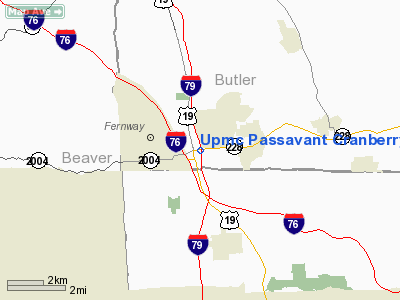
Upmc Passavant Cranberry Heliport |
Location & QuickFacts
| FAA Information Effective: | 2008-09-25 |
| Airport Identifier: | PA56 |
| Airport Status: | Operational |
| Longitude/Latitude: | 080-05-47.2130W/40-41-02.2390N
-80.096448/40.683955 (Estimated) |
| Elevation: | 1100 ft / 335.28 m (Estimated) |
| Land: | 0 acres |
| From nearest city: | 2 nautical miles S of Cranberry, PA |
| Location: | Butler County, PA |
| Magnetic Variation: | 08W (1985) |
Owner & Manager
| Ownership: | Privately owned |
| Owner: | U Of Pittsburgh Medical Center |
| Address: | 200 Lothrop St
Pittsburgh, PA 15213 |
| Phone number: | 412-647-8762 |
| Manager: | Hospital Administrator |
| Address: | Umpc Cranberry Hospital, 1 St Francis Way
Cranberry Twp, PA 16066 |
| Phone number: | 724-772-5300 |
Airport Operations and Facilities
| Airport Use: | Private
MEDICAL |
| Wind indicator: | Yes |
| Segmented Circle: | No |
| Control Tower: | No |
| Lighting Schedule: | PHONE REQ
FOR PERIMETER LGTS CALL 412-622-4343. |
| Sectional chart: | Detroit |
| Region: | AEA - Eastern |
| Boundary ARTCC: | ZOB - Cleveland |
| Tie-in FSS: | AOO - Altoona |
| FSS Toll Free: | 1-800-WX-BRIEF |
Runway Information
Helipad H1
| Dimension: | 60 x 60 ft / 18.3 x 18.3 m |
| Surface: | CONC, |
| |
Runway H1 |
Runway |
| Traffic Pattern: | Left | Left |
|
Radio Navigation Aids
| ID |
Type |
Name |
Ch |
Freq |
Var |
Dist |
| MKP | NDB | Mc Keesport | | 287.00 | 07W | 24.5 nm |
| UCP | NDB | Castle | | 272.00 | 09W | 25.0 nm |
| PNU | NDB | Washington County | | 255.00 | 08W | 32.6 nm |
| HBD | NDB | Hubbard | | 408.00 | 08W | 34.4 nm |
| BHU | NDB | Benje | | 382.00 | 07W | 42.0 nm |
| TSO | NDB | Tolson | | 395.00 | 07W | 45.4 nm |
| INP | NDB | Indiana | | 242.00 | 08W | 47.1 nm |
| CFX | NDB | Cadiz | | 239.00 | 07W | 49.8 nm |
| FKL | VOR | Franklin | | 109.60 | 06W | 46.6 nm |
| AGC | VOR/DME | Allegheny | 037X | 110.00 | 09W | 24.5 nm |
| HLG | VOR/DME | Wheeling | 059X | 112.20 | 07W | 33.4 nm |
| CIP | VOR/DME | Clarion | 076X | 112.90 | 06W | 40.2 nm |
| EWC | VORTAC | Ellwood City | 105X | 115.80 | 08W | 10.0 nm |
| MMJ | VORTAC | Montour | 057X | 112.00 | 08W | 12.6 nm |
| YNG | VORTAC | Youngstown | 027X | 109.00 | 05W | 46.9 nm |
Images and information placed above are from
http://www.airport-data.com/airport/PA56/
We thank them for the data!
| General Info
|
| Country |
United States
|
| State |
PENNSYLVANIA
|
| FAA ID |
PA56
|
| Latitude |
40-41-02.239N
|
| Longitude |
080-05-47.213W
|
| Elevation |
1100 feet
|
| Near City |
CRANBERRY
|
We don't guarantee the information is fresh and accurate. The data may
be wrong or outdated.
For more up-to-date information please refer to other sources.
|
|


