 |
|
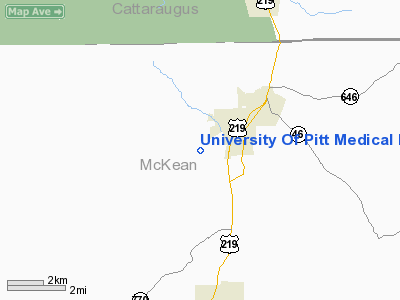
University Of Pitt Medical Landing Area Heliport |
Location & QuickFacts
| FAA Information Effective: | 2008-09-25 |
| Airport Identifier: | PN22 |
| Airport Status: | Operational |
| Longitude/Latitude: | 078-40-19.7600W/41-56-42.0000N
-78.672156/41.945000 (Estimated) |
| Elevation: | 1481 ft / 451.41 m (Estimated) |
| Land: | 0 acres |
| From nearest city: | 2 nautical miles E of Bradford, PA |
| Location: | Mc Kean County, PA |
| Magnetic Variation: | () |
Owner & Manager
| Ownership: | Privately owned |
| Owner: | University Of Pittsburgh |
| Address: | 300 Campus Drive
Bradford, PA 16701 |
| Phone number: | 814-362-7500 |
| Manager: | University Of Pittsburgh |
| Address: | 300 Campus Drive
Bradford, PA 16701 |
| Phone number: | 814-362-7500 |
Airport Operations and Facilities
| Airport Use: | Private
MEDICAL USE. |
| Control Tower: | No |
| Lighting Schedule: | DUSK-DAWN |
| Sectional chart: | Detroit |
| Region: | AEA - Eastern |
| Boundary ARTCC: | ZOB - Cleveland |
| Tie-in FSS: | AOO - Altoona |
| FSS Toll Free: | 1-800-WX-BRIEF |
Runway Information
Helipad H1
| Dimension: | 50 x 50 ft / 15.2 x 15.2 m |
| Surface: | TURF, |
| |
Runway H1 |
Runway |
| Traffic Pattern: | Left | Left |
|
Radio Navigation Aids
| ID |
Type |
Name |
Ch |
Freq |
Var |
Dist |
| LYS | NDB | Olean | | 360.00 | 09W | 25.3 nm |
| EL | NDB | Halos | | 269.00 | 09W | 35.2 nm |
| ORJ | NDB | Corry | | 258.00 | 09W | 43.7 nm |
| BFD | VOR/DME | Bradford | 113X | 116.60 | 07W | 9.8 nm |
| JHW | VOR/DME | Jamestown | 094X | 114.70 | 07W | 24.8 nm |
| ELZ | VORTAC | Wellsville | 051X | 111.40 | 09W | 31.3 nm |
| TDT | VORTAC | Tidioute | 123X | 117.60 | 09W | 36.2 nm |
| SLT | VORTAC | Slate Run | 086X | 113.90 | 08W | 40.8 nm |
| DKK | VORTAC | Dunkirk | 109X | 116.20 | 07W | 42.3 nm |
| ETG | VORTAC | Keating | 107X | 116.00 | 10W | 49.9 nm |
Remarks
- PRVDD VFR/PVT USE;TKOF/LDG AREA MKD; WIND INDICATOR MAINTAINED; AND NY FPO CONTACTED.
Images and information placed above are from
http://www.airport-data.com/airport/PN22/
We thank them for the data!
| General Info
|
| Country |
United States
|
| State |
PENNSYLVANIA
|
| FAA ID |
PN22
|
| Latitude |
41-23-00.209N
|
| Longitude |
079-49-59.196W
|
| Elevation |
1140 feet
|
| Near City |
FRANKLIN
|
We don't guarantee the information is fresh and accurate. The data may
be wrong or outdated.
For more up-to-date information please refer to other sources.
|
|


