 |
|
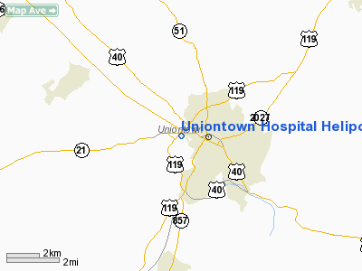
Uniontown Hospital Heliport |
Location & QuickFacts
| FAA Information Effective: | 2008-09-25 |
| Airport Identifier: | 22PA |
| Airport Status: | Operational |
| Longitude/Latitude: | 079-44-41.1590W/39-54-03.2740N
-79.744766/39.900909 (Estimated) |
| Elevation: | 1115 ft / 339.85 m (Estimated) |
| Land: | 0 acres |
| From nearest city: | 0 nautical miles W of Uniontown, PA |
| Location: | Fayette County, PA |
| Magnetic Variation: | 09W (2000) |
Owner & Manager
| Ownership: | Privately owned |
| Owner: | Uniontown Hospital |
| Address: | 500 West Berkley St
Uniontown, PA 15401 |
| Phone number: | 412-430-5000 |
| Address: |
|
Airport Operations and Facilities
| Airport Use: | Private
MEDICAL |
| Segmented Circle: | No |
| Control Tower: | No |
| Lighting Schedule: | PHONE REQ
FOR PERIMETER LGTS CALL 412-430-5000 |
| Sectional chart: | Cincinnati |
| Region: | AEA - Eastern |
| Boundary ARTCC: | ZOB - Cleveland |
| Tie-in FSS: | AOO - Altoona |
| FSS Toll Free: | 1-800-WX-BRIEF |
Runway Information
Helipad H1
| Dimension: | 65 x 65 ft / 19.8 x 19.8 m |
| Surface: | ASPH, |
| |
Runway H1 |
Runway |
| Traffic Pattern: | Left | Left |
|
Radio Navigation Aids
| ID |
Type |
Name |
Ch |
Freq |
Var |
Dist |
| VV | NDB | Camor | | 299.00 | 08W | 1.1 nm |
| PNU | NDB | Washington County | | 255.00 | 08W | 24.2 nm |
| MKP | NDB | Mc Keesport | | 287.00 | 07W | 27.4 nm |
| BHU | NDB | Benje | | 382.00 | 07W | 35.9 nm |
| SYS | NDB | Stoystown | | 209.00 | 08W | 39.7 nm |
| CBE | NDB | Cumberland | | 317.00 | 07W | 48.5 nm |
| AGC | VOR/DME | Allegheny | 037X | 110.00 | 09W | 26.5 nm |
| GRV | VOR/DME | Grantsville | 070X | 112.30 | 06W | 35.8 nm |
| HLG | VOR/DME | Wheeling | 059X | 112.20 | 07W | 43.6 nm |
| CKB | VOR/DME | Clarksburg | 073X | 112.60 | 04W | 45.9 nm |
| AIR | VOR/DME | Bellaire | 118X | 117.10 | 07W | 49.9 nm |
| IHD | VORTAC | Indian Head | 019X | 108.20 | 06W | 18.3 nm |
| MGW | VORTAC | Morgantown | 053X | 111.60 | 05W | 21.4 nm |
| MMJ | VORTAC | Montour | 057X | 112.00 | 08W | 40.9 nm |
| JST | VORTAC | Johnstown | 077X | 113.00 | 06W | 48.8 nm |
Images and information placed above are from
http://www.airport-data.com/airport/22PA/
We thank them for the data!
| General Info
|
| Country |
United States
|
| State |
PENNSYLVANIA
|
| FAA ID |
22PA
|
| Latitude |
39-54-03.274N
|
| Longitude |
079-44-41.159W
|
| Elevation |
1115 feet
|
| Near City |
UNIONTOWN
|
We don't guarantee the information is fresh and accurate. The data may
be wrong or outdated.
For more up-to-date information please refer to other sources.
|
|


