 |
|
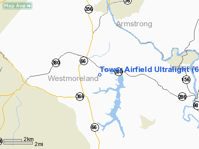
Tower Airfield Ultralight Airport |
Location & QuickFacts
| FAA Information Effective: | 2008-09-25 |
| Airport Identifier: | 6PA1 |
| Airport Status: | Operational |
| Longitude/Latitude: | 079-34-47.1570W/40-30-37.2390N
-79.579766/40.510344 (Estimated) |
| Elevation: | 1300 ft / 396.24 m (Estimated) |
| Land: | 5 acres |
| From nearest city: | 1 nautical miles N of North Washington, PA |
| Location: | Westmoreland County, PA |
| Magnetic Variation: | 09W (1995) |
Owner & Manager
| Ownership: | Privately owned |
| Owner: | S.n. Tower |
| Address: | 1151 Culp Road
Apollo, PA 15613 |
| Phone number: | 412-727-2270 |
| Manager: | S.n. Tower |
| Address: | 1151 Culp Road
Apollo, PA 15613 |
| Phone number: | 412-727-2270 |
Airport Operations and Facilities
| Airport Use: | Private |
| Wind indicator: | Yes |
| Segmented Circle: | No |
| Control Tower: | No |
| Sectional chart: | Detroit |
| Region: | AEA - Eastern |
| Boundary ARTCC: | ZOB - Cleveland |
| Tie-in FSS: | AOO - Altoona |
| FSS on Airport: | No |
| FSS Toll Free: | 1-800-WX-BRIEF |
Runway Information
Runway 03/21
| Dimension: | 500 x 100 ft / 152.4 x 30.5 m |
| Surface: | TURF, |
| |
Runway 03 |
Runway 21 |
| Traffic Pattern: | Left | Left |
|
Radio Navigation Aids
| ID |
Type |
Name |
Ch |
Freq |
Var |
Dist |
| MKP | NDB | Mc Keesport | | 287.00 | 07W | 13.1 nm |
| BHU | NDB | Benje | | 382.00 | 07W | 16.3 nm |
| INP | NDB | Indiana | | 242.00 | 08W | 24.6 nm |
| PNU | NDB | Washington County | | 255.00 | 08W | 34.6 nm |
| VV | NDB | Camor | | 299.00 | 08W | 38.5 nm |
| SYS | NDB | Stoystown | | 209.00 | 08W | 39.7 nm |
| UCP | NDB | Castle | | 272.00 | 09W | 49.0 nm |
| AGC | VOR/DME | Allegheny | 037X | 110.00 | 09W | 25.3 nm |
| REC | VOR/DME | Revloc | 043X | 110.60 | 09W | 38.1 nm |
| CIP | VOR/DME | Clarion | 076X | 112.90 | 06W | 38.6 nm |
| HLG | VOR/DME | Wheeling | 059X | 112.20 | 07W | 47.7 nm |
| MMJ | VORTAC | Montour | 057X | 112.00 | 08W | 28.1 nm |
| IHD | VORTAC | Indian Head | 019X | 108.20 | 06W | 33.8 nm |
| EWC | VORTAC | Ellwood City | 105X | 115.80 | 08W | 34.5 nm |
| JST | VORTAC | Johnstown | 077X | 113.00 | 06W | 36.1 nm |
Remarks
- PRVDD DALGT OPNS ONLY; ALL OPNS BE IN COMPLIANCE WITH APPLICABLE REGS; OPR IN MANNER TO MINIMIZE NOISE OVER RESIDENCES NEAR FAC; COORDINATE WITH BOQUET ARPT ON LNDGS/TKOFS.
Images and information placed above are from
http://www.airport-data.com/airport/6PA1/
We thank them for the data!
| General Info
|
| Country |
United States
|
| State |
PENNSYLVANIA
|
| FAA ID |
6PA1
|
| Latitude |
40-30-37.239N
|
| Longitude |
079-34-47.157W
|
| Elevation |
1300 feet
|
| Near City |
NORTH WASHINGTON
|
We don't guarantee the information is fresh and accurate. The data may
be wrong or outdated.
For more up-to-date information please refer to other sources.
|
|


