 |
|
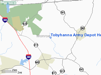
Tobyhanna Army Depot Heliport |
Location & QuickFacts
| FAA Information Effective: | 2008-09-25 |
| Airport Identifier: | 17PN |
| Airport Status: | Operational |
| Longitude/Latitude: | 075-20-34.6590W/41-10-11.3200N
-75.342961/41.169811 (Estimated) |
| Elevation: | 1990 ft / 606.55 m (Estimated) |
| Land: | 0 acres |
| From nearest city: | 0 nautical miles N of Tobyhanna, PA |
| Location: | Susquehanna County, PA |
| Magnetic Variation: | 12W (1985) |
Owner & Manager
| Ownership: | Army owned |
| Owner: | Army |
| Address: | Cmdr, Attn: Sdsto-st
Tobyhanna, PA 18466-5105 |
| Address: |
|
Airport Operations and Facilities
| Airport Use: | Private |
| Segmented Circle: | No |
| Control Tower: | No |
| Sectional chart: | New York |
| Region: | AEA - Eastern |
| Boundary ARTCC: | ZNY - New York |
| Tie-in FSS: | IPT - Williamsport |
| FSS Toll Free: | 1-800-WX-BRIEF |
Runway Information
Helipad H1
| Dimension: | 60 x 60 ft / 18.3 x 18.3 m |
| Surface: | CONC, |
| |
Runway H1 |
Runway |
| Traffic Pattern: | Left | Left |
|
Radio Navigation Aids
| ID |
Type |
Name |
Ch |
Freq |
Var |
Dist |
| CYE | NDB | Crystal Lake | | 410.00 | 11W | 22.2 nm |
| LQX | NDB | Carbon | | 339.00 | 12W | 28.6 nm |
| HXM | NDB | Humbolt | | 366.00 | 10W | 31.6 nm |
| MS | NDB | Monga | | 359.00 | 12W | 41.9 nm |
| UKT | NDB | Quakertown | | 208.00 | 12W | 44.8 nm |
| CAT | NDB | Chatham | | 254.00 | 11W | 48.8 nm |
| HZL | VOR | Hazleton | | 109.40 | 09W | 37.4 nm |
| STW | VOR/DME | Stillwater | 033X | 109.60 | 11W | 23.9 nm |
| BWZ | VOR/DME | Broadway | 089X | 114.20 | 11W | 32.5 nm |
| HUO | VOR/DME | Huguenot | 108X | 116.10 | 11W | 36.9 nm |
| ETX | VOR/DME | East Texas | 039X | 110.20 | 09W | 38.6 nm |
| SBJ | VOR/DME | Solberg | 076X | 112.90 | 10W | 44.6 nm |
| CKZ | VOR/DME | Pennridge | 025Y | 108.85 | 12W | 46.9 nm |
| LVZ | VORTAC | Wilkes-barre | 053X | 111.60 | 10W | 16.8 nm |
| LHY | VORTAC | Lake Henry | 045X | 110.80 | 10W | 19.4 nm |
| FJC | VORTAC | Allentown | 122X | 117.50 | 10W | 27.1 nm |
| SAX | VORTAC | Sparta | 104X | 115.70 | 11W | 37.0 nm |
Images and information placed above are from
http://www.airport-data.com/airport/17PN/
We thank them for the data!
| General Info
|
| Country |
United States
|
| State |
PENNSYLVANIA
|
| FAA ID |
17PN
|
| Latitude |
41-10-11.320N
|
| Longitude |
075-20-34.659W
|
| Elevation |
1990 feet
|
| Near City |
TOBYHANNA
|
We don't guarantee the information is fresh and accurate. The data may
be wrong or outdated.
For more up-to-date information please refer to other sources.
|
|


