 |
|
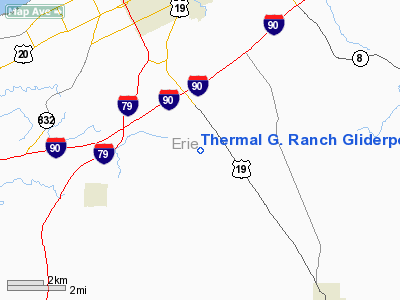
Thermal G. Ranch Gliderport Airport |
Location & QuickFacts
| FAA Information Effective: | 2008-09-25 |
| Airport Identifier: | PA20 |
| Airport Status: | Operational |
| Longitude/Latitude: | 080-04-14.1970W/42-01-14.1990N
-80.070610/42.020611 (Estimated) |
| Elevation: | 1430 ft / 435.86 m (Estimated) |
| Land: | 110 acres |
| From nearest city: | 0 nautical miles S of Erie, PA |
| Location: | Erie County, PA |
| Magnetic Variation: | 08W (1985) |
Owner & Manager
| Ownership: | Privately owned |
| Owner: | Lawrence J. Gehrlein |
| Address: | 9001 Hamot Road
Waterford, PA 16441 |
| Phone number: | 814-864-8580 |
| Manager: | Lawrence J. Gehrlein |
| Address: | 9001 Hamot Road
Waterford, PA 16441 |
| Phone number: | 814-864-8580 |
Airport Operations and Facilities
| Airport Use: | Private |
| Wind indicator: | Yes |
| Segmented Circle: | No |
| Control Tower: | No |
| Landing fee charge: | No |
| Sectional chart: | Detroit |
| Region: | AEA - Eastern |
| Boundary ARTCC: | ZOB - Cleveland |
| Tie-in FSS: | AOO - Altoona |
| FSS on Airport: | No |
| FSS Toll Free: | 1-800-WX-BRIEF |
Airport Services
Runway Information
Runway 07/25
| Dimension: | 1200 x 100 ft / 365.8 x 30.5 m |
| Surface: | TURF, Good Condition |
| |
Runway 07 |
Runway 25 |
| Traffic Pattern: | Left | Left |
|
Radio Navigation Aids
| ID |
Type |
Name |
Ch |
Freq |
Var |
Dist |
| CQD | NDB | Cascade | | 372.00 | 08W | 6.1 nm |
| ORJ | NDB | Corry | | 258.00 | 09W | 20.0 nm |
| FKL | VOR | Franklin | | 109.60 | 06W | 36.3 nm |
| JFN | VOR/DME | Jefferson | 099X | 115.20 | 05W | 34.1 nm |
| JHW | VOR/DME | Jamestown | 094X | 114.70 | 07W | 43.5 nm |
| ERI | VORTAC | Erie | 031X | 109.40 | 06W | 9.9 nm |
| TDT | VORTAC | Tidioute | 123X | 117.60 | 09W | 34.6 nm |
| DKK | VORTAC | Dunkirk | 109X | 116.20 | 07W | 45.3 nm |
| YNG | VORTAC | Youngstown | 027X | 109.00 | 05W | 49.5 nm |
Remarks
- 1 CIRCULAR HOT AIR BALLOON LAUNCHING PAD RADIO CONTROLLED MODEL AIRPLANE CIRCLE.
- 945' TURF STWY ON WEST END OF RWY.
- GLIDER & HOT AIR BALLOON REPAIRS.
- VFR ONLY
Images and information placed above are from
http://www.airport-data.com/airport/PA20/
We thank them for the data!
| General Info
|
| Country |
United States
|
| State |
PENNSYLVANIA
|
| FAA ID |
PA20
|
| Latitude |
42-01-14.199N
|
| Longitude |
080-04-14.197W
|
| Elevation |
1430 feet
|
| Near City |
ERIE
|
We don't guarantee the information is fresh and accurate. The data may
be wrong or outdated.
For more up-to-date information please refer to other sources.
|
|


