 |
|
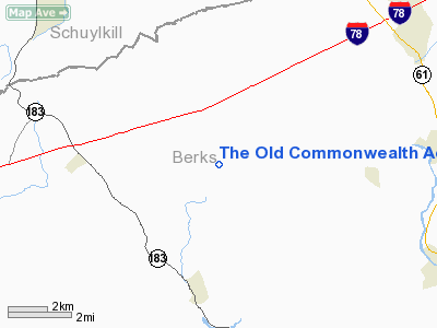
The Old Commonwealth Aerodrome Airport |
Location & QuickFacts
| FAA Information Effective: | 2008-09-25 |
| Airport Identifier: | 2PA6 |
| Airport Status: | Operational |
| Longitude/Latitude: | 076-05-51.7880W/40-29-28.3340N
-76.097719/40.491204 (Estimated) |
| Elevation: | 540 ft / 164.59 m (Estimated) |
| Land: | 0 acres |
| From nearest city: | 2 nautical miles S of Shartlesville, PA |
| Location: | Berks County, PA |
| Magnetic Variation: | 11W (1990) |
Owner & Manager
| Ownership: | Privately owned |
| Owner: | Dean E. Kramer |
| Address: | Rr1 Box 238
Bernville, PA 19506-9767 |
| Phone number: | 215-488-6177 |
| Manager: | Dean E. Kramer |
| Address: | Rr1 Box 238
Bernville, PA 19506-9767 |
| Phone number: | 215-488-6177 |
Airport Operations and Facilities
| Airport Use: | Private |
| Wind indicator: | Yes |
| Segmented Circle: | No |
| Control Tower: | No |
| Sectional chart: | New York |
| Region: | AEA - Eastern |
| Boundary ARTCC: | ZNY - New York |
| Tie-in FSS: | IPT - Williamsport |
| FSS on Airport: | No |
| FSS Toll Free: | 1-800-WX-BRIEF |
Airport Services
Runway Information
Runway 18/36
| Dimension: | 1050 x 100 ft / 320.0 x 30.5 m |
| Surface: | TURF, |
| |
Runway 18 |
Runway 36 |
| Traffic Pattern: | Left | Left |
|
Radio Navigation Aids
| ID |
Type |
Name |
Ch |
Freq |
Var |
Dist |
| BZJ | NDB | Bellgrove | | 328.00 | 10W | 21.1 nm |
| LQX | NDB | Carbon | | 339.00 | 12W | 24.7 nm |
| HXM | NDB | Humbolt | | 366.00 | 10W | 30.2 nm |
| UKT | NDB | Quakertown | | 208.00 | 12W | 36.8 nm |
| ING | NDB | Ambler | | 275.00 | 11W | 43.2 nm |
| CYE | NDB | Crystal Lake | | 410.00 | 11W | 44.9 nm |
| DYL | NDB | Doylestown | | 237.00 | 10W | 45.6 nm |
| NXX | NDB | Willow Grove | | 388.00 | 12W | 47.3 nm |
| EUD | NDB | York | | 254.00 | 11W | 49.6 nm |
| NXX | TACAN | Willow Grove | 061X | | 10W | 47.1 nm |
| HZL | VOR | Hazleton | | 109.40 | 09W | 29.1 nm |
| ETX | VOR/DME | East Texas | 039X | 110.20 | 09W | 19.7 nm |
| CKZ | VOR/DME | Pennridge | 025Y | 108.85 | 12W | 37.5 nm |
| RAV | VORTAC | Ravine | 093X | 114.60 | 11W | 23.2 nm |
| LRP | VORTAC | Lancaster | 120X | 117.30 | 09W | 24.0 nm |
| PTW | VORTAC | Pottstown | 112X | 116.50 | 09W | 29.5 nm |
| FJC | VORTAC | Allentown | 122X | 117.50 | 10W | 32.6 nm |
| MXE | VORTAC | Modena | 079X | 113.20 | 09W | 39.6 nm |
| SEG | VORTAC | Selinsgrove | 041X | 110.40 | 08W | 40.1 nm |
| MIP | VORTAC | Milton | 029X | 109.20 | 09W | 41.1 nm |
| HAR | VORTAC | Harrisburg | 072X | 112.50 | 10W | 45.9 nm |
| MDT | VOT | Harrisburg International | | 110.00 | | 35.2 nm |
Images and information placed above are from
http://www.airport-data.com/airport/2PA6/
We thank them for the data!
| General Info
|
| Country |
United States
|
| State |
PENNSYLVANIA
|
| FAA ID |
2PA6
|
| Latitude |
40-29-28.334N
|
| Longitude |
076-05-51.788W
|
| Elevation |
540 feet
|
| Near City |
SHARTLESVILLE
|
We don't guarantee the information is fresh and accurate. The data may
be wrong or outdated.
For more up-to-date information please refer to other sources.
|
|


