 |
|
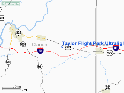
Taylor Flight Park Ultralight Airport |
Location & QuickFacts
| FAA Information Effective: | 2008-09-25 |
| Airport Identifier: | 5PA9 |
| Airport Status: | Operational |
| Longitude/Latitude: | 079-16-56.1490W/41-11-18.2300N
-79.282264/41.188397 (Estimated) |
| Elevation: | 1580 ft / 481.58 m (Estimated) |
| Land: | 180 acres |
| From nearest city: | 2 nautical miles SE of Strattanville, PA |
| Location: | Clarion County, PA |
| Magnetic Variation: | 08W (1985) |
Owner & Manager
| Ownership: | Privately owned |
| Owner: | R.w. Taylor |
| Address: | Rd 1, Box 143
Strattanville, PA 16258 |
| Phone number: | 814-764-5728 |
| Manager: | R.w. Taylor |
| Address: | Rd 1, Box 143
Strattanville, PA 16258 |
| Phone number: | 814-764-5728 |
Airport Operations and Facilities
| Airport Use: | Private |
| Wind indicator: | Yes |
| Segmented Circle: | No |
| Control Tower: | No |
| Sectional chart: | Detroit |
| Region: | AEA - Eastern |
| Boundary ARTCC: | ZOB - Cleveland |
| Tie-in FSS: | AOO - Altoona |
| FSS on Airport: | No |
| FSS Toll Free: | 1-800-WX-BRIEF |
Runway Information
Runway 13/31
| Dimension: | 1550 x 100 ft / 472.4 x 30.5 m |
| Surface: | DIRT, |
| |
Runway 13 |
Runway 31 |
| Traffic Pattern: | Left | Left |
|
Radio Navigation Aids
| ID |
Type |
Name |
Ch |
Freq |
Var |
Dist |
| INP | NDB | Indiana | | 242.00 | 08W | 34.9 nm |
| ORJ | NDB | Corry | | 258.00 | 09W | 46.5 nm |
| BHU | NDB | Benje | | 382.00 | 07W | 48.9 nm |
| FKL | VOR | Franklin | | 109.60 | 06W | 30.0 nm |
| CIP | VOR/DME | Clarion | 076X | 112.90 | 06W | 8.3 nm |
| REC | VOR/DME | Revloc | 043X | 110.60 | 09W | 45.6 nm |
| BFD | VOR/DME | Bradford | 113X | 116.60 | 07W | 46.7 nm |
| TDT | VORTAC | Tidioute | 123X | 117.60 | 09W | 32.1 nm |
| EWC | VORTAC | Ellwood City | 105X | 115.80 | 08W | 47.5 nm |
Remarks
- PRVDD THAT OPNS ARE DURING VFR DALGT CONDITIONS & AVOID CLARION LIMESTONE HIGH SCHOOL.
Images and information placed above are from
http://www.airport-data.com/airport/5PA9/
We thank them for the data!
| General Info
|
| Country |
United States
|
| State |
PENNSYLVANIA
|
| FAA ID |
5PA9
|
| Latitude |
41-11-18.230N
|
| Longitude |
079-16-56.149W
|
| Elevation |
1580 feet
|
| Near City |
STRATTANVILLE
|
We don't guarantee the information is fresh and accurate. The data may
be wrong or outdated.
For more up-to-date information please refer to other sources.
|
|


