 |
|
Location & QuickFacts
| FAA Information Effective: | 2008-09-25 |
| Airport Identifier: | PS00 |
| Airport Status: | Operational |
| Longitude/Latitude: | 076-56-23.9110W/40-24-20.3110N
-76.939975/40.405642 (Estimated) |
| Elevation: | 480 ft / 146.30 m (Estimated) |
| Land: | 0 acres |
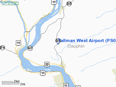
| From nearest city: | 2 nautical miles N of Dauphin, PA |
| Location: | Dauphin County, PA |
| Magnetic Variation: | 10W (1985) |
Owner & Manager
| Ownership: | Privately owned |
| Owner: | John D. Tallman |
| Address: | 1701 Peters Mtn Road
Dauphin, PA 17018 |
| Phone number: | 717-921-2476 |
| Manager: | John D. Tallman |
| Address: | 1701 Peters Mtn Rd
Dauphin, PA 17018 |
| Phone number: | 717-921-2476 |
Airport Operations and Facilities
| Airport Use: | Private |
| Wind indicator: | Yes |
| Segmented Circle: | No |
| Control Tower: | No |
| Landing fee charge: | No |
| Sectional chart: | New York |
| Region: | AEA - Eastern |
| Boundary ARTCC: | ZNY - New York |
| Tie-in FSS: | IPT - Williamsport |
| FSS on Airport: | No |
| FSS Toll Free: | 1-800-WX-BRIEF |
Runway Information
Runway 08/26
| Dimension: | 2100 x 100 ft / 640.1 x 30.5 m |
| Surface: | TURF, |
| |
Runway 08 |
Runway 26 |
| Traffic Pattern: | Left | Left |
| Obstruction: | 35 ft pline, 150.0 ft from runway | 100 ft trees, 200.0 ft from runway |
|
Radio Navigation Aids
| ID |
Type |
Name |
Ch |
Freq |
Var |
Dist |
| BZJ | NDB | Bellgrove | | 328.00 | 10W | 17.8 nm |
| EUD | NDB | York | | 254.00 | 11W | 29.3 nm |
| RV | NDB | Stroh | | 407.00 | 10W | 37.7 nm |
| HAR | VORTAC | Harrisburg | 072X | 112.50 | 10W | 8.6 nm |
| RAV | VORTAC | Ravine | 093X | 114.60 | 11W | 17.9 nm |
| SEG | VORTAC | Selinsgrove | 041X | 110.40 | 08W | 23.3 nm |
| LRP | VORTAC | Lancaster | 120X | 117.30 | 09W | 34.4 nm |
| MIP | VORTAC | Milton | 029X | 109.20 | 09W | 39.2 nm |
| MDT | VOT | Harrisburg International | | 110.00 | | 14.9 nm |
Remarks
- AGRICULTURAL AIRCRAFT OPERATIONS ON AIRPORT.
Images and information placed above are from
http://www.airport-data.com/airport/PS00/
We thank them for the data!
| General Info
|
| Country |
United States
|
| State |
PENNSYLVANIA
|
| FAA ID |
PS00
|
| Latitude |
40-24-20.311N
|
| Longitude |
076-56-23.911W
|
| Elevation |
480 feet
|
| Near City |
DAUPHIN
|
We don't guarantee the information is fresh and accurate. The data may
be wrong or outdated.
For more up-to-date information please refer to other sources.
|
|


