 |
|
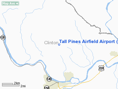
Tall Pines Airfield Airport |
Location & QuickFacts
| FAA Information Effective: | 2008-09-25 |
| Airport Identifier: | 6PA8 |
| Airport Status: | Operational |
| Longitude/Latitude: | 077-26-27.0000W/41-12-05.0000N
-77.440833/41.201389 (Estimated) |
| Elevation: | 1500 ft / 457.20 m (Estimated) |
| Land: | 0 acres |
| From nearest city: | 5 nautical miles N of Lock Haven, PA |
| Location: | Clinton County, PA |
| Magnetic Variation: | 10W (1990) |
Owner & Manager
| Ownership: | Privately owned |
| Owner: | Thomas Tedrow |
| Address: | Po Box 212
Farmingdale, NJ 07727 |
| Phone number: | 717-748-5828 |
| Manager: | Thomas Tedrow |
| Address: | Po Box 212
Farmingdale, NJ 07727 |
| Phone number: | 908-462-7946 |
Airport Operations and Facilities
| Airport Use: | Private |
| Wind indicator: | Yes |
| Segmented Circle: | No |
| Control Tower: | No |
| Sectional chart: | Detroit |
| Region: | AEA - Eastern |
| Boundary ARTCC: | ZNY - New York |
| Tie-in FSS: | IPT - Williamsport |
| FSS on Airport: | No |
| FSS Toll Free: | 1-800-WX-BRIEF |
Runway Information
Runway 09/27
| Dimension: | 1550 x 100 ft / 472.4 x 30.5 m |
| Surface: | TURF, |
| |
Runway 09 |
Runway 27 |
| Traffic Pattern: | Left | Left |
| Obstruction: | | 80 ft trees, 800.0 ft from runway |
|
Radio Navigation Aids
| ID |
Type |
Name |
Ch |
Freq |
Var |
Dist |
| PIX | NDB | Picture Rocks | | 344.00 | 09W | 33.3 nm |
| RV | NDB | Stroh | | 407.00 | 10W | 37.4 nm |
| SFK | VOR/DME | Stonyfork | 023X | 108.60 | 08W | 29.7 nm |
| FQM | VOR/DME | Williamsport | 091X | 114.40 | 09W | 31.2 nm |
| PSB | VORTAC | Philipsburg | 102X | 115.50 | 10W | 30.3 nm |
| SLT | VORTAC | Slate Run | 086X | 113.90 | 08W | 30.3 nm |
| ETG | VORTAC | Keating | 107X | 116.00 | 10W | 31.8 nm |
| SEG | VORTAC | Selinsgrove | 041X | 110.40 | 08W | 35.3 nm |
| MIP | VORTAC | Milton | 029X | 109.20 | 09W | 36.7 nm |
| TON | VORTAC | Tyrone | 096X | 114.90 | 07W | 49.2 nm |
Remarks
- OWNER DESIRES ARPT NOT TO BE CHARTED.
- PRVDD ARPT IS USED FOR DALGT OPNS ONLY; NOT USED FOR IFR OPNS; LARGEST CLASS OF ACFT RCMDD IS SEL OPERATING WITH LESS THAN 300 HORSEPOWER.
Images and information placed above are from
http://www.airport-data.com/airport/6PA8/
We thank them for the data!
| General Info
|
| Country |
United States
|
| State |
PENNSYLVANIA
|
| FAA ID |
6PA8
|
| Latitude |
41-12-05.000N
|
| Longitude |
077-26-27.000W
|
| Elevation |
1500 feet
|
| Near City |
LOCK HAVEN
|
We don't guarantee the information is fresh and accurate. The data may
be wrong or outdated.
For more up-to-date information please refer to other sources.
|
|


