 |
|
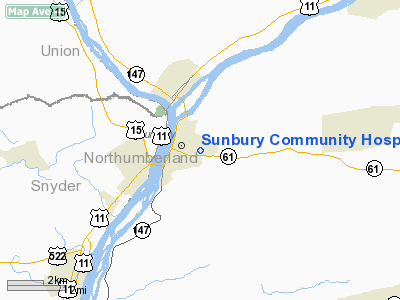
Sunbury Community Hospital Heliport |
Location & QuickFacts
| FAA Information Effective: | 2008-09-25 |
| Airport Identifier: | 2PS8 |
| Airport Status: | Operational |
| Longitude/Latitude: | 076-46-38.8750W/40-51-42.3060N
-76.777465/40.861752 (Estimated) |
| Elevation: | 500 ft / 152.40 m (Estimated) |
| Land: | 0 acres |
| From nearest city: | 0 nautical miles N of Sunbury, PA |
| Location: | Northumberland County, PA |
| Magnetic Variation: | 10W (1985) |
Owner & Manager
| Ownership: | Privately owned |
| Owner: | Sunbury Community Hospital |
| Address: | 350 North 11th Street
Sunbury, PA 17801 |
| Phone number: | 717-286-3333 |
| Manager: | Ken Leininger |
| Address: | 350 North 11th Street
Sunbury, PA 17801 |
| Phone number: | 717-286-3333 |
Airport Operations and Facilities
| Airport Use: | Private
MEDICAL USE. |
| Wind indicator: | Yes |
| Segmented Circle: | No |
| Control Tower: | No |
| Landing fee charge: | No |
| Sectional chart: | New York |
| Region: | AEA - Eastern |
| Boundary ARTCC: | ZNY - New York |
| Tie-in FSS: | IPT - Williamsport |
| FSS on Airport: | No |
| FSS Toll Free: | 1-800-WX-BRIEF |
Runway Information
Helipad H1
| Dimension: | 48 x 30 ft / 14.6 x 9.1 m |
| Surface: | CONC,
ROOFTOP. |
| |
Runway H1 |
Runway |
| Traffic Pattern: | Left | Left |
|
Radio Navigation Aids
| ID |
Type |
Name |
Ch |
Freq |
Var |
Dist |
| PIX | NDB | Picture Rocks | | 344.00 | 09W | 25.1 nm |
| BZJ | NDB | Bellgrove | | 328.00 | 10W | 27.6 nm |
| HXM | NDB | Humbolt | | 366.00 | 10W | 36.3 nm |
| RV | NDB | Stroh | | 407.00 | 10W | 45.3 nm |
| LQX | NDB | Carbon | | 339.00 | 12W | 46.4 nm |
| CYE | NDB | Crystal Lake | | 410.00 | 11W | 47.7 nm |
| HZL | VOR | Hazleton | | 109.40 | 09W | 30.4 nm |
| FQM | VOR/DME | Williamsport | 091X | 114.40 | 09W | 28.7 nm |
| SEG | VORTAC | Selinsgrove | 041X | 110.40 | 08W | 6.5 nm |
| MIP | VORTAC | Milton | 029X | 109.20 | 09W | 11.0 nm |
| RAV | VORTAC | Ravine | 093X | 114.60 | 11W | 20.2 nm |
| HAR | VORTAC | Harrisburg | 072X | 112.50 | 10W | 36.2 nm |
| LRP | VORTAC | Lancaster | 120X | 117.30 | 09W | 49.8 nm |
| MDT | VOT | Harrisburg International | | 110.00 | | 39.9 nm |
Remarks
- PROVIDED INGRESS/EGRESS ROUTES ARE AWAY FROM TRAFFIC PATTERNS AT SUNBURY ARPT.
Images and information placed above are from
http://www.airport-data.com/airport/2PS8/
We thank them for the data!
| General Info
|
| Country |
United States
|
| State |
PENNSYLVANIA
|
| FAA ID |
2PS8
|
| Latitude |
40-51-42.306N
|
| Longitude |
076-46-38.875W
|
| Elevation |
500 feet
|
| Near City |
SUNBURY
|
We don't guarantee the information is fresh and accurate. The data may
be wrong or outdated.
For more up-to-date information please refer to other sources.
|
|


