 |
|
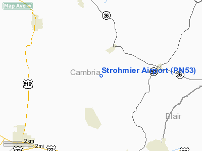
Location & QuickFacts
| FAA Information Effective: | 2008-09-25 |
| Airport Identifier: | PN53 |
| Airport Status: | Operational |
| Longitude/Latitude: | 078-37-24.0700W/40-33-05.2490N
-78.623353/40.551458 (Estimated) |
| Elevation: | 1962 ft / 598.02 m (Estimated) |
| Land: | 7 acres |
| From nearest city: | 3 nautical miles NE of Loretto, PA |
| Location: | Cambria County, PA |
| Magnetic Variation: | 09W (1985) |
Owner & Manager
| Ownership: | Privately owned |
| Owner: | Bernard & Virginia Strohmier |
| Address: | Rd 1, Box 131-s
Loretto, PA 15940-9645 |
| Phone number: | 814-674-5214 |
| Manager: | Bernard C. Strohmier |
| Address: | Rd 1, Box 131-s
Loretto, PA 15940-9645 |
| Phone number: | 814-674-5214 |
Airport Operations and Facilities
| Airport Use: | Private |
| Wind indicator: | Yes |
| Segmented Circle: | No |
| Control Tower: | No |
| Landing fee charge: | No |
| Sectional chart: | Detroit |
| Region: | AEA - Eastern |
| Boundary ARTCC: | ZOB - Cleveland |
| Tie-in FSS: | AOO - Altoona |
| FSS on Airport: | No |
| FSS Toll Free: | 1-800-WX-BRIEF |
Airport Services
| Airframe Repair: | NONE |
| Power Plant Repair: | NONE |
Runway Information
Runway 05/23
| Dimension: | 1200 x 50 ft / 365.8 x 15.2 m |
| Surface: | TURF, Good Condition |
| |
Runway 05 |
Runway 23 |
| Traffic Pattern: | Left | Left |
| Displaced threshold: | 400.00 ft | 0.00 ft |
|
Runway 15/33
| Dimension: | 1550 x 50 ft / 472.4 x 15.2 m |
| Surface: | TURF, Good Condition |
| |
Runway 15 |
Runway 33 |
| Traffic Pattern: | Left | Left |
| Obstruction: | 50 ft pline, 300.0 ft from runway | |
|
Radio Navigation Aids
| ID |
Type |
Name |
Ch |
Freq |
Var |
Dist |
| INP | NDB | Indiana | | 242.00 | 08W | 20.8 nm |
| SYS | NDB | Stoystown | | 209.00 | 08W | 31.1 nm |
| BHU | NDB | Benje | | 382.00 | 07W | 31.5 nm |
| RV | NDB | Stroh | | 407.00 | 10W | 41.5 nm |
| AOO | VOR | Altoona | | 108.80 | 07W | 20.0 nm |
| REC | VOR/DME | Revloc | 043X | 110.60 | 09W | 5.7 nm |
| JST | VORTAC | Johnstown | 077X | 113.00 | 06W | 17.1 nm |
| TON | VORTAC | Tyrone | 096X | 114.90 | 07W | 17.3 nm |
| PSB | VORTAC | Philipsburg | 102X | 115.50 | 10W | 36.1 nm |
| ETG | VORTAC | Keating | 107X | 116.00 | 10W | 45.5 nm |
| THS | VORTAC | St Thomas | 097X | 115.00 | 07W | 48.3 nm |
| IHD | VORTAC | Indian Head | 019X | 108.20 | 06W | 48.4 nm |
Remarks
Images and information placed above are from
http://www.airport-data.com/airport/PN53/
We thank them for the data!
| General Info
|
| Country |
United States
|
| State |
PENNSYLVANIA
|
| FAA ID |
PN53
|
| Latitude |
40-33-05.249N
|
| Longitude |
078-37-24.070W
|
| Elevation |
1962 feet
|
| Near City |
LORETTO
|
We don't guarantee the information is fresh and accurate. The data may
be wrong or outdated.
For more up-to-date information please refer to other sources.
|
|


