 |
|
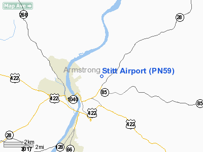
Location & QuickFacts
| FAA Information Effective: | 2008-09-25 |
| Airport Identifier: | PN59 |
| Airport Status: | Operational |
| Longitude/Latitude: | 079-29-12.9900W/40-49-51.9900N
-79.486942/40.831108 (Estimated) |
| Elevation: | 1200 ft / 365.76 m (Estimated) |
| Land: | 0 acres |
| From nearest city: | 2 nautical miles E of Kittanning, PA |
| Location: | Adams County, PA |
| Magnetic Variation: | 09W (2000) |
Owner & Manager
| Ownership: | Privately owned |
| Owner: | Thomas C. Stitt |
| Address: | R.d. #6 Box 463
Kittanning, PA 16201 |
| Phone number: | 720-545-2701 |
| Manager: | Thomas C. Stitt |
| Address: | R.d. #6 Box 463
Kittanning, PA 16201 |
| Phone number: | 720-545-2701 |
Airport Operations and Facilities
| Airport Use: | Private |
| Segmented Circle: | No |
| Control Tower: | No |
| Region: | AEA - Eastern |
| Boundary ARTCC: | ZOB - Cleveland |
| Tie-in FSS: | AOO - Altoona |
| FSS Toll Free: | 1-800-WX-BRIEF |
Runway Information
Runway 01/19
| Dimension: | 1800 x 100 ft / 548.6 x 30.5 m |
| Surface: | TURF, |
| |
Runway 01 |
Runway 19 |
| Traffic Pattern: | Left | Left |
| Obstruction: | 550 ft twr | |
|
Radio Navigation Aids
| ID |
Type |
Name |
Ch |
Freq |
Var |
Dist |
| INP | NDB | Indiana | | 242.00 | 08W | 22.6 nm |
| BHU | NDB | Benje | | 382.00 | 07W | 29.1 nm |
| MKP | NDB | Mc Keesport | | 287.00 | 07W | 31.6 nm |
| UCP | NDB | Castle | | 272.00 | 09W | 43.7 nm |
| FKL | VOR | Franklin | | 109.60 | 06W | 40.2 nm |
| CIP | VOR/DME | Clarion | 076X | 112.90 | 06W | 19.0 nm |
| REC | VOR/DME | Revloc | 043X | 110.60 | 09W | 37.8 nm |
| AGC | VOR/DME | Allegheny | 037X | 110.00 | 09W | 41.7 nm |
| EWC | VORTAC | Ellwood City | 105X | 115.80 | 08W | 33.0 nm |
| MMJ | VORTAC | Montour | 057X | 112.00 | 08W | 38.3 nm |
| JST | VORTAC | Johnstown | 077X | 113.00 | 06W | 42.9 nm |
Remarks
- PRVDD VFR ONLY, CLEAR 20:1 APCH/DEP PATH, MINIMUM NOISE OVER RESIDENCES.
Images and information placed above are from
http://www.airport-data.com/airport/PN59/
We thank them for the data!
|
|


