 |
|
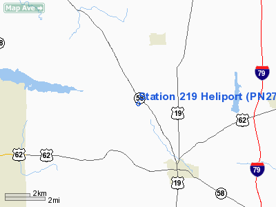
Location & QuickFacts
| FAA Information Effective: | 2008-09-25 |
| Airport Identifier: | PN27 |
| Airport Status: | Operational |
| Longitude/Latitude: | 080-16-38.2300W/41-16-29.2050N
-80.277286/41.274779 (Estimated) |
| Elevation: | 1310 ft / 399.29 m (Estimated) |
| Land: | 0 acres |
| From nearest city: | 10 nautical miles N of Mercer, PA |
| Location: | Mercer County, PA |
| Magnetic Variation: | 08W (1990) |
Owner & Manager
| Ownership: | Privately owned |
| Owner: | Tennessee Gas Pipeline |
| Address: | Rd 2 Box 2180
Mercer, PA 16137 |
| Phone number: | 412-662-2990 |
| Manager: | Mack Parrott |
| Address: | Rd 2 Box 2180
Mercer, PA 16137 |
| Phone number: | 412-662-2990 |
Airport Operations and Facilities
| Airport Use: | Private |
| Segmented Circle: | No |
| Control Tower: | No |
| Sectional chart: | Detroit |
| Region: | AEA - Eastern |
| Boundary ARTCC: | ZOB - Cleveland |
| Tie-in FSS: | AOO - Altoona |
| FSS on Airport: | No |
| FSS Toll Free: | 1-800-WX-BRIEF |
Runway Information
Helipad H1
| Dimension: | 20 x 20 ft / 6.1 x 6.1 m |
| Surface: | CONC, |
| |
Runway H1 |
Runway |
| Traffic Pattern: | Left | Left |
|
Radio Navigation Aids
| ID |
Type |
Name |
Ch |
Freq |
Var |
Dist |
| HBD | NDB | Hubbard | | 408.00 | 08W | 13.6 nm |
| UCP | NDB | Castle | | 272.00 | 09W | 16.4 nm |
| ORJ | NDB | Corry | | 258.00 | 09W | 47.6 nm |
| FKL | VOR | Franklin | | 109.60 | 06W | 21.4 nm |
| JFN | VOR/DME | Jefferson | 099X | 115.20 | 05W | 36.1 nm |
| CIP | VOR/DME | Clarion | 076X | 112.90 | 06W | 37.8 nm |
| CXR | VOR/DME | Chardon | 074X | 112.70 | 05W | 42.5 nm |
| ACO | VOR/DME | Akron | 091X | 114.40 | 04W | 43.0 nm |
| YNG | VORTAC | Youngstown | 027X | 109.00 | 05W | 18.3 nm |
| EWC | VORTAC | Ellwood City | 105X | 115.80 | 08W | 27.2 nm |
| ERI | VORTAC | Erie | 031X | 109.40 | 06W | 44.6 nm |
| TDT | VORTAC | Tidioute | 123X | 117.60 | 09W | 46.8 nm |
| MMJ | VORTAC | Montour | 057X | 112.00 | 08W | 47.4 nm |
Remarks
- DALGT; VFR USE ONLY; LMTD TO HELICOPTERS WEIGHING 12000 LBS OR LESS.
Images and information placed above are from
http://www.airport-data.com/airport/PN27/
We thank them for the data!
| General Info
|
| Country |
United States
|
| State |
PENNSYLVANIA
|
| FAA ID |
PN27
|
| Latitude |
41-16-29.205N
|
| Longitude |
080-16-38.230W
|
| Elevation |
1310 feet
|
| Near City |
MERCER
|
We don't guarantee the information is fresh and accurate. The data may
be wrong or outdated.
For more up-to-date information please refer to other sources.
|
|


