 |
|
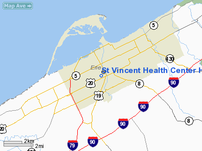
St Vincent Health Center Heliport |
Location & QuickFacts
| FAA Information Effective: | 2008-09-25 |
| Airport Identifier: | 29PN |
| Airport Status: | Operational |
| Longitude/Latitude: | 080-04-51.0000W/42-06-43.0000N
-80.080833/42.111944 (Estimated) |
| Elevation: | 731 ft / 222.81 m (Estimated) |
| Land: | 0 acres |
| From nearest city: | 6 nautical miles W of Erie, PA |
| Location: | Erie County, PA |
| Magnetic Variation: | 08W (1985) |
Owner & Manager
| Ownership: | Privately owned |
| Owner: | St Vincent Health Center |
| Address: | 232 West 25th St
Erie, PA 16544 |
| Phone number: | 814-452-5000 |
| Manager: | Paul B. Matters
VP PLANT OPERATIONS. |
| Address: | 232 West 25th St
Erie, PA 16544 |
| Phone number: | 814-452-5590 |
Airport Operations and Facilities
| Airport Use: | Private
MEDICAL USE. |
| Wind indicator: | Yes |
| Segmented Circle: | Yes |
| Control Tower: | No |
| Landing fee charge: | No |
| Sectional chart: | Detroit |
| Region: | AEA - Eastern |
| Boundary ARTCC: | ZOB - Cleveland |
| Tie-in FSS: | AOO - Altoona |
| FSS on Airport: | No |
| FSS Toll Free: | 1-800-WX-BRIEF |
Runway Information
Helipad H1
| Dimension: | 65 x 65 ft / 19.8 x 19.8 m |
| Surface: | ASPH, |
| |
Runway H1 |
Runway |
| Traffic Pattern: | Left | Left |
|
Radio Navigation Aids
| ID |
Type |
Name |
Ch |
Freq |
Var |
Dist |
| CQD | NDB | Cascade | | 372.00 | 08W | 1.1 nm |
| ORJ | NDB | Corry | | 258.00 | 09W | 22.7 nm |
| FKL | VOR | Franklin | | 109.60 | 06W | 41.7 nm |
| JFN | VOR/DME | Jefferson | 099X | 115.20 | 05W | 36.6 nm |
| JHW | VOR/DME | Jamestown | 094X | 114.70 | 07W | 43.0 nm |
| ERI | VORTAC | Erie | 031X | 109.40 | 06W | 11.0 nm |
| TDT | VORTAC | Tidioute | 123X | 117.60 | 09W | 38.2 nm |
| DKK | VORTAC | Dunkirk | 109X | 116.20 | 07W | 42.5 nm |
Remarks
- PRVDD ALL INGRESS & EGRESS ROUTES ARE ACCOMPLISHED FROM & TO TOS WEST; HELIPORT RESTRICTED TO EMERG LIFE SUPPORT OPNS.
Images and information placed above are from
http://www.airport-data.com/airport/29PN/
We thank them for the data!
| General Info
|
| Country |
United States
|
| State |
PENNSYLVANIA
|
| FAA ID |
29PN
|
| Latitude |
42-06-42.205N
|
| Longitude |
080-04-48.209W
|
| Elevation |
740 feet
|
| Near City |
ERIE
|
We don't guarantee the information is fresh and accurate. The data may
be wrong or outdated.
For more up-to-date information please refer to other sources.
|
|


