 |
|
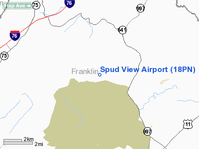
Location & QuickFacts
| FAA Information Effective: | 2008-09-25 |
| Airport Identifier: | 18PN |
| Airport Status: | Operational |
| Longitude/Latitude: | 077-41-33.9680W/40-03-55.3180N
-77.692769/40.065366 (Estimated) |
| Elevation: | 733 ft / 223.42 m (Surveyed) |
| Land: | 2 acres |
| From nearest city: | 1 nautical miles E of Upper Strasburg, PA |
| Location: | Franklin County, PA |
| Magnetic Variation: | 09W (1985) |
Owner & Manager
| Ownership: | Privately owned |
| Owner: | Charles A Bender Jr |
| Address: | 10379 Sandy Mt Rd
Orrstown, PA 17244 |
| Phone number: | 717-532-9108 |
| Manager: | Charles A Bender Jr |
| Address: | 10379 Sandy Mt Rd
Orrstown, PA 17244 |
| Phone number: | 717-532-9108 |
Airport Operations and Facilities
| Airport Use: | Private
PERSONAL USE. |
| Wind indicator: | Yes |
| Segmented Circle: | No |
| Control Tower: | No |
| Sectional chart: | Washington |
| Region: | AEA - Eastern |
| Boundary ARTCC: | ZNY - New York |
| Tie-in FSS: | IPT - Williamsport |
| FSS Toll Free: | 1-800-WX-BRIEF |
Runway Information
Runway 05/23
| Dimension: | 1640 x 50 ft / 499.9 x 15.2 m |
| Surface: | TURF, |
| |
Runway 05 |
Runway 23 |
| Traffic Pattern: | Left | Left |
| Obstruction: | | 70 ft pline, 2500.0 ft from runway |
|
Radio Navigation Aids
| ID |
Type |
Name |
Ch |
Freq |
Var |
Dist |
| RV | NDB | Stroh | | 407.00 | 10W | 33.0 nm |
| EUD | NDB | York | | 254.00 | 11W | 38.5 nm |
| HGR | VOR | Hagerstown | | 109.80 | 07W | 23.3 nm |
| AOO | VOR | Altoona | | 108.80 | 07W | 32.1 nm |
| FDK | VOR | Frederick | | 109.00 | 08W | 41.9 nm |
| THS | VORTAC | St Thomas | 097X | 115.00 | 07W | 14.3 nm |
| HAR | VORTAC | Harrisburg | 072X | 112.50 | 10W | 32.0 nm |
| MRB | VORTAC | Martinsburg | 058X | 112.10 | 07W | 41.5 nm |
| EMI | VORTAC | Westminster | 126X | 117.90 | 08W | 47.6 nm |
| TON | VORTAC | Tyrone | 096X | 114.90 | 07W | 49.7 nm |
| MDT | VOT | Harrisburg International | | 110.00 | | 43.4 nm |
Remarks
- PRVDD SINGLE ENGINE LAND OPS ONLY & TREE 110' E OF RY REMOVED & TREE NEAREST W SIDE RY 05 REMOVED.
Images and information placed above are from
http://www.airport-data.com/airport/18PN/
We thank them for the data!
| General Info
|
| Country |
United States
|
| State |
PENNSYLVANIA
|
| FAA ID |
18PN
|
| Latitude |
40-03-55.318N
|
| Longitude |
077-41-33.968W
|
| Elevation |
733 feet
|
| Near City |
UPPER STRASBURG
|
We don't guarantee the information is fresh and accurate. The data may
be wrong or outdated.
For more up-to-date information please refer to other sources.
|
|


