 |
|
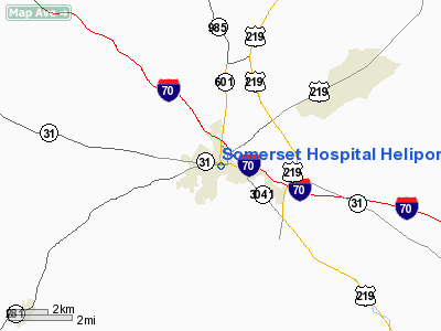
Somerset Hospital Heliport |
Location & QuickFacts
| FAA Information Effective: | 2008-09-25 |
| Airport Identifier: | 6PA2 |
| Airport Status: | Operational |
| Longitude/Latitude: | 079-04-41.0990W/40-00-25.2790N
-79.078083/40.007022 (Estimated) |
| Elevation: | 2272 ft / 692.51 m (Estimated) |
| Land: | 0 acres |
| From nearest city: | 0 nautical miles N of Somerset, PA |
| Location: | Somerset County, PA |
| Magnetic Variation: | 09W (1995) |
Owner & Manager
| Ownership: | Privately owned |
| Owner: | Somerset Hospital |
| Address: | 225 South Center Avenue
Somerset, PA 15501 |
| Phone number: | 814-443-5000 |
| Manager: | George Dively |
| Address: | 225 South Center Avenue
Somerset, PA 15501 |
| Phone number: | 814-443-5000 |
Airport Operations and Facilities
| Airport Use: | Private
MEDICAL USE. |
| Wind indicator: | Yes |
| Segmented Circle: | No |
| Control Tower: | No |
| Sectional chart: | Detroit |
| Region: | AEA - Eastern |
| Boundary ARTCC: | ZOB - Cleveland |
| Tie-in FSS: | AOO - Altoona |
| FSS on Airport: | No |
| FSS Toll Free: | 1-800-WX-BRIEF |
Runway Information
Helipad H1
| Dimension: | 45 x 45 ft / 13.7 x 13.7 m |
| Surface: | CONC, |
| |
Runway H1 |
Runway |
| Traffic Pattern: | Left | Left |
|
Radio Navigation Aids
| ID |
Type |
Name |
Ch |
Freq |
Var |
Dist |
| SYS | NDB | Stoystown | | 209.00 | 08W | 8.8 nm |
| BHU | NDB | Benje | | 382.00 | 07W | 23.9 nm |
| CBE | NDB | Cumberland | | 317.00 | 07W | 26.4 nm |
| VV | NDB | Camor | | 299.00 | 08W | 31.6 nm |
| INP | NDB | Indiana | | 242.00 | 08W | 37.6 nm |
| MKP | NDB | Mc Keesport | | 287.00 | 07W | 38.5 nm |
| AOO | VOR | Altoona | | 108.80 | 07W | 40.4 nm |
| GRV | VOR/DME | Grantsville | 070X | 112.30 | 06W | 22.4 nm |
| REC | VOR/DME | Revloc | 043X | 110.60 | 09W | 35.8 nm |
| ESL | VOR/DME | Kessel | 045X | 110.80 | 06W | 47.2 nm |
| AGC | VOR/DME | Allegheny | 037X | 110.00 | 09W | 47.2 nm |
| IHD | VORTAC | Indian Head | 019X | 108.20 | 06W | 13.1 nm |
| JST | VORTAC | Johnstown | 077X | 113.00 | 06W | 21.7 nm |
| MGW | VORTAC | Morgantown | 053X | 111.60 | 05W | 45.1 nm |
Remarks
- PRVDD OBSTNS BE MKD/LGTD; OPRS MINIMIZE NOISE OVER SCHOOLS & RESIDENTIAL AREAS.
Images and information placed above are from
http://www.airport-data.com/airport/6PA2/
We thank them for the data!
| General Info
|
| Country |
United States
|
| State |
PENNSYLVANIA
|
| FAA ID |
6PA2
|
| Latitude |
40-00-25.279N
|
| Longitude |
079-04-41.099W
|
| Elevation |
2272 feet
|
| Near City |
SOMERSET
|
We don't guarantee the information is fresh and accurate. The data may
be wrong or outdated.
For more up-to-date information please refer to other sources.
|
|


