 |
|
| Smoketown Airport |
| IATA: none – ICAO: none – FAA LID: S37 |
| Summary |
| Airport type |
Public |
| Owner |
Glick Aviation |
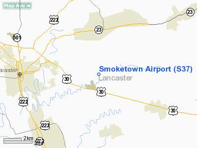
| Location |
Smoketown, Pennsylvania |
| Elevation AMSL |
370 ft / 112.8 m |
| Coordinates |
40°02′28″N 76°12′05″W / 40.04111°N 76.20139°W / 40.04111; -76.20139 |
| Runways |
| Direction |
Length |
Surface |
| ft |
m |
| 10/28 |
2,400 |
732 |
Asphalt |
This picture is looking at the western end of the field. The T-Hangers are located on the far side of the runway and the FBO is located near the gas pumps on the near side of the runway. (The approach end of runway 28 is not visible.) Smoketown Airport (FAA LID: S37) is an airport open to the public, located in Smoketown, 6.3 miles (10.1 km) east of Lancaster, in Lancaster County, Pennsylvania, USA. The airport is owned by Marlin Horst and managed by Mel Glick. The FAA reports an average of 74 aircraft operations per day and also reports that there are 86 aircraft based on the field. The airport also offers 100 LL aircraft fuel on the field as well as nearby lodging and food. Facilities
Smoketown Airport covers 49 acres and has one runway:
- Runway 10/28: 2,400 x 50 ft (732 x 15 m), Surface: Asphalt
Events
In the past the Smoketown Airport has hosted its local EAA chapter's fly-in however, the event moved to the nearby, larger Lancaster Airport (Pennsylvania). After this the airport began to have its own yearly fly in called the Smoketown Airport Fly-In.
In the news
On January 25, 1994, a Smoketown-based Piper piloted by Robert Faber of Lancaster, Pennsylvania, collided with trees and impacted a mountain while in cruise flight, returning from Bloomsburg Municipal Airport in Bloomsburg, Pennsylvania. The plane and occupant were not found for four days. Mechanical failure was suspected.
On May 12, 2005, Hayden Sheaffer of Lititz, Pennsylvania and Troy Martin, of Akron, Pennsylvania entered restricted air space in Washington, DC on the way to an air show in Lumberton, North Carolina. Subsequently, they were forced to land and were subject to having their misadventure broadcasted internationally.
On Aug 25, 2009, A student pilot, flying the same aircraft that Hayden Sheafer and Troy Martin flew into DC Airspace, violated the Special Flight Rules area of the District of Columbia. The student pilot was also forced to land at Montgomery County Airpark in Gaithersburg, Maryland.
The above content comes from Wikipedia and is published under free licenses – click here to read more.
Location & QuickFacts
| FAA Information Effective: | 2008-09-25 |
| Airport Identifier: | S37 |
| Airport Status: | Operational |
| Longitude/Latitude: | 076-12-04.8390W/40-02-28.3540N
-76.201344/40.041209 (Estimated) |
| Elevation: | 370 ft / 112.78 m (Estimated) |
| Land: | 49 acres |
| From nearest city: | 0 nautical miles N of Smoketown, PA |
| Location: | Lancaster County, PA |
| Magnetic Variation: | 11W (1985) |
Owner & Manager
| Ownership: | Privately owned |
| Owner: | G. Marlin Horst |
| Address: | 110 Short Street
New Holland, PA 17557 |
| Phone number: | 717-354-3059 |
| Manager: | Melvin S. Glick |
| Address: | 311 Airport Dr
Smoketown, PA 17576 |
| Phone number: | 717-394-6476 |
Airport Operations and Facilities
| Airport Use: | Open to public |
| Wind indicator: | Yes |
| Segmented Circle: | Yes |
| Control Tower: | No |
| Lighting Schedule: | DUSK-DAWN |
| Beacon Color: | Clear-Green (lighted land airport) |
| Landing fee charge: | No |
| Sectional chart: | New York |
| Region: | AEA - Eastern |
| Boundary ARTCC: | ZNY - New York |
| Tie-in FSS: | IPT - Williamsport |
| FSS on Airport: | No |
| FSS Toll Free: | 1-800-WX-BRIEF |
| NOTAMs Facility: | IPT (NOTAM-d service avaliable) |
Airport Communications
| CTAF: | 123.050 |
| Unicom: | 123.050 |
Airport Services
| Fuel available: | 100LL |
| Airframe Repair: | MAJOR |
| Power Plant Repair: | MAJOR |
Runway Information
Runway 10/28
| Dimension: | 2400 x 50 ft / 731.5 x 15.2 m |
| Surface: | ASPH, Good Condition |
| Weight Limit: | Single wheel: 12500 lbs.
Dual wheel: 12500 lbs. |
| Edge Lights: | Low |
| |
Runway 10 |
Runway 28 |
| Traffic Pattern: | Left | Left |
| Markings: | Basic, Good Condition | Basic, Good Condition |
| Displaced threshold: | 167.00 ft | 110.00 ft |
| Obstruction: | 40 ft tree, 341.0 ft from runway, 20 ft left of centerline, 3:1 slope to clear
RY 10 APCH SLOPE 22:1 TO DSPLCD THLD.
+10 FT PRIVATE ROAD. | , 50:1 slope to clear
+9 FT ROAD. |
|
Radio Navigation Aids
| ID |
Type |
Name |
Ch |
Freq |
Var |
Dist |
| BZJ | NDB | Bellgrove | | 328.00 | 10W | 28.7 nm |
| APG | NDB | Aberdeen | | 349.00 | 11W | 30.7 nm |
| EUD | NDB | York | | 254.00 | 11W | 32.0 nm |
| ING | NDB | Ambler | | 275.00 | 11W | 42.4 nm |
| MTN | NDB | Martin | | 342.00 | 11W | 45.3 nm |
| UKT | NDB | Quakertown | | 208.00 | 12W | 47.5 nm |
| NXX | NDB | Willow Grove | | 388.00 | 12W | 49.4 nm |
| IUB | NDB | Institute | | 404.00 | 08W | 49.4 nm |
| MTN | TACAN | Martin | 068X | | 11W | 43.8 nm |
| NXX | TACAN | Willow Grove | 061X | | 10W | 49.4 nm |
| PPM | VOR/DME | Phillips | 021X | 108.40 | 09W | 34.6 nm |
| ETX | VOR/DME | East Texas | 039X | 110.20 | 09W | 40.2 nm |
| CKZ | VOR/DME | Pennridge | 025Y | 108.85 | 12W | 46.9 nm |
| LRP | VORTAC | Lancaster | 120X | 117.30 | 09W | 6.3 nm |
| MXE | VORTAC | Modena | 079X | 113.20 | 09W | 25.5 nm |
| PTW | VORTAC | Pottstown | 112X | 116.50 | 09W | 31.4 nm |
| DQO | VORTAC | Dupont | 087X | 114.00 | 10W | 35.0 nm |
| RAV | VORTAC | Ravine | 093X | 114.60 | 11W | 35.8 nm |
| HAR | VORTAC | Harrisburg | 072X | 112.50 | 10W | 42.9 nm |
| OOD | VORTAC | Woodstown | 075X | 112.80 | 10W | 48.1 nm |
| EMI | VORTAC | Westminster | 126X | 117.90 | 08W | 48.7 nm |
| MDT | VOT | Harrisburg International | | 110.00 | | 27.5 nm |
| PHL | VOT | Philadelphia Intl | | 109.80 | | 45.2 nm |
Remarks
- FOR PICKUP CLNC TF 800-932-0712.
Images and information placed above are from
http://www.airport-data.com/airport/S37/
We thank them for the data!
|
|


