 |
|
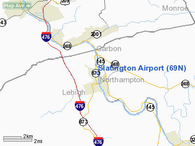
Location & QuickFacts
| FAA Information Effective: | 2008-09-25 |
| Airport Identifier: | 69N |
| Airport Status: | Operational |
| Longitude/Latitude: | 075-36-17.4687W/40-45-48.9386N
-75.604852/40.763594 (Estimated) |
| Elevation: | 380 ft / 115.82 m (Estimated) |
| Land: | 55 acres |
| From nearest city: | 1 nautical miles N of Slatington, PA |
| Location: | Lehigh County, PA |
| Magnetic Variation: | 11W (1985) |
Owner & Manager
| Ownership: | Privately owned |
| Owner: | Roger P. Sell, Inc |
| Address: | 407 E Franklin St
Slatington, PA 18080 |
| Phone number: | 610-799-3302 |
| Manager: | Roger S. Sell |
| Address: | 1000 Airport Lane
Slatington, PA 18080 |
| Phone number: | 610-767-5881
OR 610-767-8739. FOR SVC AFTER HRS 610-799-3302. |
Airport Operations and Facilities
| Airport Use: | Open to public |
| Wind indicator: | Yes |
| Segmented Circle: | Yes |
| Control Tower: | No |
| Lighting Schedule: | RDO-CTL
ACTVT LIRL RY 01/19 & ROTG BCN - CTAF. |
| Beacon Color: | Clear-Green (lighted land airport) |
| Landing fee charge: | No |
| Sectional chart: | New York |
| Region: | AEA - Eastern |
| Boundary ARTCC: | ZNY - New York |
| Tie-in FSS: | IPT - Williamsport |
| FSS on Airport: | No |
| FSS Toll Free: | 1-800-WX-BRIEF |
| NOTAMs Facility: | IPT (NOTAM-d service avaliable) |
Airport Communications
| CTAF: | 122.800 |
| Unicom: | 122.800 |
Airport Services
| Fuel available: | 100LLA |
| Airframe Repair: | MAJOR |
| Power Plant Repair: | MAJOR |
| Bottled Oxygen: | NONE |
| Bulk Oxygen: | NONE |
Runway Information
Runway 01/19
| Dimension: | 2455 x 50 ft / 748.3 x 15.2 m |
| Surface: | ASPH, Good Condition |
| Edge Lights: | Non-standard lighting system
NSTD LIRL LCTD 10 & 20 FT OUTBOARD FM RY EDGES RESPECTIVELY.THLD LGTS LOCATED OUTBOARD FM RY EDGES; 3 LGTS EACH SIDE. |
| |
Runway 01 |
Runway 19 |
| Longitude: | 075-36-17.6290W | 075-36-17.2927W |
| Latitude: | 40-45-36.8115N | 40-46-01.0656N |
| Alignment: | 1 | 127 |
| Traffic Pattern: | Left | Left |
| Markings: | Basic, Good Condition | Basic, Good Condition |
| Displaced threshold: | 352.00 ft | 0.00 ft |
| Obstruction: | 72 ft trees, 1014.0 ft from runway, 106 ft left of centerline, 11:1 slope to clear
RY 01 APCH SLOPE 18:1 TO DSPLCD THLD. | 14 ft trees, 252.0 ft from runway, 96 ft left of centerline, 3:1 slope to clear
RY 19, +12 FT TREE, 196 FT FROM RY END, 109 FT L. |
|
Radio Navigation Aids
| ID |
Type |
Name |
Ch |
Freq |
Var |
Dist |
| LQX | NDB | Carbon | | 339.00 | 12W | 7.6 nm |
| HXM | NDB | Humbolt | | 366.00 | 10W | 22.4 nm |
| UKT | NDB | Quakertown | | 208.00 | 12W | 24.7 nm |
| CYE | NDB | Crystal Lake | | 410.00 | 11W | 28.8 nm |
| DYL | NDB | Doylestown | | 237.00 | 10W | 33.9 nm |
| NXX | NDB | Willow Grove | | 388.00 | 12W | 40.4 nm |
| ING | NDB | Ambler | | 275.00 | 11W | 41.0 nm |
| BZJ | NDB | Bellgrove | | 328.00 | 10W | 47.5 nm |
| NXX | TACAN | Willow Grove | 061X | | 10W | 40.1 nm |
| HZL | VOR | Hazleton | | 109.40 | 09W | 26.9 nm |
| PNE | VOR | North Philadelphia | | 112.00 | 10W | 49.2 nm |
| ETX | VOR/DME | East Texas | 039X | 110.20 | 09W | 11.6 nm |
| CKZ | VOR/DME | Pennridge | 025Y | 108.85 | 12W | 26.6 nm |
| BWZ | VOR/DME | Broadway | 089X | 114.20 | 11W | 35.7 nm |
| STW | VOR/DME | Stillwater | 033X | 109.60 | 11W | 36.2 nm |
| SBJ | VOR/DME | Solberg | 076X | 112.90 | 10W | 40.8 nm |
| ARD | VOR/DME | Yardley | 019X | 108.20 | 10W | 44.2 nm |
| FJC | VORTAC | Allentown | 122X | 117.50 | 10W | 7.2 nm |
| LVZ | VORTAC | Wilkes-barre | 053X | 111.60 | 10W | 30.8 nm |
| PTW | VORTAC | Pottstown | 112X | 116.50 | 09W | 32.6 nm |
| LHY | VORTAC | Lake Henry | 045X | 110.80 | 10W | 43.2 nm |
| RAV | VORTAC | Ravine | 093X | 114.60 | 11W | 47.1 nm |
| LRP | VORTAC | Lancaster | 120X | 117.30 | 09W | 49.8 nm |
Remarks
- +977 FT HILL 7700 FT FROM RY 19 THLD.
- EXISTED PRIOR TO 1959.
Images and information placed above are from
http://www.airport-data.com/airport/69N/
We thank them for the data!
|
|


