 |
|
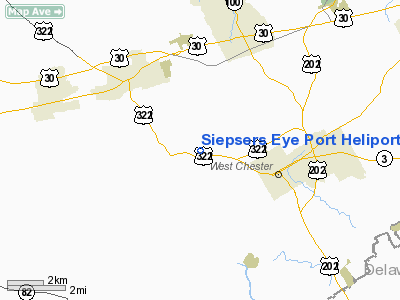
Siepsers Eye Port Heliport |
Location & QuickFacts
| FAA Information Effective: | 2008-09-25 |
| Airport Identifier: | 9PS6 |
| Airport Status: | Operational |
| Longitude/Latitude: | 075-39-21.7700W/39-58-15.3800N
-75.656047/39.970939 (Estimated) |
| Elevation: | 350 ft / 106.68 m (Estimated) |
| Land: | 0 acres |
| From nearest city: | 4 nautical miles W of Downingtown, PA |
| Location: | Chester County, PA |
| Magnetic Variation: | 12W (1995) |
Owner & Manager
| Ownership: | Privately owned |
| Owner: | Steven B Siepser |
| Address: | 812 S. Apple Hill Dr
West Chester, PA 19380 |
| Phone number: | 610-431-3344 |
| Manager: | Steven B. Siepser |
| Address: | 812 S. Apple Hill Dr
West Chester, PA 19380 |
| Phone number: | 610-431-3344 |
Airport Operations and Facilities
| Airport Use: | Private |
| Wind indicator: | Yes |
| Segmented Circle: | No |
| Control Tower: | No |
| Lighting Schedule: | PHONE REQ
FOR PERIMETER LGTS CALL 610-431-3344. |
| Sectional chart: | Washington |
| Region: | AEA - Eastern |
| Boundary ARTCC: | ZNY - New York |
| Tie-in FSS: | IPT - Williamsport |
| FSS on Airport: | No |
| FSS Toll Free: | 1-800-WX-BRIEF |
Runway Information
Helipad H1
| Dimension: | 20 x 20 ft / 6.1 x 6.1 m |
| Surface: | ASPH, Good Condition |
| |
Runway H1 |
Runway |
| Traffic Pattern: | Left | Left |
|
Radio Navigation Aids
| ID |
Type |
Name |
Ch |
Freq |
Var |
Dist |
| ING | NDB | Ambler | | 275.00 | 11W | 19.4 nm |
| NXX | NDB | Willow Grove | | 388.00 | 12W | 26.9 nm |
| UKT | NDB | Quakertown | | 208.00 | 12W | 31.9 nm |
| DYL | NDB | Doylestown | | 237.00 | 10W | 32.9 nm |
| APG | NDB | Aberdeen | | 349.00 | 11W | 33.5 nm |
| RNB | NDB | Rainbow | | 363.00 | 11W | 41.0 nm |
| BZJ | NDB | Bellgrove | | 328.00 | 10W | 49.8 nm |
| NXX | TACAN | Willow Grove | 061X | | 10W | 27.0 nm |
| PNE | VOR | North Philadelphia | | 112.00 | 10W | 30.5 nm |
| CKZ | VOR/DME | Pennridge | 025Y | 108.85 | 12W | 30.4 nm |
| ETX | VOR/DME | East Texas | 039X | 110.20 | 09W | 36.7 nm |
| ARD | VOR/DME | Yardley | 019X | 108.20 | 10W | 38.4 nm |
| PPM | VOR/DME | Phillips | 021X | 108.40 | 09W | 38.5 nm |
| MXE | VORTAC | Modena | 079X | 113.20 | 09W | 3.3 nm |
| PTW | VORTAC | Pottstown | 112X | 116.50 | 09W | 15.7 nm |
| DQO | VORTAC | Dupont | 087X | 114.00 | 10W | 17.7 nm |
| OOD | VORTAC | Woodstown | 075X | 112.80 | 10W | 25.9 nm |
| LRP | VORTAC | Lancaster | 120X | 117.30 | 09W | 30.6 nm |
| VCN | VORTAC | Cedar Lake | 099X | 115.20 | 10W | 41.1 nm |
| ENO | VORTAC | Smyrna | 051X | 111.40 | 09W | 44.9 nm |
| FJC | VORTAC | Allentown | 122X | 117.50 | 10W | 46.4 nm |
| GXU | VORTAC | Mc Guire | 043X | 110.60 | 11W | 48.9 nm |
| PHL | VOT | Philadelphia Intl | | 109.80 | | 19.9 nm |
Remarks
- PRVDD IFR ONLY; 8:1 APCHS/DEPS; HANGAR OBSTN LGTD; APPROPRIATE MARKINGS; LGTD WINDSOCK INSTALLED; METAL POLE NEXT TO PAD REMOVED.
Images and information placed above are from
http://www.airport-data.com/airport/9PS6/
We thank them for the data!
| General Info
|
| Country |
United States
|
| State |
PENNSYLVANIA
|
| FAA ID |
9PS6
|
| Latitude |
39-58-15.380N
|
| Longitude |
075-39-21.770W
|
| Elevation |
350 feet
|
| Near City |
DOWNINGTOWN
|
We don't guarantee the information is fresh and accurate. The data may
be wrong or outdated.
For more up-to-date information please refer to other sources.
|
|


