 |
|
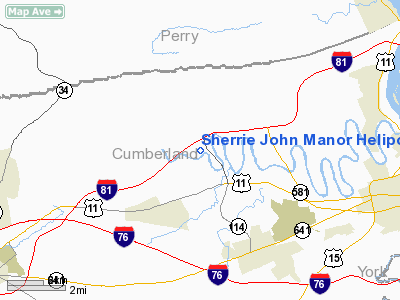
Sherrie John Manor Heliport |
Location & QuickFacts
| FAA Information Effective: | 2008-09-25 |
| Airport Identifier: | 11PA |
| Airport Status: | Operational |
| Longitude/Latitude: | 077-02-44.9180W/40-15-45.3170N
-77.045811/40.262588 (Estimated) |
| Elevation: | 400 ft / 121.92 m (Estimated) |
| Land: | 0 acres |
| From nearest city: | 6 nautical miles SE of Mechanicsburg, PA |
| Location: | Cumberland County, PA |
| Magnetic Variation: | 10W (1985) |
Owner & Manager
| Ownership: | Privately owned |
| Owner: | John P Hall |
| Address: | Sherrie John Manor
Mechanicsburg, PA 17055 |
| Phone number: | 717-766-0550 |
| Manager: | John P Hall |
| Address: | Sherrie John Manor
Mechanicsburg, PA 17055 |
| Phone number: | 717-766-0550 |
Airport Operations and Facilities
| Airport Use: | Private |
| Segmented Circle: | No |
| Control Tower: | No |
| Sectional chart: | Detroit |
| Region: | AEA - Eastern |
| Boundary ARTCC: | ZNY - New York |
| Tie-in FSS: | IPT - Williamsport |
| FSS Toll Free: | 1-800-WX-BRIEF |
Runway Information
Helipad H1
| Dimension: | 75 x 75 ft / 22.9 x 22.9 m |
| Surface: | TURF, |
| |
Runway H1 |
Runway |
| Traffic Pattern: | Left | Left |
|
Radio Navigation Aids
| ID |
Type |
Name |
Ch |
Freq |
Var |
Dist |
| EUD | NDB | York | | 254.00 | 11W | 22.0 nm |
| BZJ | NDB | Bellgrove | | 328.00 | 10W | 24.9 nm |
| RV | NDB | Stroh | | 407.00 | 10W | 37.3 nm |
| HAR | VORTAC | Harrisburg | 072X | 112.50 | 10W | 2.6 nm |
| RAV | VORTAC | Ravine | 093X | 114.60 | 11W | 26.9 nm |
| SEG | VORTAC | Selinsgrove | 041X | 110.40 | 08W | 32.6 nm |
| LRP | VORTAC | Lancaster | 120X | 117.30 | 09W | 35.7 nm |
| THS | VORTAC | St Thomas | 097X | 115.00 | 07W | 46.1 nm |
| EMI | VORTAC | Westminster | 126X | 117.90 | 08W | 46.2 nm |
| MIP | VORTAC | Milton | 029X | 109.20 | 09W | 48.9 nm |
| MDT | VOT | Harrisburg International | | 110.00 | | 13.5 nm |
Remarks
- AIRSPACE DETERMINATION PENDING.
Images and information placed above are from
http://www.airport-data.com/airport/11PA/
We thank them for the data!
| General Info
|
| Country |
United States
|
| State |
PENNSYLVANIA
|
| FAA ID |
11PA
|
| Latitude |
40-15-45.317N
|
| Longitude |
077-02-44.918W
|
| Elevation |
400 feet
|
| Near City |
MECHANICSBURG
|
We don't guarantee the information is fresh and accurate. The data may
be wrong or outdated.
For more up-to-date information please refer to other sources.
|
|


