|
|
 |
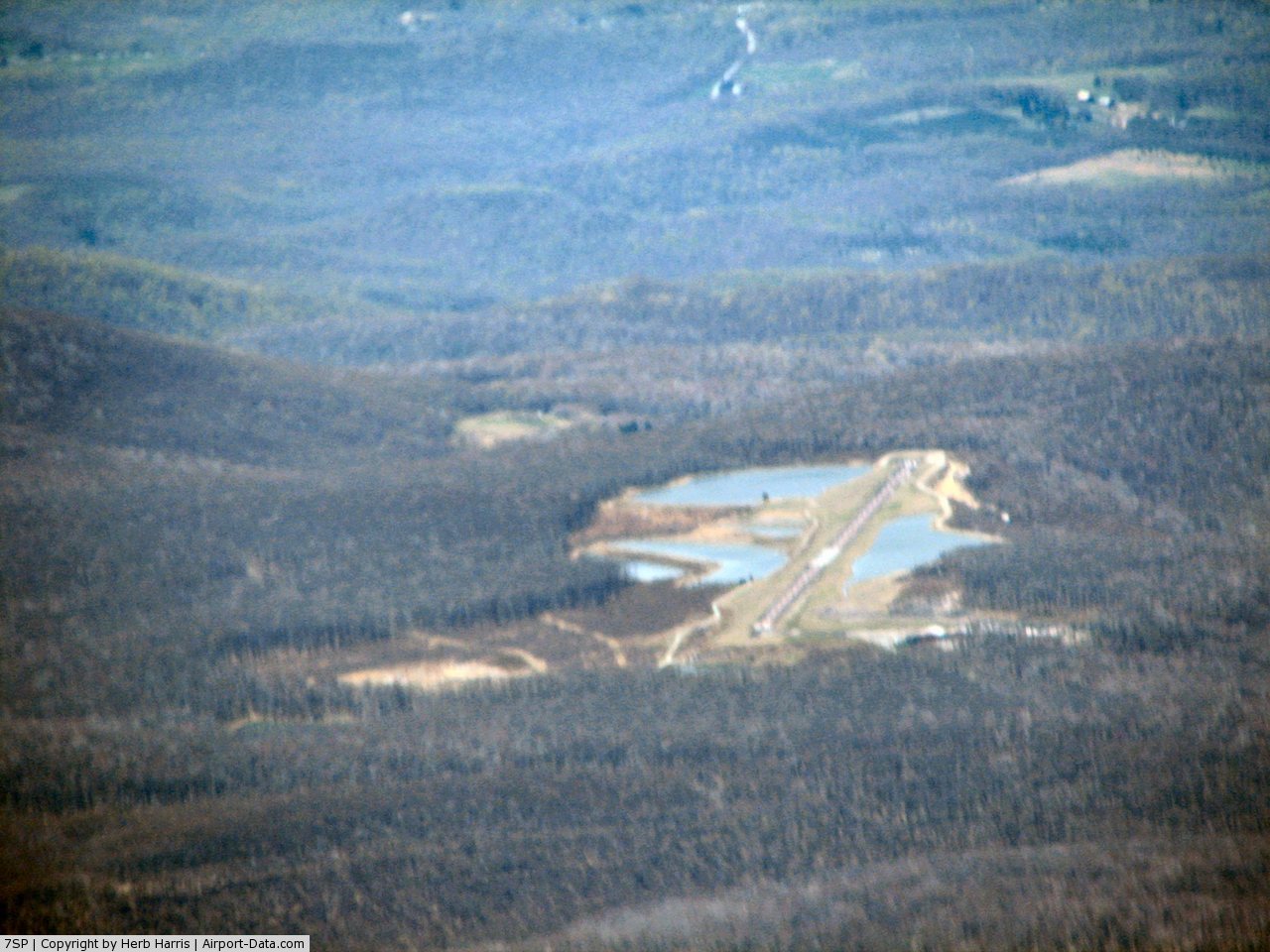
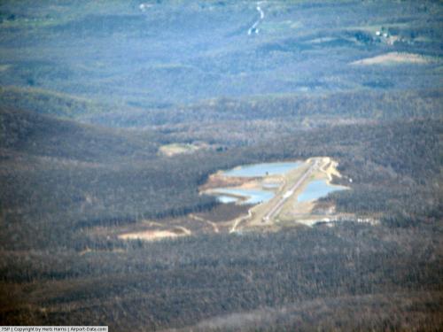
(Click on the photo to enlarge) |
 |
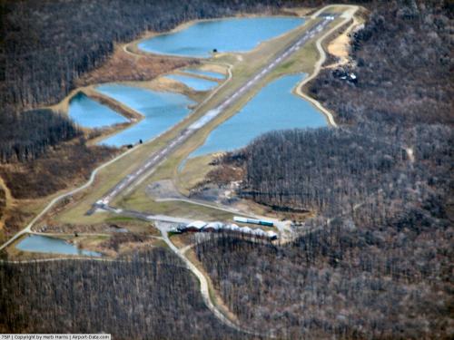
(Click on the photo to enlarge) |
Location & QuickFacts
| FAA Information Effective: | 2008-09-25 |
| Airport Identifier: | 7SP |
| Airport Status: | Operational |
| Longitude/Latitude: | 079-19-18.8190W/40-00-36.1690N
-79.321894/40.010047 (Estimated) |
| Elevation: | 2907 ft / 886.05 m (Surveyed) |
| Land: | 25 acres |
| From nearest city: | 1 nautical miles SW of Seven Springs Borough, PA |
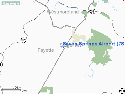
| Location: | Fayette County, PA |
| Magnetic Variation: | 06W (1965) |
Owner & Manager
| Ownership: | Publicly owned |
| Owner: | Seven Springs Arpt Authority |
| Address: | 777 Waterwheel Drive
Seven Springs, PA 15622 |
| Phone number: | 814-352-7777 |
| Manager: | John Mates |
| Address: | 777 Waterwheel Drive
Seven Springs, PA 15622 |
| Phone number: | 814-352-7777 |
Airport Operations and Facilities
| Airport Use: | Open to public |
| Wind indicator: | Yes |
| Segmented Circle: | Yes |
| Control Tower: | No |
| Lighting Schedule: | DUSK-DAWN
ACTVT MIRL RY 10/28 - CTAF. |
| Beacon Color: | Clear-Green (lighted land airport) |
| Landing fee charge: | No |
| Sectional chart: | Detroit |
| Region: | AEA - Eastern |
| Boundary ARTCC: | ZOB - Cleveland |
| Tie-in FSS: | AOO - Altoona |
| FSS on Airport: | No |
| FSS Toll Free: | 1-800-WX-BRIEF |
| NOTAMs Facility: | AOO (NOTAM-d service avaliable) |
Airport Communications
Airport Services
| Airframe Repair: | NONE |
| Power Plant Repair: | NONE |
Runway Information
Runway 10/28
| Dimension: | 3045 x 42 ft / 928.1 x 12.8 m
152 X 22 FT PAVED UNMKD SAFETY AREA E END; 84 X 42 FT PAVED UNMKD SAFETY AREA W END. |
| Surface: | ASPH, Fair Condition |
| Edge Lights: | Medium |
| |
Runway 10 |
Runway 28 |
| Longitude: | 079-19-38.3870W | 079-18-59.2680W |
| Latitude: | 40-00-35.6860N | 40-00-36.5870N |
| Elevation: | 2907.00 ft | 2873.00 ft |
| Alignment: | 88 | 127 |
| Traffic Pattern: | Left | Left |
| Markings: | Basic, Fair Condition | Basic, Fair Condition |
| Obstruction: | 6 ft trees, 215.0 ft from runway, 86 ft left of centerline, 2:1 slope to clear | 21 ft trees, 730.0 ft from runway, 105 ft right of centerline, 25:1 slope to clear |
|
Radio Navigation Aids
| ID |
Type |
Name |
Ch |
Freq |
Var |
Dist |
| SYS | NDB | Stoystown | | 209.00 | 08W | 19.2 nm |
| VV | NDB | Camor | | 299.00 | 08W | 20.9 nm |
| BHU | NDB | Benje | | 382.00 | 07W | 22.1 nm |
| MKP | NDB | Mc Keesport | | 287.00 | 07W | 29.6 nm |
| CBE | NDB | Cumberland | | 317.00 | 07W | 34.3 nm |
| INP | NDB | Indiana | | 242.00 | 08W | 39.2 nm |
| PNU | NDB | Washington County | | 255.00 | 08W | 39.5 nm |
| GRV | VOR/DME | Grantsville | 070X | 112.30 | 06W | 25.8 nm |
| AGC | VOR/DME | Allegheny | 037X | 110.00 | 09W | 36.8 nm |
| REC | VOR/DME | Revloc | 043X | 110.60 | 09W | 41.6 nm |
| ESL | VOR/DME | Kessel | 045X | 110.80 | 06W | 49.6 nm |
| IHD | VORTAC | Indian Head | 019X | 108.20 | 06W | 2.7 nm |
| JST | VORTAC | Johnstown | 077X | 113.00 | 06W | 29.0 nm |
| MGW | VORTAC | Morgantown | 053X | 111.60 | 05W | 36.9 nm |
| MMJ | VORTAC | Montour | 057X | 112.00 | 08W | 49.3 nm |
Remarks
- ARPT SURROUNDED BY TREES; HIGHER TERRAIN WITH TREES LCTD APRXLY 302 FT IN FM RY 28 THLD & 433 FT NORTH.
- VFR ONLY.
Images and information placed above are from
http://www.airport-data.com/airport/7SP/
We thank them for the data!
| General Info
|
| Country |
United States
|
| State |
PENNSYLVANIA
|
| FAA ID |
7SP
|
| Latitude |
40-00-36.169N
|
| Longitude |
079-19-18.819W
|
| Elevation |
2907 feet
|
| Near City |
SEVEN SPRINGS BOROUGH
|
We don't guarantee the information is fresh and accurate. The data may
be wrong or outdated.
For more up-to-date information please refer to other sources.
|
|