 |
|
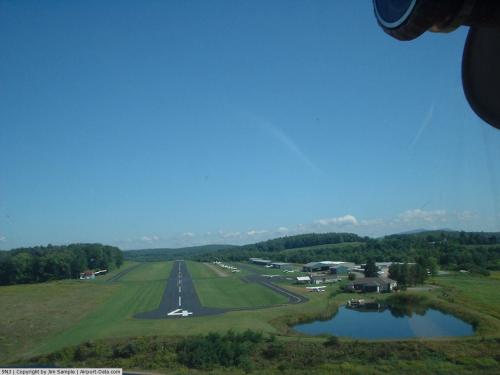 |
(Click on the photo to enlarge) |
Location & QuickFacts
| FAA Information Effective: | 2008-09-25 |
| Airport Identifier: | 9N3 |
| Airport Status: | Operational |
| Longitude/Latitude: | 075-45-21.8900W/41-35-21.6770N
-75.756081/41.589355 (Estimated) |
| Elevation: | 1209 ft / 368.50 m (Estimated) |
| Land: | 100 acres |
| From nearest city: | 2 nautical miles N of Factoryville, PA |
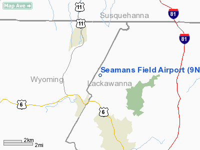
| Location: | Lackawanna County, PA |
| Magnetic Variation: | 12W (1985) |
Owner & Manager
| Ownership: | Privately owned |
| Owner: | Endless Mountains Air, Inc. |
| Address: | 727 Windsock La.
Factoryville, PA 18419 |
| Phone number: | 570-945-5125 |
| Manager: | Bill Dobitsch |
| Address: | 727 Windsock La
Factoryville, PA 18419 |
| Phone number: | 570-945-5125 |
Airport Operations and Facilities
| Airport Use: | Open to public |
| Wind indicator: | Yes |
| Segmented Circle: | No |
| Control Tower: | No |
| Lighting Schedule: | DUSK-DAWN |
| Beacon Color: | Clear-Green (lighted land airport) |
| Landing fee charge: | No |
| Sectional chart: | New York |
| Region: | AEA - Eastern |
| Traffic Pattern Alt: | 800 ft |
| Boundary ARTCC: | ZNY - New York |
| Tie-in FSS: | IPT - Williamsport |
| FSS on Airport: | No |
| FSS Toll Free: | 1-800-WX-BRIEF |
| NOTAMs Facility: | IPT (NOTAM-d service avaliable) |
Airport Communications
| CTAF: | 122.700 |
| Unicom: | 122.700 |
Airport Services
| Fuel available: | 100LL |
| Airframe Repair: | MAJOR
MECHANIC ON FIELD WKDAYS; ON CALL WKENDS CALL 570-945-3769. |
| Power Plant Repair: | MAJOR |
| Bottled Oxygen: | NONE |
| Bulk Oxygen: | NONE |
Runway Information
Runway 04/22
| Dimension: | 2500 x 50 ft / 762.0 x 15.2 m |
| Surface: | ASPH, Good Condition |
| Edge Lights: | Low |
| |
Runway 04 |
Runway 22 |
| Longitude: | 075-45-29.8256W | 075-45-16.5495W |
| Latitude: | 41-35-08.1164N | 41-35-30.7066N |
| Elevation: | 1184.00 ft | 1203.00 ft |
| Alignment: | 24 | 127 |
| Traffic Pattern: | Left | Left |
| Markings: | Basic, Good Condition | Basic, Good Condition |
| Obstruction: | , 50:1 slope to clear | 27 ft trees, 1185.0 ft from runway, 187 ft left of centerline, 36:1 slope to clear
+9 FT TREES 137 FT FM THLD 36 FT L. |
|
Radio Navigation Aids
| ID |
Type |
Name |
Ch |
Freq |
Var |
Dist |
| CYE | NDB | Crystal Lake | | 410.00 | 11W | 23.0 nm |
| HXM | NDB | Humbolt | | 366.00 | 10W | 37.7 nm |
| MS | NDB | Monga | | 359.00 | 12W | 41.6 nm |
| LQX | NDB | Carbon | | 339.00 | 12W | 46.7 nm |
| PIX | NDB | Picture Rocks | | 344.00 | 09W | 46.9 nm |
| HZL | VOR | Hazleton | | 109.40 | 09W | 40.5 nm |
| HNK | VOR/DME | Hancock | 115X | 116.80 | 11W | 34.6 nm |
| FQM | VOR/DME | Williamsport | 091X | 114.40 | 09W | 48.3 nm |
| LHY | VORTAC | Lake Henry | 045X | 110.80 | 10W | 14.1 nm |
| LVZ | VORTAC | Wilkes-barre | 053X | 111.60 | 10W | 19.3 nm |
| CFB | VORTAC | Binghamton | 059X | 112.20 | 10W | 38.2 nm |
Remarks
Images and information placed above are from
http://www.airport-data.com/airport/9N3/
We thank them for the data!
| General Info
|
| Country |
United States
|
| State |
PENNSYLVANIA
|
| FAA ID |
9N3
|
| Latitude |
41-35-21.677N
|
| Longitude |
075-45-21.890W
|
| Elevation |
1209 feet
|
| Near City |
FACTORYVILLE
|
We don't guarantee the information is fresh and accurate. The data may
be wrong or outdated.
For more up-to-date information please refer to other sources.
|
|


