 |
|
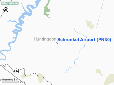
Location & QuickFacts
| FAA Information Effective: | 2008-09-25 |
| Airport Identifier: | PN30 |
| Airport Status: | Operational |
| Longitude/Latitude: | 078-06-09.0000W/40-15-46.0000N
-78.102500/40.262778 (Estimated) |
| Elevation: | 1200 ft / 365.76 m (Estimated) |
| Land: | 144 acres |
| From nearest city: | 4 nautical miles W of Cassville, PA |
| Location: | Huntingdon County, PA |
| Magnetic Variation: | 10W (1995) |
Owner & Manager
| Ownership: | Privately owned |
| Owner: | Charles M Schrenkel Jr |
| Address: | Hcr 1 Box 6
Todd, PA 16685 |
| Phone number: | 814-448-9218 |
| Manager: | Charles M Schrenkel |
| Address: | Hcr 1 Box 6
Todd, PA 16685 |
| Phone number: | 814-448-9218 |
Airport Operations and Facilities
| Airport Use: | Private |
| Wind indicator: | Yes |
| Segmented Circle: | No |
| Control Tower: | No |
| Sectional chart: | Detroit |
| Region: | AEA - Eastern |
| Boundary ARTCC: | ZOB - Cleveland |
| Tie-in FSS: | AOO - Altoona |
| FSS on Airport: | No |
| FSS Toll Free: | 1-800-WX-BRIEF |
Runway Information
Runway 17/35
| Dimension: | 2200 x 75 ft / 670.6 x 22.9 m |
| Surface: | TURF, Good Condition |
| |
Runway 17 |
Runway 35 |
| Traffic Pattern: | Left | Left |
| Obstruction: | 30 ft pline, 850.0 ft from runway | |
|
Radio Navigation Aids
| ID |
Type |
Name |
Ch |
Freq |
Var |
Dist |
| RV | NDB | Stroh | | 407.00 | 10W | 27.5 nm |
| SYS | NDB | Stoystown | | 209.00 | 08W | 38.9 nm |
| CBE | NDB | Cumberland | | 317.00 | 07W | 47.4 nm |
| INP | NDB | Indiana | | 242.00 | 08W | 49.3 nm |
| AOO | VOR | Altoona | | 108.80 | 07W | 10.0 nm |
| HGR | VOR | Hagerstown | | 109.80 | 07W | 35.8 nm |
| REC | VOR/DME | Revloc | 043X | 110.60 | 09W | 34.1 nm |
| THS | VORTAC | St Thomas | 097X | 115.00 | 07W | 21.0 nm |
| TON | VORTAC | Tyrone | 096X | 114.90 | 07W | 30.3 nm |
| JST | VORTAC | Johnstown | 077X | 113.00 | 06W | 33.7 nm |
| PSB | VORTAC | Philipsburg | 102X | 115.50 | 10W | 39.6 nm |
| HAR | VORTAC | Harrisburg | 072X | 112.50 | 10W | 47.4 nm |
Remarks
- PRVDD VFR ONLY; ROADWAYS ADEQUATELY MARKED TO WARN TFC OF APPROACHING ACFT.
Images and information placed above are from
http://www.airport-data.com/airport/PN30/
We thank them for the data!
| General Info
|
| Country |
United States
|
| State |
PENNSYLVANIA
|
| FAA ID |
PN30
|
| Latitude |
40-15-46.000N
|
| Longitude |
078-06-09.000W
|
| Elevation |
1200 feet
|
| Near City |
CASSVILLE
|
We don't guarantee the information is fresh and accurate. The data may
be wrong or outdated.
For more up-to-date information please refer to other sources.
|
|


