 |
|
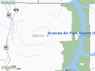
Location & QuickFacts
| FAA Information Effective: | 2008-09-25 |
| Airport Identifier: | 6PA4 |
| Airport Status: | Operational |
| Longitude/Latitude: | 079-02-03.1510W/41-55-50.2140N
-79.034209/41.930615 (Estimated) |
| Elevation: | 2050 ft / 624.84 m (Estimated) |
| Land: | 40 acres |
| From nearest city: | 4 nautical miles E of Russell, PA |
| Location: | Warren County, PA |
| Magnetic Variation: | 09W (1985) |
Owner & Manager
| Ownership: | Privately owned |
| Owner: | Harold F. Beach |
| Address: | 5 Beach St
North Warren, PA 16365 |
| Phone number: | 814-757-5699 |
| Manager: | Harold F. Beach |
| Address: | 5 Beach St
North Warren, PA 16356 |
| Phone number: | 814-723-4780 |
Airport Operations and Facilities
| Airport Use: | Private |
| Wind indicator: | Yes |
| Segmented Circle: | No |
| Control Tower: | No |
| Landing fee charge: | No |
| Sectional chart: | Detroit |
| Region: | AEA - Eastern |
| Boundary ARTCC: | ZOB - Cleveland |
| Tie-in FSS: | AOO - Altoona |
| FSS on Airport: | No |
| FSS Toll Free: | 1-800-WX-BRIEF |
Airport Services
| Fuel available: | MOGAS
FOR FUEL CALL 814-723-4780. |
| Airframe Repair: | NONE |
| Power Plant Repair: | NONE |
| Bottled Oxygen: | NONE |
| Bulk Oxygen: | NONE |
Runway Information
Runway 17/35
| Dimension: | 2000 x 100 ft / 609.6 x 30.5 m |
| Surface: | TURF, Good Condition
SOFT DURING SPRING THAW. |
| |
Runway 17 |
Runway 35 |
| Traffic Pattern: | Left | Left |
| Displaced threshold: | 634.00 ft | 634.00 ft
DSPLCD THLD MARKED WITH RED BOUNDARY MARKERS. |
| Obstruction: | 44 ft trees, 240.0 ft from runway, 136 ft left of centerline, 5:1 slope to clear
RY 17 APCH RATIO 19:1 TO DSPLCD THLD. | 13 ft trees, 61.0 ft from runway, 130 ft left of centerline, 4:1 slope to clear
RY35 APCH RATIO 50:1 TO DSPLCD THLD. |
|
Radio Navigation Aids
| ID |
Type |
Name |
Ch |
Freq |
Var |
Dist |
| ORJ | NDB | Corry | | 258.00 | 09W | 27.5 nm |
| LYS | NDB | Olean | | 360.00 | 09W | 37.7 nm |
| CQD | NDB | Cascade | | 372.00 | 08W | 49.1 nm |
| FKL | VOR | Franklin | | 109.60 | 06W | 47.3 nm |
| JHW | VOR/DME | Jamestown | 094X | 114.70 | 07W | 16.0 nm |
| BFD | VOR/DME | Bradford | 113X | 116.60 | 07W | 20.5 nm |
| TDT | VORTAC | Tidioute | 123X | 117.60 | 09W | 21.6 nm |
| DKK | VORTAC | Dunkirk | 109X | 116.20 | 07W | 35.3 nm |
| ELZ | VORTAC | Wellsville | 051X | 111.40 | 09W | 47.2 nm |
Remarks
- SKI ACFT ONLY WINTER MONTHS.
- 50 X 150 FT SAFETY AREA BOTH ENDS OF RY 17/35.
- DEER/WOODCHUCK ON RY.
- RADIO CONTROLLED MODEL ACFT OPS ON RY 35 APCH END.
- VFR OPNS ONLY
Images and information placed above are from
http://www.airport-data.com/airport/6PA4/
We thank them for the data!
| General Info
|
| Country |
United States
|
| State |
PENNSYLVANIA
|
| FAA ID |
6PA4
|
| Latitude |
41-55-50.214N
|
| Longitude |
079-02-03.151W
|
| Elevation |
2050 feet
|
| Near City |
RUSSELL
|
We don't guarantee the information is fresh and accurate. The data may
be wrong or outdated.
For more up-to-date information please refer to other sources.
|
|


