 |
|
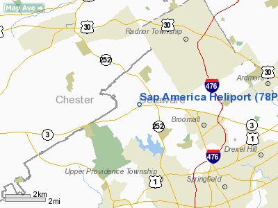
Location & QuickFacts
| FAA Information Effective: | 2008-09-25 |
| Airport Identifier: | 78PA |
| Airport Status: | Operational |
| Longitude/Latitude: | 075-24-57.4000W/39-59-13.3000N
-75.415944/39.987028 (Estimated) |
| Elevation: | 417 ft / 127.10 m (Estimated) |
| Land: | 0 acres |
| From nearest city: | 0 nautical miles N of Newton Square, PA |
| Location: | Delaware County, PA |
| Magnetic Variation: | () |
Owner & Manager
| Ownership: | Privately owned |
| Owner: | Sap America Inc. |
| Address: | 3999 West Chester Pike
Newton Square, PA 19073 |
| Phone number: | 610-661-3600 |
| Manager: | Patrick Rafferty |
| Address: | 3999 West Chester Pike
Newton Square, PA 19073 |
| Phone number: | 610-661-3600 |
Airport Operations and Facilities
| Airport Use: | Private |
| Wind indicator: | Yes |
| Control Tower: | No |
| Lighting Schedule: | PHONE REQ
FOR PERIMETER AND LEAD-IN LGTS CALL 610-661-3600. |
| Sectional chart: | New York |
| Region: | AEA - Eastern |
| Boundary ARTCC: | ZDC - Washington |
| Tie-in FSS: | IPT - Williamsport |
| FSS Toll Free: | 1-800-WX-BRIEF |
Runway Information
Helipad H1
| Dimension: | 45 x 45 ft / 13.7 x 13.7 m |
| Surface: | CONC, |
| |
Runway H1 |
Runway |
| Traffic Pattern: | Left | Left |
|
Radio Navigation Aids
| ID |
Type |
Name |
Ch |
Freq |
Var |
Dist |
| ING | NDB | Ambler | | 275.00 | 11W | 10.3 nm |
| NXX | NDB | Willow Grove | | 388.00 | 12W | 17.4 nm |
| DYL | NDB | Doylestown | | 237.00 | 10W | 24.9 nm |
| UKT | NDB | Quakertown | | 208.00 | 12W | 26.9 nm |
| RNB | NDB | Rainbow | | 363.00 | 11W | 36.6 nm |
| APG | NDB | Aberdeen | | 349.00 | 11W | 41.9 nm |
| NEL | NDB | Lakehurst | | 396.00 | 13W | 49.8 nm |
| NXX | TACAN | Willow Grove | 061X | | 10W | 17.6 nm |
| NEL | TACAN | Lakehurst | 055X | | 11W | 49.0 nm |
| NEL | UHF/NDB | Lakehurst | | 274.80 | 13W | 49.8 nm |
| PNE | VOR | North Philadelphia | | 112.00 | 10W | 19.6 nm |
| CKZ | VOR/DME | Pennridge | 025Y | 108.85 | 12W | 25.0 nm |
| ARD | VOR/DME | Yardley | 019X | 108.20 | 10W | 28.3 nm |
| ETX | VOR/DME | East Texas | 039X | 110.20 | 09W | 37.8 nm |
| PPM | VOR/DME | Phillips | 021X | 108.40 | 09W | 46.9 nm |
| SBJ | VOR/DME | Solberg | 076X | 112.90 | 10W | 47.3 nm |
| MXE | VORTAC | Modena | 079X | 113.20 | 09W | 12.5 nm |
| PTW | VORTAC | Pottstown | 112X | 116.50 | 09W | 15.6 nm |
| DQO | VORTAC | Dupont | 087X | 114.00 | 10W | 20.6 nm |
| OOD | VORTAC | Woodstown | 075X | 112.80 | 10W | 21.7 nm |
| VCN | VORTAC | Cedar Lake | 099X | 115.20 | 10W | 34.1 nm |
| GXU | VORTAC | Mc Guire | 043X | 110.60 | 11W | 37.8 nm |
| LRP | VORTAC | Lancaster | 120X | 117.30 | 09W | 41.1 nm |
| RBV | VORTAC | Robbinsville | 085X | 113.80 | 10W | 44.3 nm |
| FJC | VORTAC | Allentown | 122X | 117.50 | 10W | 44.5 nm |
| ENO | VORTAC | Smyrna | 051X | 111.40 | 09W | 45.6 nm |
| CYN | VORTAC | Coyle | 081X | 113.40 | 10W | 46.5 nm |
| PHL | VOT | Philadelphia Intl | | 109.80 | | 10.5 nm |
Remarks
- THIS PVT HELIPORT RQRS WRITTEN APVL FOR ACES.
- EMERGENCY SERVICE HELICOPTERS CONTACT MANAGER FOR ACCESS DETAILS PHONE 610-661-3600.
- USE PRIMA APCH/DEP PATHS FOR PATHS 060/240 DEGS AND 330/150 DEGS FOR NOISE ABATEMENT AND GOOD COMMUNITY RELATION. IF THERE IS AN ISSUE OF SAFETY OR CRITICAL EMERG MISSION NEED; OTHER PATHS MAYBE USED IF NEEDED. AVOID THE RESIDENTIAL AREAS AROUND THE FAC.
- 56 FT MAXIMUM ROTOR DIAMETER.
- MAX GROSS WEIGHT IS 30,000 LBS..
- PRVDD VFR OPNS; PVT USE; AREA IS MKD; OPNS FM 060 TO 240 DEGREES AND FM 330 TO 150 DEGREES.
Images and information placed above are from
http://www.airport-data.com/airport/78PA/
We thank them for the data!
| General Info
|
| Country |
United States
|
| State |
PENNSYLVANIA
|
| FAA ID |
78PA
|
| Latitude |
39-55-55.289N
|
| Longitude |
078-57-24.087W
|
| Elevation |
2320 feet
|
| Near City |
BERLIN
|
We don't guarantee the information is fresh and accurate. The data may
be wrong or outdated.
For more up-to-date information please refer to other sources.
|
|


