 |
|
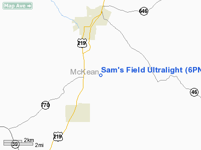
Sam's Field Ultralight Airport |
Location & QuickFacts
| FAA Information Effective: | 2008-09-25 |
| Airport Identifier: | 6PN5 |
| Airport Status: | Operational |
| Longitude/Latitude: | 078-37-44.0000W/41-54-27.0000N
-78.628889/41.907500 (Estimated) |
| Elevation: | 1540 ft / 469.39 m () |
| Land: | 4 acres |
| From nearest city: | 4 nautical miles NW of Bradford, PA |
| Location: | Mc Kean County, PA |
| Magnetic Variation: | 10W (2000) |
Owner & Manager
| Ownership: | Privately owned |
| Owner: | Tom M. Neilly |
| Address: | P.o. Box 32
Custer City, PA 16725 |
| Phone number: | 814-362-4443 |
| Manager: | Tom M. Neilly |
| Address: | P.o. Box 32
Custer City, PA 16725 |
| Phone number: | 814-362- |
Airport Operations and Facilities
| Airport Use: | Private |
| Wind indicator: | Yes |
| Segmented Circle: | No |
| Control Tower: | No |
| Sectional chart: | Washington |
| Region: | AEA - Eastern |
| Boundary ARTCC: | ZOB - Cleveland |
| Tie-in FSS: | AOO - Altoona |
| FSS Toll Free: | 1-800-WX-BRIEF |
Runway Information
Runway 09/27
| Dimension: | 1300 x 100 ft / 396.2 x 30.5 m |
| Surface: | TURF, |
| |
Runway 09 |
Runway 27 |
| Traffic Pattern: | Left | Left |
| Obstruction: | 40 ft pline, 110.0 ft from runway | |
|
Radio Navigation Aids
| ID |
Type |
Name |
Ch |
Freq |
Var |
Dist |
| LYS | NDB | Olean | | 360.00 | 09W | 26.1 nm |
| EL | NDB | Halos | | 269.00 | 09W | 34.1 nm |
| ORJ | NDB | Corry | | 258.00 | 09W | 45.6 nm |
| BFD | VOR/DME | Bradford | 113X | 116.60 | 07W | 7.3 nm |
| JHW | VOR/DME | Jamestown | 094X | 114.70 | 07W | 27.7 nm |
| ELZ | VORTAC | Wellsville | 051X | 111.40 | 09W | 30.2 nm |
| TDT | VORTAC | Tidioute | 123X | 117.60 | 09W | 37.2 nm |
| SLT | VORTAC | Slate Run | 086X | 113.90 | 08W | 37.9 nm |
| DKK | VORTAC | Dunkirk | 109X | 116.20 | 07W | 45.3 nm |
| ETG | VORTAC | Keating | 107X | 116.00 | 10W | 47.0 nm |
Images and information placed above are from
http://www.airport-data.com/airport/6PN5/
We thank them for the data!
|
|


