 |
|
Location & QuickFacts
| FAA Information Effective: | 2008-09-25 |
| Airport Identifier: | PN31 |
| Airport Status: | Operational |
| Longitude/Latitude: | 080-06-51.2160W/41-14-35.2100N
-80.114227/41.243114 (Estimated) |
| Elevation: | 1378 ft / 420.01 m (Estimated) |
| Land: | 0 acres |
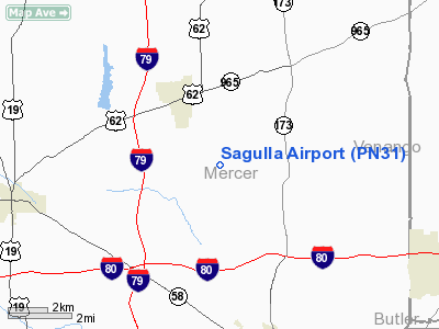
| From nearest city: | 5 nautical miles N of Grove City, PA |
| Location: | Mercer County, PA |
| Magnetic Variation: | 08W (1985) |
Owner & Manager
| Ownership: | Privately owned |
| Owner: | John Sagulla |
| Address: | Rd 1
Jackson Center, PA 16133 |
| Address: |
|
Airport Operations and Facilities
| Airport Use: | Private |
| Wind indicator: | No |
| Segmented Circle: | No |
| Control Tower: | No |
| Landing fee charge: | No |
| Sectional chart: | Detroit |
| Region: | AEA - Eastern |
| Boundary ARTCC: | ZOB - Cleveland |
| Tie-in FSS: | AOO - Altoona |
| FSS on Airport: | No |
| FSS Toll Free: | 1-800-WX-BRIEF |
Airport Services
| Airframe Repair: | NONE |
| Power Plant Repair: | NONE |
Runway Information
Runway NW/SE
| Dimension: | 2740 x 300 ft / 835.2 x 91.4 m |
| Surface: | TURF, |
| |
Runway NW |
Runway SE |
| Traffic Pattern: | Left | Left |
|
Radio Navigation Aids
| ID |
Type |
Name |
Ch |
Freq |
Var |
Dist |
| UCP | NDB | Castle | | 272.00 | 09W | 19.0 nm |
| HBD | NDB | Hubbard | | 408.00 | 08W | 19.6 nm |
| ORJ | NDB | Corry | | 258.00 | 09W | 45.4 nm |
| FKL | VOR | Franklin | | 109.60 | 06W | 16.5 nm |
| CIP | VOR/DME | Clarion | 076X | 112.90 | 06W | 30.2 nm |
| JFN | VOR/DME | Jefferson | 099X | 115.20 | 05W | 42.2 nm |
| ACO | VOR/DME | Akron | 091X | 114.40 | 04W | 49.9 nm |
| EWC | VORTAC | Ellwood City | 105X | 115.80 | 08W | 25.5 nm |
| YNG | VORTAC | Youngstown | 027X | 109.00 | 05W | 25.9 nm |
| TDT | VORTAC | Tidioute | 123X | 117.60 | 09W | 42.2 nm |
| MMJ | VORTAC | Montour | 057X | 112.00 | 08W | 45.5 nm |
| ERI | VORTAC | Erie | 031X | 109.40 | 06W | 47.2 nm |
Images and information placed above are from
http://www.airport-data.com/airport/PN31/
We thank them for the data!
| General Info
|
| Country |
United States
|
| State |
PENNSYLVANIA
|
| FAA ID |
PN31
|
| Latitude |
41-14-35.210N
|
| Longitude |
080-06-51.216W
|
| Elevation |
1378 feet
|
| Near City |
GROVE CITY
|
We don't guarantee the information is fresh and accurate. The data may
be wrong or outdated.
For more up-to-date information please refer to other sources.
|
|


