 |
|
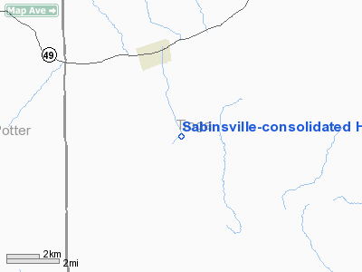
Sabinsville-consolidated Heliport |
Location & QuickFacts
| FAA Information Effective: | 2008-09-25 |
| Airport Identifier: | 35PN |
| Airport Status: | Operational |
| Longitude/Latitude: | 077-31-13.9420W/41-52-21.2530N
-77.520539/41.872570 (Estimated) |
| Elevation: | 1618 ft / 493.17 m (Estimated) |
| Land: | 0 acres |
| From nearest city: | 3 nautical miles NW of Westfield, PA |
| Location: | Tioga County, PA |
| Magnetic Variation: | 10W (1985) |
Owner & Manager
| Ownership: | Privately owned |
| Owner: | Consolidated Gas Supply Corp |
| Address: | P O Box 460
Westfield, PA 16950 |
| Phone number: | 814-367-2237 |
| Address: |
|
Airport Operations and Facilities
| Airport Use: | Private |
| Wind indicator: | Yes |
| Segmented Circle: | No |
| Control Tower: | No |
| Sectional chart: | Detroit |
| Region: | AEA - Eastern |
| Boundary ARTCC: | ZOB - Cleveland |
| Tie-in FSS: | AOO - Altoona |
| FSS on Airport: | No |
| FSS Toll Free: | 1-800-WX-BRIEF |
Runway Information
Helipad H1
| Dimension: | 60 x 50 ft / 18.3 x 15.2 m |
| Surface: | CONC, |
| |
Runway H1 |
Runway |
| Traffic Pattern: | Left | Left |
|
Radio Navigation Aids
| ID |
Type |
Name |
Ch |
Freq |
Var |
Dist |
| EL | NDB | Halos | | 269.00 | 09W | 22.7 nm |
| ALP | NDB | Alpine | | 245.00 | 12W | 40.3 nm |
| LYS | NDB | Olean | | 360.00 | 09W | 43.9 nm |
| SFK | VOR/DME | Stonyfork | 023X | 108.60 | 08W | 11.6 nm |
| ULW | VOR/DME | Elmira | 033Y | 109.65 | 12W | 25.8 nm |
| FQM | VOR/DME | Williamsport | 091X | 114.40 | 09W | 46.4 nm |
| BFD | VOR/DME | Bradford | 113X | 116.60 | 07W | 49.5 nm |
| ELZ | VORTAC | Wellsville | 051X | 111.40 | 09W | 25.1 nm |
| SLT | VORTAC | Slate Run | 086X | 113.90 | 08W | 29.6 nm |
| ETG | VORTAC | Keating | 107X | 116.00 | 10W | 48.4 nm |
Images and information placed above are from
http://www.airport-data.com/airport/35PN/
We thank them for the data!
| General Info
|
| Country |
United States
|
| State |
PENNSYLVANIA
|
| FAA ID |
35PN
|
| Latitude |
41-52-21.253N
|
| Longitude |
077-31-13.942W
|
| Elevation |
1618 feet
|
| Near City |
WESTFIELD
|
We don't guarantee the information is fresh and accurate. The data may
be wrong or outdated.
For more up-to-date information please refer to other sources.
|
|


