 |
|
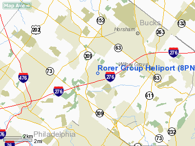
Location & QuickFacts
| FAA Information Effective: | 2008-09-25 |
| Airport Identifier: | 8PN8 |
| Airport Status: | Operational |
| Longitude/Latitude: | 075-11-18.6310W/40-08-30.3940N
-75.188509/40.141776 (Estimated) |
| Elevation: | 182 ft / 55.47 m (Estimated) |
| Land: | 0 acres |
| From nearest city: | 1 nautical miles E of Fort Washington, PA |
| Location: | Montgomery County, PA |
| Magnetic Variation: | 11W (1985) |
Owner & Manager
| Ownership: | Privately owned |
| Owner: | Rhone-poulenc Rorer |
| Address: | 500 Arcola Rd
Collegeville, PA 19426 |
| Phone number: | 215-454-8620 |
| Manager: | Gary A. Divincenzo |
| Address: | 500 Arcola Rd
Collegeville, PA 19426 |
| Phone number: | 215-454-8620 |
Airport Operations and Facilities
| Airport Use: | Private |
| Wind indicator: | Yes |
| Segmented Circle: | No |
| Control Tower: | No |
| Lighting Schedule: | RDO-CTL
FOR LGTS KEY 131.95. |
| Landing fee charge: | No |
| Sectional chart: | New York |
| Region: | AEA - Eastern |
| Boundary ARTCC: | ZDC - Washington |
| Responsible ARTCC: | ZNY - New York |
| Tie-in FSS: | IPT - Williamsport |
| FSS on Airport: | No |
| FSS Toll Free: | 1-800-WX-BRIEF |
Runway Information
Helipad H1
| Dimension: | 100 x 60 ft / 30.5 x 18.3 m |
| Surface: | ASPH, |
| Edge Lights: | Medium |
| |
Runway H1 |
Runway |
| Traffic Pattern: | Left | Left |
|
Radio Navigation Aids
| ID |
Type |
Name |
Ch |
Freq |
Var |
Dist |
| NXX | NDB | Willow Grove | | 388.00 | 12W | 3.5 nm |
| ING | NDB | Ambler | | 275.00 | 11W | 4.5 nm |
| DYL | NDB | Doylestown | | 237.00 | 10W | 12.0 nm |
| UKT | NDB | Quakertown | | 208.00 | 12W | 17.7 nm |
| NEL | NDB | Lakehurst | | 396.00 | 13W | 39.6 nm |
| RNB | NDB | Rainbow | | 363.00 | 11W | 43.6 nm |
| LQX | NDB | Carbon | | 339.00 | 12W | 48.0 nm |
| NXX | TACAN | Willow Grove | 061X | | 10W | 3.7 nm |
| NEL | TACAN | Lakehurst | 055X | | 11W | 38.9 nm |
| NEL | UHF/NDB | Lakehurst | | 274.80 | 13W | 39.6 nm |
| PNE | VOR | North Philadelphia | | 112.00 | 10W | 9.0 nm |
| ARD | VOR/DME | Yardley | 019X | 108.20 | 10W | 14.5 nm |
| CKZ | VOR/DME | Pennridge | 025Y | 108.85 | 12W | 15.7 nm |
| SBJ | VOR/DME | Solberg | 076X | 112.90 | 10W | 33.5 nm |
| ETX | VOR/DME | East Texas | 039X | 110.20 | 09W | 34.8 nm |
| BWZ | VOR/DME | Broadway | 089X | 114.20 | 11W | 42.9 nm |
| COL | VOR/DME | Colts Neck | 101X | 115.40 | 11W | 48.3 nm |
| PTW | VORTAC | Pottstown | 112X | 116.50 | 09W | 17.7 nm |
| MXE | VORTAC | Modena | 079X | 113.20 | 09W | 26.0 nm |
| GXU | VORTAC | Mc Guire | 043X | 110.60 | 11W | 28.4 nm |
| OOD | VORTAC | Woodstown | 075X | 112.80 | 10W | 30.9 nm |
| RBV | VORTAC | Robbinsville | 085X | 113.80 | 10W | 32.1 nm |
| DQO | VORTAC | Dupont | 087X | 114.00 | 10W | 33.9 nm |
| FJC | VORTAC | Allentown | 122X | 117.50 | 10W | 37.2 nm |
| VCN | VORTAC | Cedar Lake | 099X | 115.20 | 10W | 37.7 nm |
| CYN | VORTAC | Coyle | 081X | 113.40 | 10W | 39.9 nm |
| ACY | VORTAC | Atlantic City | 023X | 108.60 | 10W | 50.0 nm |
| PHL | VOT | Philadelphia Intl | | 109.80 | | 16.5 nm |
Images and information placed above are from
http://www.airport-data.com/airport/8PN8/
We thank them for the data!
| General Info
|
| Country |
United States
|
| State |
PENNSYLVANIA
|
| FAA ID |
8PN8
|
| Latitude |
40-08-30.394N
|
| Longitude |
075-11-18.631W
|
| Elevation |
182 feet
|
| Near City |
FORT WASHINGTON
|
We don't guarantee the information is fresh and accurate. The data may
be wrong or outdated.
For more up-to-date information please refer to other sources.
|
|


