 |
|
Rocky Hill Ultralight Airport |
| Rocky Hill Ultralight Flightpark |
| IATA: none – ICAO: none – FAA LID: 48P |
| Summary |
| Airport type |
Public use |
| Owner |
William G. Barry |
| Location |
Cresco, Pennsylvania |
| Elevation AMSL |
1,240 ft / 378 m |
| Coordinates |
41°08′52″N 075°16′30″W / 41.14778°N 75.275°W / 41.14778; -75.275 |
| Runways |
| Direction |
Length |
Surface |
| ft |
m |
| 9/27 |
1,000 |
305 |
Turf |
| Statistics (2008) |
| Aircraft operations |
150 |
| Source: Federal Aviation Administration |
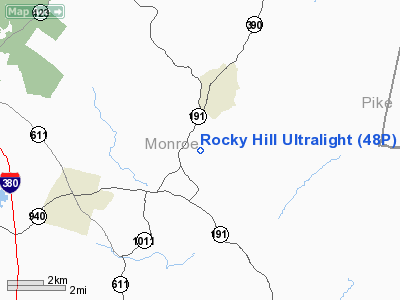
Rocky Hill Ultralight Flightpark (FAA LID: 48P) is a public use ultralight airport located one nautical mile (1.85 km) southeast of the central business district of Cresco, a town in Monroe County, Pennsylvania, United States.
Facilities and aircraft
Rocky Hill Ultralight Flightpark covers an area of 1,230 acres (498 ha) at an elevation of 1,240 feet (378 m) above mean sea level. It has one runway designated 9/27 with a turf surface measuring 1,000 by 100 feet (305 x 30 m). For the 12-month period ending April 17, 2008, the airport had 150 general aviation aircraft operations.
The above content comes from Wikipedia and is published under free licenses – click here to read more.
Location & QuickFacts
| FAA Information Effective: | 2008-09-25 |
| Airport Identifier: | 48P |
| Airport Status: | Operational |
| Longitude/Latitude: | 075-16-30.0000W/41-08-52.0000N
-75.275000/41.147778 (Estimated) |
| Elevation: | 1240 ft / 377.95 m (Estimated) |
| Land: | 1230 acres |
| From nearest city: | 1 nautical miles SE of Cresco, PA |
| Location: | Monroe County, PA |
| Magnetic Variation: | () |
Owner & Manager
| Ownership: | Privately owned |
| Owner: | William G. Barry |
| Address: | Rr 3 Box 3271
Cresco, PA 18326 |
| Phone number: | 570-595-2269 |
| Manager: | William G. Barry |
| Address: | Rr 3 Box 3271
Cresco, PA 18326 |
| Phone number: | 570-595-2269 |
Airport Operations and Facilities
| Airport Use: | Open to public |
| Wind indicator: | Yes |
| Control Tower: | No |
| Sectional chart: | New York |
| Region: | AEA - Eastern |
| Boundary ARTCC: | ZNY - New York |
| Tie-in FSS: | IPT - Williamsport |
| FSS Toll Free: | 1-800-WX-BRIEF |
| NOTAMs Facility: | IPT (NOTAM-d service avaliable) |
Airport Communications
Runway Information
Runway 09/27
| Dimension: | 1000 x 100 ft / 304.8 x 30.5 m |
| Surface: | TURF, Good Condition |
| |
Runway 09 |
Runway 27 |
| Traffic Pattern: | Left | Left |
|
Radio Navigation Aids
| ID |
Type |
Name |
Ch |
Freq |
Var |
Dist |
| CYE | NDB | Crystal Lake | | 410.00 | 11W | 25.5 nm |
| LQX | NDB | Carbon | | 339.00 | 12W | 29.8 nm |
| HXM | NDB | Humbolt | | 366.00 | 10W | 34.1 nm |
| MS | NDB | Monga | | 359.00 | 12W | 41.6 nm |
| UKT | NDB | Quakertown | | 208.00 | 12W | 43.5 nm |
| CAT | NDB | Chatham | | 254.00 | 11W | 45.5 nm |
| DYL | NDB | Doylestown | | 237.00 | 10W | 49.3 nm |
| HZL | VOR | Hazleton | | 109.40 | 09W | 39.9 nm |
| STW | VOR/DME | Stillwater | 033X | 109.60 | 11W | 20.5 nm |
| BWZ | VOR/DME | Broadway | 089X | 114.20 | 11W | 29.4 nm |
| HUO | VOR/DME | Huguenot | 108X | 116.10 | 11W | 34.7 nm |
| ETX | VOR/DME | East Texas | 039X | 110.20 | 09W | 38.8 nm |
| SBJ | VOR/DME | Solberg | 076X | 112.90 | 10W | 41.7 nm |
| CKZ | VOR/DME | Pennridge | 025Y | 108.85 | 12W | 45.5 nm |
| LVZ | VORTAC | Wilkes-barre | 053X | 111.60 | 10W | 20.2 nm |
| LHY | VORTAC | Lake Henry | 045X | 110.80 | 10W | 21.8 nm |
| FJC | VORTAC | Allentown | 122X | 117.50 | 10W | 26.6 nm |
| SAX | VORTAC | Sparta | 104X | 115.70 | 11W | 33.7 nm |
Remarks
- PRVDD DAYLGT VFR OPNS; A CLEAR 20:1 APCH/DEP PATH; OPERATE IN A MANNER TO MINIMIZE NOISE; AND LOA W/MOCENT POCONO MUNI ARPT COORDINATING ALL ACTIVITIES.
Images and information placed above are from
http://www.airport-data.com/airport/48P/
We thank them for the data!
|
|


