 |
|
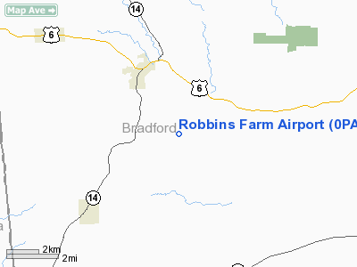
Location & QuickFacts
| FAA Information Effective: | 2008-09-25 |
| Airport Identifier: | 0PA3 |
| Airport Status: | Operational |
| Longitude/Latitude: | 076-45-36.8370W/41-44-58.2680N
-76.760233/41.749519 (Estimated) |
| Elevation: | 1207 ft / 367.89 m (Estimated) |
| Land: | 6 acres |
| From nearest city: | 3 nautical miles SE of Troy, PA |
| Location: | Bradford County, PA |
| Magnetic Variation: | 11W (1990) |
Owner & Manager
| Ownership: | Privately owned |
| Owner: | Clyde E & Elizabeth B Robbins |
| Address: | 815 C St, Se
Washington, DC 20003 |
| Phone number: | 202-546-7899 |
| Manager: | Clyde E & Elizabeth B Robbins |
| Address: | 815 C St, Se
Washington, DC 20003 |
| Phone number: | 202-546-7899 |
Airport Operations and Facilities
| Airport Use: | Private |
| Wind indicator: | Yes |
| Segmented Circle: | No |
| Control Tower: | No |
| Sectional chart: | New York |
| Region: | AEA - Eastern |
| Boundary ARTCC: | ZNY - New York |
| Tie-in FSS: | IPT - Williamsport |
| FSS on Airport: | No |
| FSS Toll Free: | 1-800-WX-BRIEF |
Runway Information
Runway 17/35
| Dimension: | 1277 x 100 ft / 389.2 x 30.5 m |
| Surface: | TURF,
RISING GND TO RIGHT OF CNTRLN EXTDD AER 35. |
| |
Runway 17 |
Runway 35 |
| Traffic Pattern: | Left | Left |
| Displaced threshold: | 0.00 ft | 130.00 ft |
| Obstruction: | | 10 ft gnd |
|
Radio Navigation Aids
| ID |
Type |
Name |
Ch |
Freq |
Var |
Dist |
| PIX | NDB | Picture Rocks | | 344.00 | 09W | 28.5 nm |
| ALP | NDB | Alpine | | 245.00 | 12W | 29.4 nm |
| ULW | VOR/DME | Elmira | 033Y | 109.65 | 12W | 23.9 nm |
| FQM | VOR/DME | Williamsport | 091X | 114.40 | 09W | 24.7 nm |
| SFK | VOR/DME | Stonyfork | 023X | 108.60 | 08W | 29.8 nm |
| ITH | VOR/DME | Ithaca | 055X | 111.80 | 10W | 46.8 nm |
| CFB | VORTAC | Binghamton | 059X | 112.20 | 10W | 37.1 nm |
| MIP | VORTAC | Milton | 029X | 109.20 | 09W | 43.9 nm |
Remarks
- PRVDD OPNS RSTRD TO ACFT CAPABLE OF OPERATING WITH DUE CONSIDERATION OF THE DENSITY ALT - SHORT RY CONDS; OPERATORS MUST BE MORE AWARE OF THE NEARBY MTR (VR707).
Images and information placed above are from
http://www.airport-data.com/airport/0PA3/
We thank them for the data!
| General Info
|
| Country |
United States
|
| State |
PENNSYLVANIA
|
| FAA ID |
0PA3
|
| Latitude |
41-44-58.268N
|
| Longitude |
076-45-36.837W
|
| Elevation |
1207 feet
|
| Near City |
TROY
|
We don't guarantee the information is fresh and accurate. The data may
be wrong or outdated.
For more up-to-date information please refer to other sources.
|
|


