 |
|
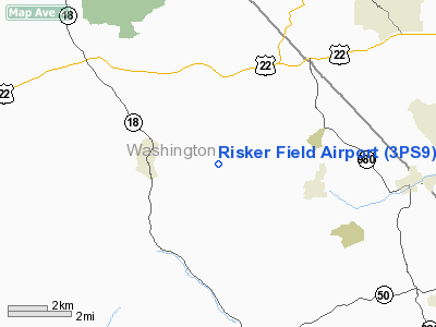
Location & QuickFacts
| FAA Information Effective: | 2008-09-25 |
| Airport Identifier: | 3PS9 |
| Airport Status: | Operational |
| Longitude/Latitude: | 080-20-58.3200W/40-22-42.3000N
-80.349533/40.378417 (Estimated) |
| Elevation: | 1100 ft / 335.28 m () |
| Land: | 25 acres |
| From nearest city: | 3 nautical miles W of Bulger, PA |
| Location: | Washington County, PA |
| Magnetic Variation: | () |
Owner & Manager
| Ownership: | Privately owned |
| Owner: | Dale W. Risker |
| Address: | 666 Joffre Bulger Road
Bulger, PA 15019 |
| Phone number: | 724-796-4855 |
| Manager: | Dale W. Risker |
| Address: | 666 Joffre Bulger Road
Bulger, PA 15019 |
| Phone number: | 724-796-4855 |
Airport Operations and Facilities
| Airport Use: | Private |
| Wind indicator: | Yes |
| Control Tower: | No |
| Sectional chart: | Cincinnati |
| Region: | AEA - Eastern |
| Boundary ARTCC: | ZOB - Cleveland |
| Tie-in FSS: | AOO - Altoona |
| FSS Toll Free: | 1-800-WX-BRIEF |
Runway Information
Runway 08/26
| Dimension: | 1855 x 100 ft / 565.4 x 30.5 m |
| Surface: | TURF, |
| |
Runway 08 |
Runway 26 |
| Traffic Pattern: | Left | Left |
| Displaced threshold: | 50.00 ft
RY 08/26 DISPLACEMENTS MARKED WITH RED BUCKETTS. | 700.00 ft |
| Obstruction: | 42 ft trees, 168.0 ft from runway | 72 ft trees, 1414.0 ft from runway |
|
Radio Navigation Aids
| ID |
Type |
Name |
Ch |
Freq |
Var |
Dist |
| PNU | NDB | Washington County | | 255.00 | 08W | 16.5 nm |
| MKP | NDB | Mc Keesport | | 287.00 | 07W | 26.1 nm |
| CFX | NDB | Cadiz | | 239.00 | 07W | 31.6 nm |
| TSO | NDB | Tolson | | 395.00 | 07W | 35.1 nm |
| UCP | NDB | Castle | | 272.00 | 09W | 38.9 nm |
| VV | NDB | Camor | | 299.00 | 08W | 40.7 nm |
| HBD | NDB | Hubbard | | 408.00 | 08W | 47.3 nm |
| BHU | NDB | Benje | | 382.00 | 07W | 49.4 nm |
| HLG | VOR/DME | Wheeling | 059X | 112.20 | 07W | 12.3 nm |
| AGC | VOR/DME | Allegheny | 037X | 110.00 | 09W | 15.4 nm |
| AIR | VOR/DME | Bellaire | 118X | 117.10 | 07W | 30.5 nm |
| MMJ | VORTAC | Montour | 057X | 112.00 | 08W | 9.7 nm |
| EWC | VORTAC | Ellwood City | 105X | 115.80 | 08W | 27.6 nm |
Images and information placed above are from
http://www.airport-data.com/airport/3PS9/
We thank them for the data!
|
|


