 |
|
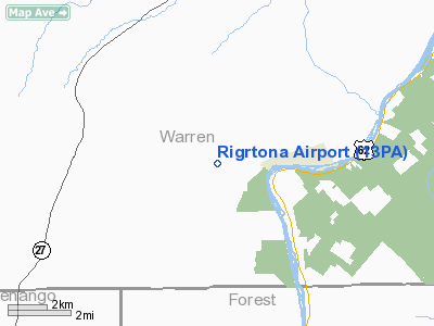
Location & QuickFacts
| FAA Information Effective: | 2008-09-25 |
| Airport Identifier: | 13PA |
| Airport Status: | Operational |
| Longitude/Latitude: | 079-27-07.1750W/41-40-57.2160N
-79.451993/41.682560 (Estimated) |
| Elevation: | 1703 ft / 519.07 m (Estimated) |
| Land: | 0 acres |
| From nearest city: | 1 nautical miles W of Tidioute, PA |
| Location: | Warren County, PA |
| Magnetic Variation: | 10W (2000) |
Owner & Manager
| Ownership: | Privately owned |
| Owner: | Lightning Oil Co. Ltd |
| Address: | 225a Swede Rd
Tidioute, PA 16351 |
| Phone number: | 814-434-0270 |
| Manager: | Richard M. Osborne |
| Address: | 225a Swede Rd
Tidioute, PA 16351 |
| Phone number: | 814-434-0270 |
Airport Operations and Facilities
| Airport Use: | Private |
| Wind indicator: | Yes |
| Segmented Circle: | No |
| Control Tower: | No |
| Lighting Schedule: | RDO-CTL
ACTVT MIRL RY 10/28 & ROTG BCN - CTAF. |
| Beacon Color: | Clear-Green (lighted land airport) |
| Sectional chart: | Detroit |
| Region: | AEA - Eastern |
| Boundary ARTCC: | ZOB - Cleveland |
| Tie-in FSS: | AOO - Altoona |
| FSS Toll Free: | 1-800-WX-BRIEF |
Runway Information
Runway 10/28
| Dimension: | 2075 x 50 ft / 632.5 x 15.2 m |
| Surface: | ASPH, |
| Edge Lights: | Medium |
| |
Runway 10 |
Runway 28 |
| Traffic Pattern: | Left | Right |
| Markings: | Basic, | Basic, |
| Displaced threshold: | 0.00 ft | 500.00 ft |
| Obstruction: | | 20 ft trees, 125.0 ft from runway |
|
Radio Navigation Aids
| ID |
Type |
Name |
Ch |
Freq |
Var |
Dist |
| ORJ | NDB | Corry | | 258.00 | 09W | 16.4 nm |
| CQD | NDB | Cascade | | 372.00 | 08W | 39.3 nm |
| FKL | VOR | Franklin | | 109.60 | 06W | 23.4 nm |
| CIP | VOR/DME | Clarion | 076X | 112.90 | 06W | 32.2 nm |
| JHW | VOR/DME | Jamestown | 094X | 114.70 | 07W | 33.8 nm |
| BFD | VOR/DME | Bradford | 113X | 116.60 | 07W | 37.9 nm |
| TDT | VORTAC | Tidioute | 123X | 117.60 | 09W | 2.4 nm |
| ERI | VORTAC | Erie | 031X | 109.40 | 06W | 42.7 nm |
| DKK | VORTAC | Dunkirk | 109X | 116.20 | 07W | 49.2 nm |
Remarks
- PRVDD DAYLGT OPNS; IFR OPNS NOT CONDUCTED; OVERFLIGHTS OF CHURCHES; SCHOOLS & RESIDENTIAL AREAS MUST BE AVIODED TO THE EXTENT POSSIBLE WHEN ARRIVING AND/OR DEPARTING ARPT.
Images and information placed above are from
http://www.airport-data.com/airport/13PA/
We thank them for the data!
| General Info
|
| Country |
United States
|
| State |
PENNSYLVANIA
|
| FAA ID |
13PA
|
| Latitude |
41-40-57.216N
|
| Longitude |
079-27-07.175W
|
| Elevation |
1703 feet
|
| Near City |
TIDIOUTE
|
We don't guarantee the information is fresh and accurate. The data may
be wrong or outdated.
For more up-to-date information please refer to other sources.
|
|


