 |
|
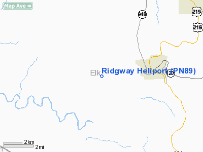
Location & QuickFacts
| FAA Information Effective: | 2008-09-25 |
| Airport Identifier: | PN89 |
| Airport Status: | Operational |
| Longitude/Latitude: | 078-47-48.8500W/41-25-06.7100N
-78.796903/41.418531 (Estimated) |
| Elevation: | 2042 ft / 622.40 m () |
| Land: | 0 acres |
| From nearest city: | 0 nautical miles E of Ridgway, PA |
| Location: | Elk County, PA |
| Magnetic Variation: | () |
Owner & Manager
| Ownership: | Privately owned |
| Owner: | Ridgeway Ems |
| Address: | Hwy 219
Ridgeway, PA 15853 |
| Phone number: | 814-773-3633 |
| Manager: | Sean Papa Ridgeway Ems |
| Address: | Hwy 219
Ridgeway, PA 15853 |
| Phone number: | 814-773-3633 |
Airport Operations and Facilities
| Airport Use: | Private
MEDICAL. |
| Control Tower: | No |
| Lighting Schedule: | PHONE REQ
CALL 814-773-3633 FOR PERIMETER LGTS. |
| Region: | AEA - Eastern |
| Boundary ARTCC: | ZOB - Cleveland |
| Tie-in FSS: | AOO - Altoona |
| FSS Toll Free: | 1-800-WX-BRIEF |
Runway Information
Helipad H1
| Dimension: | 70 x 70 ft / 21.3 x 21.3 m |
| Surface: | ASPH, |
| |
Runway H1 |
Runway |
| Traffic Pattern: | Left | Left |
|
Radio Navigation Aids
| ID |
Type |
Name |
Ch |
Freq |
Var |
Dist |
| ORJ | NDB | Corry | | 258.00 | 09W | 48.4 nm |
| INP | NDB | Indiana | | 242.00 | 08W | 48.8 nm |
| FKL | VOR | Franklin | | 109.60 | 06W | 47.8 nm |
| BFD | VOR/DME | Bradford | 113X | 116.60 | 07W | 23.5 nm |
| CIP | VOR/DME | Clarion | 076X | 112.90 | 06W | 34.1 nm |
| JHW | VOR/DME | Jamestown | 094X | 114.70 | 07W | 48.5 nm |
| ETG | VORTAC | Keating | 107X | 116.00 | 10W | 32.0 nm |
| TDT | VORTAC | Tidioute | 123X | 117.60 | 09W | 33.0 nm |
| SLT | VORTAC | Slate Run | 086X | 113.90 | 08W | 37.7 nm |
| TON | VORTAC | Tyrone | 096X | 114.90 | 07W | 46.2 nm |
| PSB | VORTAC | Philipsburg | 102X | 115.50 | 10W | 47.3 nm |
Remarks
- PRVDD VFR/PVTUSE; TAKEOFF/LANDING AREA MKD; AWIND INDICATOR MAINTAINED;.
Images and information placed above are from
http://www.airport-data.com/airport/PN89/
We thank them for the data!
|
|


