|
|
Ridge Soaring Gliderport Airport |
| Ridge Soaring Gliderport |
 |
| IATA: none – ICAO: none – FAA LID: 79N |
| Summary |
| Airport type |
Public |
| Owner |
Knauff & Grove, Inc |
| Serves |
Unionville, Centre County, Pennsylvania |
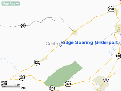
| Location |
Julian, Pennsylvania |
| Elevation AMSL |
815 ft / 248 m |
| Coordinates |
40°53′02″N 077°54′26″W / 40.88389°N 77.90722°W / 40.88389; -77.90722 |
| Runways |
| Direction |
Length |
Surface |
| ft |
m |
| 7/25 |
3,322 |
1,013 |
Asphalt/Turf |
| Statistics (2006) |
| Aircraft operations |
18,000 |
| Based aircraft |
34 |
| Source: Federal Aviation Administration |
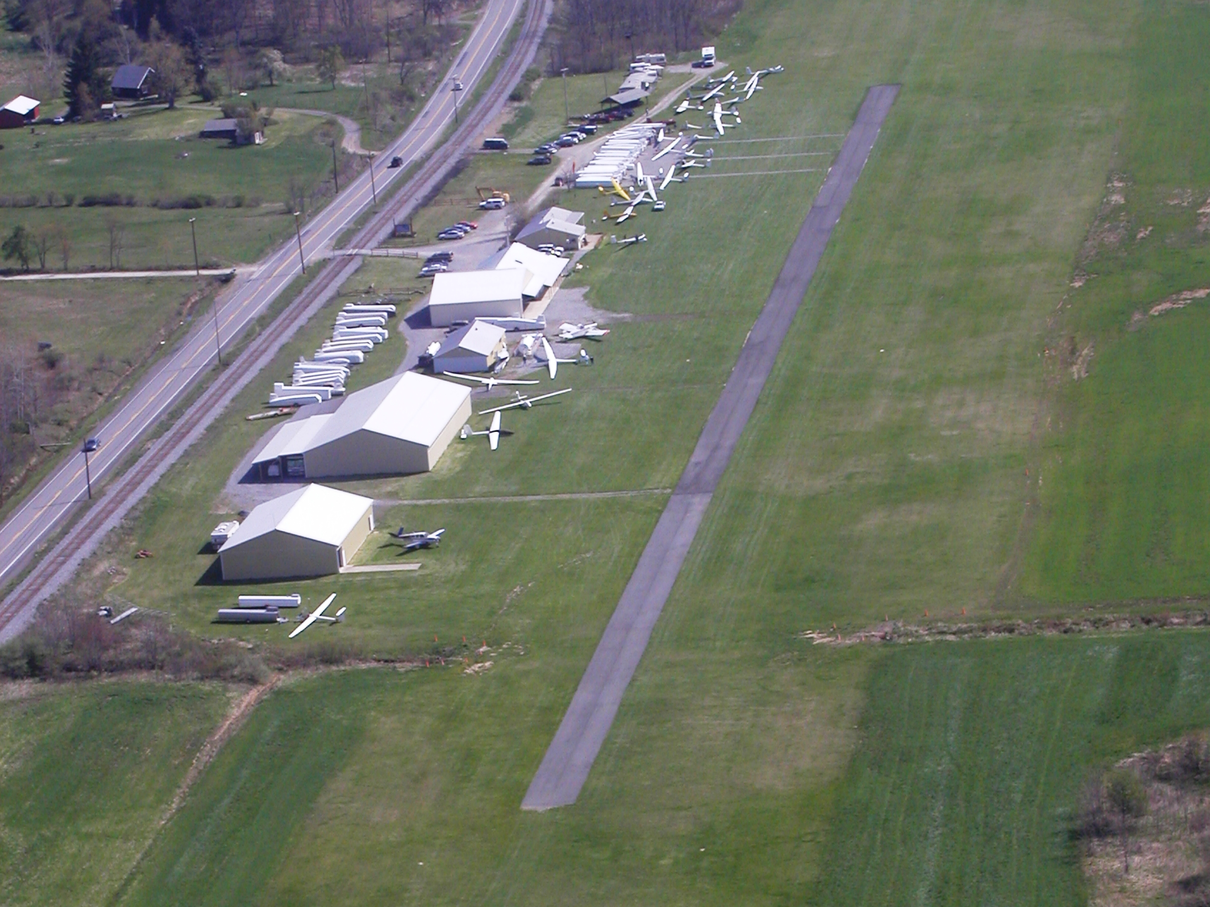
An immature Bald Eagle thermals over the Ridge Soaring Gliderport in a lake effect rain shower during the fall migration. Ridge Soaring Gliderport (FAA LID: 79N) is a public-use glider airport located two nautical miles (4 km) southwest of the central business district of Unionville, in Centre County, Pennsylvania, United States. It is privately owned by Knauff & Grove, Inc.
This FBO airport is world famous for ridge, thermal and wave soaring. It is located on U.S. Route 220 (alternate) 8 miles south of Interstate 80, between Unionville and Julian, at the base of the Bald Eagle Mountain ridge. It is also approximately midway between Altoona and Lock Haven in the Bald Eagle Valley. Visitors can look at an entire wall of U.S. National and World records that have been set from this airfield. Facilities and aircraft
Ridge Soaring Gliderport covers an area of 90 acres (36 ha) at an elevation of 815 feet (248 m) above mean sea level. It has one runway designated 7/25 with a 3,322 x 150 ft (1,013 x 46 m) asphalt and turf surface.
For the 12-month period ending June 30, 2006, the airport had 18,000 general aviation aircraft operations, an average of 49 per day. At that time there were 34 aircraft based at this airport: 88% glider and 12% single-engine.
There is a bunkhouse with showers on the airport and motorhome facilities.
A repair shop with a full-time A&P mechanic is also on the field.
Airport facts
- Portions of the 1999 movie The Thomas Crown Affair were filmed here.
- Co-owner Thomas L. Knauff set five FAI world records, and over 50 NAA national records flying from this airport.
- Co-owner Doris Grove set three FAI feminine world records flying from this airport, and was the first woman to fly a glider more than 1000 km.
The above content comes from Wikipedia and is published under free licenses – click here to read more.
Location & QuickFacts
| FAA Information Effective: | 2008-09-25 |
| Airport Identifier: | 79N |
| Airport Status: | Operational |
| Longitude/Latitude: | 077-54-26.0120W/40-53-02.2150N
-77.907226/40.883949 (Estimated) |
| Elevation: | 815 ft / 248.41 m (Estimated) |
| Land: | 90 acres |
| From nearest city: | 2 nautical miles SW of Unionville, PA |
| Location: | Centre County, PA |
| Magnetic Variation: | 10W (1985) |
Owner & Manager
| Ownership: | Privately owned |
| Owner: | Knauff & Grove, Inc |
| Address: | 3523 S. Eagle Valley Rd
Julian, PA 16844 |
| Phone number: | 814-355-2483 |
| Manager: | Thomas Knauff/doris Grove |
| Address: | 3523 S. Eagle Valley Rd
Julian, PA 16844 |
| Phone number: | 814-355-2483 |
Airport Operations and Facilities
| Airport Use: | Open to public |
| Wind indicator: | Yes |
| Segmented Circle: | No |
| Control Tower: | No |
| Lighting Schedule: | NONE |
| Landing fee charge: | No |
| Sectional chart: | Detroit |
| Region: | AEA - Eastern |
| Boundary ARTCC: | ZNY - New York |
| Tie-in FSS: | AOO - Altoona |
| FSS on Airport: | No |
| FSS Toll Free: | 1-800-WX-BRIEF |
| NOTAMs Facility: | AOO (NOTAM-d service avaliable) |
Airport Communications
Airport Services
| Fuel available: | 100LL |
| Airframe Repair: | NONE |
| Power Plant Repair: | NONE |
| Bottled Oxygen: | NONE |
| Bulk Oxygen: | NONE |
Runway Information
Runway 07/25
| Dimension: | 3322 x 150 ft / 1012.5 x 45.7 m
RWY 07/25 W END RY 1367 FT BY 100 FT TURF; E END RY 345 FT BY 100 FT TURF; CENTER PORTION CONTAINS ASPH/GRVL STRIP 1953 FT BY 20 FT. |
| Surface: | ASPH-TURF, Fair Condition |
| |
Runway 07 |
Runway 25 |
| Traffic Pattern: | Left | Left |
| Markings: | Nonstandard, Fair Condition
RWY 07 /25 ENDS & SIDES MKD WITH PINK FOAM MARKERS; DSPLCD THLD MKD WITH RECESSED PINK FOAM MARKERS PERPENDICULAR TO OTHER RY. | Nonstandard, Fair Condition
DSPLCD THRLD MARKED WITH PINK FOAM MARKERS. |
| Displaced threshold: | 725.00 ft | 470.00 ft |
| Obstruction: | 84 ft tree, 883.0 ft from runway, 171 ft right of centerline, 10:1 slope to clear
APCH RATIO 19:1 TO DSPLCD THLD. | 88 ft trees, 1083.0 ft from runway, 191 ft left of centerline, 12:1 slope to clear
APCH RATIO 17:1 TO DSPLCD THLD. |
|
Radio Navigation Aids
| ID |
Type |
Name |
Ch |
Freq |
Var |
Dist |
| RV | NDB | Stroh | | 407.00 | 10W | 18.3 nm |
| AOO | VOR | Altoona | | 108.80 | 07W | 38.1 nm |
| REC | VOR/DME | Revloc | 043X | 110.60 | 09W | 43.3 nm |
| PSB | VORTAC | Philipsburg | 102X | 115.50 | 10W | 4.3 nm |
| TON | VORTAC | Tyrone | 096X | 114.90 | 07W | 21.3 nm |
| ETG | VORTAC | Keating | 107X | 116.00 | 10W | 22.6 nm |
| SLT | VORTAC | Slate Run | 086X | 113.90 | 08W | 37.9 nm |
| SEG | VORTAC | Selinsgrove | 041X | 110.40 | 08W | 46.9 nm |
Remarks
- DITCH BORDERS RY EDGES BOTH SIDES 1738 FT INBOUND FROM RY 25.
- RY 25 - 192 FT MOWED BUT UNMARKED RY SAFETY AREA AT APCH END.
- RY 07/25 CNTRLN RUNS ALONG SOUTH EDGE OF PAVED STRIP.
Images and information placed above are from
http://www.airport-data.com/airport/79N/
We thank them for the data!
| General Info
|
| Country |
United States
|
| State |
PENNSYLVANIA
|
| FAA ID |
79N
|
| Latitude |
40-53-02.215N
|
| Longitude |
077-54-26.012W
|
| Elevation |
815 feet
|
| Near City |
UNIONVILLE
|
We don't guarantee the information is fresh and accurate. The data may
be wrong or outdated.
For more up-to-date information please refer to other sources.
|
|