 |
|
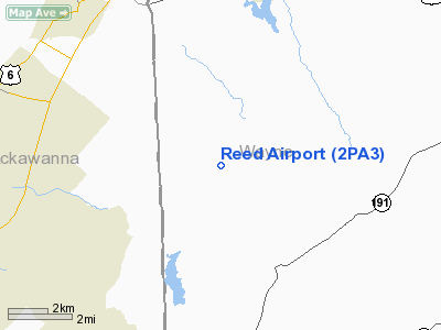
Location & QuickFacts
| FAA Information Effective: | 2008-09-25 |
| Airport Identifier: | 2PA3 |
| Airport Status: | Operational |
| Longitude/Latitude: | 075-24-58.6530W/41-30-00.3040N
-75.416292/41.500084 (Estimated) |
| Elevation: | 1400 ft / 426.72 m (Estimated) |
| Land: | 0 acres |
| From nearest city: | 12 nautical miles NE of Lake Ariel, PA |
| Location: | Wayne County, PA |
| Magnetic Variation: | 12W (1985) |
Owner & Manager
| Ownership: | Privately owned |
| Owner: | Hartford A. Reed |
| Address: | Rd 5
Lake Ariel, PA 18436 |
| Phone number: | 717-937-4195 |
| Manager: | Walter L. Ogden |
| Address: | Rd 5
Lake Ariel, PA 18436 |
| Phone number: | 717-937-4195 |
Airport Operations and Facilities
| Airport Use: | Private |
| Wind indicator: | Yes |
| Segmented Circle: | No |
| Control Tower: | No |
| Landing fee charge: | No |
| Sectional chart: | New York |
| Region: | AEA - Eastern |
| Boundary ARTCC: | ZNY - New York |
| Tie-in FSS: | IPT - Williamsport |
| FSS on Airport: | No |
| FSS Toll Free: | 1-800-WX-BRIEF |
Airport Services
| Airframe Repair: | NONE |
| Power Plant Repair: | NONE |
Runway Information
Runway 15/33
| Dimension: | 1200 x 200 ft / 365.8 x 61.0 m |
| Surface: | TURF, |
| |
Runway 15 |
Runway 33 |
| Traffic Pattern: | Left | Left |
|
Radio Navigation Aids
| ID |
Type |
Name |
Ch |
Freq |
Var |
Dist |
| CYE | NDB | Crystal Lake | | 410.00 | 11W | 25.6 nm |
| MS | NDB | Monga | | 359.00 | 12W | 29.7 nm |
| HXM | NDB | Humbolt | | 366.00 | 10W | 40.4 nm |
| LQX | NDB | Carbon | | 339.00 | 12W | 44.2 nm |
| HZL | VOR | Hazleton | | 109.40 | 09W | 45.0 nm |
| HNK | VOR/DME | Hancock | 115X | 116.80 | 11W | 34.1 nm |
| HUO | VOR/DME | Huguenot | 108X | 116.10 | 11W | 37.5 nm |
| STW | VOR/DME | Stillwater | 033X | 109.60 | 11W | 39.1 nm |
| DNY | VOR/DME | De Lancey | 058X | 112.10 | 11W | 45.7 nm |
| LHY | VORTAC | Lake Henry | 045X | 110.80 | 10W | 3.3 nm |
| LVZ | VORTAC | Wilkes-barre | 053X | 111.60 | 10W | 18.4 nm |
| FJC | VORTAC | Allentown | 122X | 117.50 | 10W | 46.5 nm |
| SAX | VORTAC | Sparta | 104X | 115.70 | 11W | 47.4 nm |
Remarks
Images and information placed above are from
http://www.airport-data.com/airport/2PA3/
We thank them for the data!
| General Info
|
| Country |
United States
|
| State |
PENNSYLVANIA
|
| FAA ID |
2PA3
|
| Latitude |
41-30-00.304N
|
| Longitude |
075-24-58.653W
|
| Elevation |
1400 feet
|
| Near City |
LAKE ARIEL
|
We don't guarantee the information is fresh and accurate. The data may
be wrong or outdated.
For more up-to-date information please refer to other sources.
|
|


