|
|
Reading Rgnl/carl A Spaatz Field Airport |
Reading Regional Airport
Carl A. Spaatz Field |
 |
 |
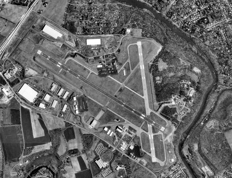
| USGS image as of 13 April 1999 |
| IATA: RDG – ICAO: KRDG – FAA LID: RDG |
| Summary |
| Airport type |
Public |
| Owner |
Reading Regional Airport Authority |
| Serves |
Reading, Pennsylvania |
| Location |
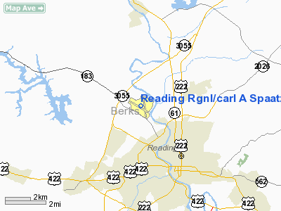
Bern Township, Berks County, Pennsylvania |
| Elevation AMSL |
344 ft / 105 m |
| Coordinates |
40°22′43″N 075°57′55″W / 40.37861°N 75.96528°W / 40.37861; -75.96528 |
| Website |
www.ReadingAirport.org |
| Runways |
| Direction |
Length |
Surface |
| ft |
m |
| 13/31 |
6,350 |
1,935 |
Asphalt |
| 18/36 |
5,151 |
1,570 |
Asphalt |
| Statistics (2006) |
| Aircraft operations |
124,650 |
| Based aircraft |
177 |
| Passenger boardings |
2,268 |
| Source: FAA and airport web site |
Reading Regional Airport (IATA: RDG, ICAO: KRDG, FAA LID: RDG), also known as Carl A. Spaatz Field, is a public airport located three miles (5 km) northwest of the central business district of Reading, a city in Berks County, Pennsylvania, United States. It is owned by the Reading Regional Airport Authority.
As per Federal Aviation Administration records, the airport had 2,268 passenger boardings in calendar year 2006, 2,445 in 2005 and 9,288 in 2004. The airport formerly had scheduled service on US Airways Express carrier Air Midwest, which ended on September 3, 2004. The airport is now served by three charter airlines. Charter airlines
- Millennium Aviation
- Reading Air Charter
- Southwest Airlines (Orlando) provided by Boscov's Travel.
Facilities and aircraft
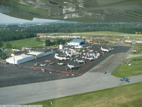
Reading Regional Airport covers an area of 888 acres (359 ha) which contains two asphalt paved runways: 13/31 measuring 6,350 x 150 ft (1,935 x 46 m) and 18/36 measuring 5,151 x 150 ft (1,570 x 46 m).
For the 12-month period ending December 31, 2006, the airport had 124,650 aircraft operations, an average of 341 per day: 91% general aviation, 5% air taxi, 3% military, 1% commuter/cargo and <1% scheduled commercial. There are 177 aircraft based at this airport: 63% single-engine, 21% multi-engine, 11% jet, 2% helicopter, 2% ultralight and 1% glider.
History
Opened as a civil airport in April 1938, Reading Airport was used by the United States Army Air Force First Air Force as a training airfield during World War II.
Reading Army Airfield was opened on 1 June 1943, with the 309th Base Headquarters and Air Base Squadron as its host unit. The mission of the airfield was to train tactical reconnaissance units. The 26th Tactical Reconnaissance Group was activated on the airfield the same date, with the 37th, 39th, 40th and 91st Photo Reconnaissance Squadrons.
Aircraft used by the group for training were the Curtiss O-52 Owl; Douglas O-53 Havoc; Douglas O-46, and the Stinson O-49 Vigilant . The 72d Liaison Squadron, flying the Aeronaca O-58 Grasshopper arrived on 7 June and remained assigned to the station until 29 July 1943 when it was assigned to Camp Mackall, North Carolina.
On 11 November 1943, the 26th was reassigned to Camp Campbell, Kentucky to train with the 101st Airborne Division before deploying to England, and engaging in combat operations as part of Ninth Air Force. It was replaced by the 11th Photographic Group on 1 December 1943. The 11th Photo Group used Reading as its worldwide headquarters, as its reconnaissance and photo squadrons were deployed to various parts of the world.
On 1 January 1944, Reading AAF was reassigned to Air Technical Service Command and became a sub-base of the Middletown Air Depot near Harrisburg. The mission of the station became to repair and overhaul aircraft and return them to active service. The 11th Photo Group moved out to MacDill Airfield, Florida.
On 1 June 1944, the 309th Air Base Squadron was redesignated as the 85th Army Air Force Base Unit. The activity at Reading was phased down during the summer of 1945, and with the war ending, it was inactivated as an active military airfield on 1 November 1945.
The needs of the postwar Air Force Reserve brought the 2237th Air Force Reserve Training Center to Reading Airport on 26 February 1946, and the airport was designated as an Air Force Reserve base. During the late 1940s, a series of reserve bombardment groups were assigned to the airport, these being:
- 322d Bombardment Group (Light), 9 August 1947-27 June 1949, Flew the A-26 Invader
- 59th, 451st and 452d Bombardment Squadrons. Also had the 55th Troop Carrier Group assigned, but never equipped.
- 319th Bombardment Group (Light), 27 June-2 September 1949, Flew the A-26 Invader
- 49th and 51st Bombardment Squadrons
- 512th Troop Carrier Group (Combat Cargo), 2 September 1949-1 May 1950, Flew the C-46 Commando
- 1st, 2d, 3d and 4th Combat Cargo Squadrons
Due to budgetary cutbacks, the Reserve Training Center at Reading was inactivated on 1 May 1950 and reassigned to New Castle County Airport, Delaware. The Air Force closed its facilities at Reading airport and it was returned to full civil control.
On 5 December 1984, Reading Airport was dedicated as Carl Andrew Spaatz Field. Carl Spaatz was a nearby Boyertown, Pennsylvania native and a World War II General. General Spaatz was the first Chief of Staff of the United States Air Force.
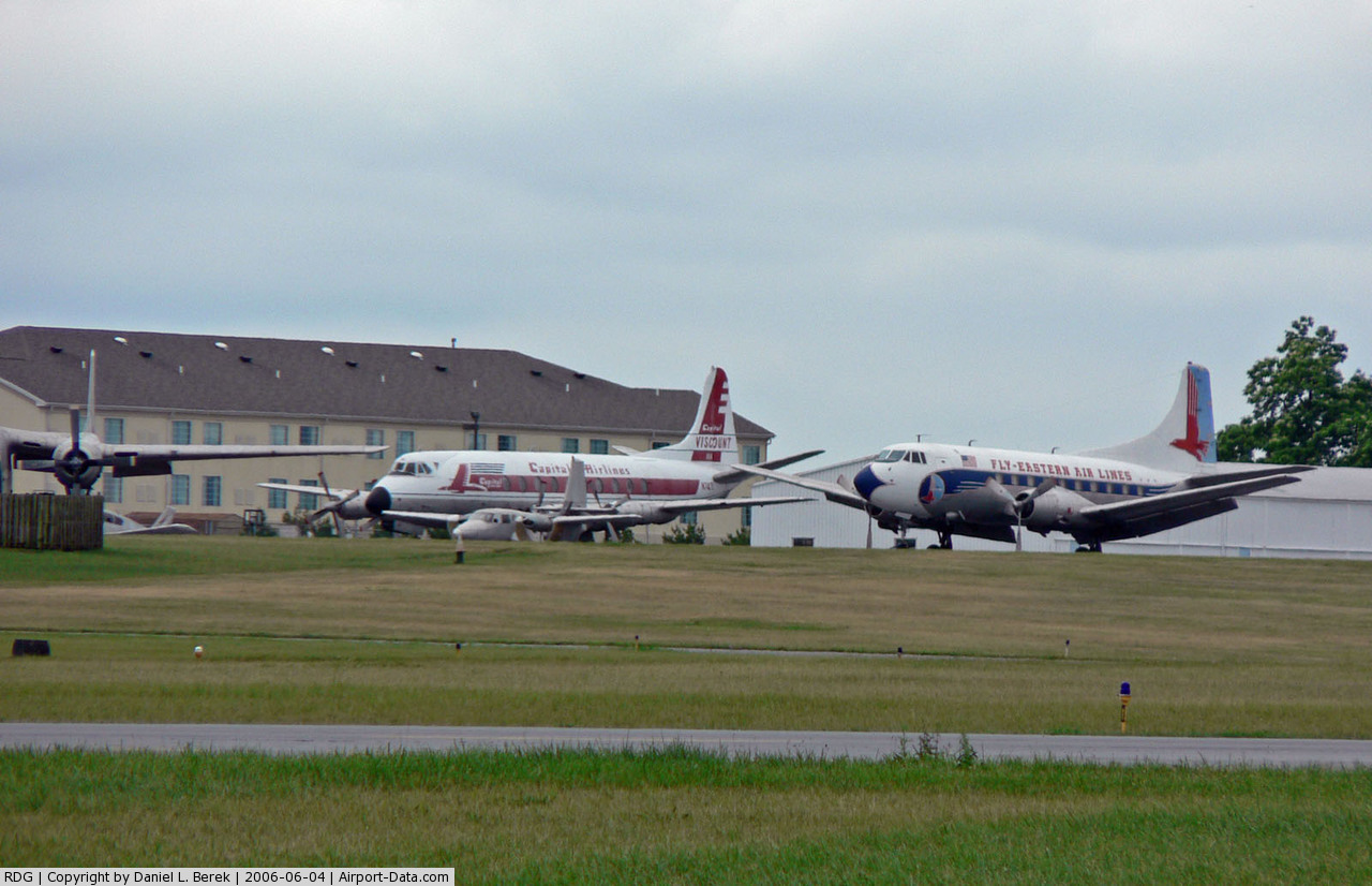
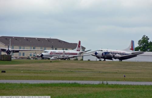
Mid-Atlantic Air Museum
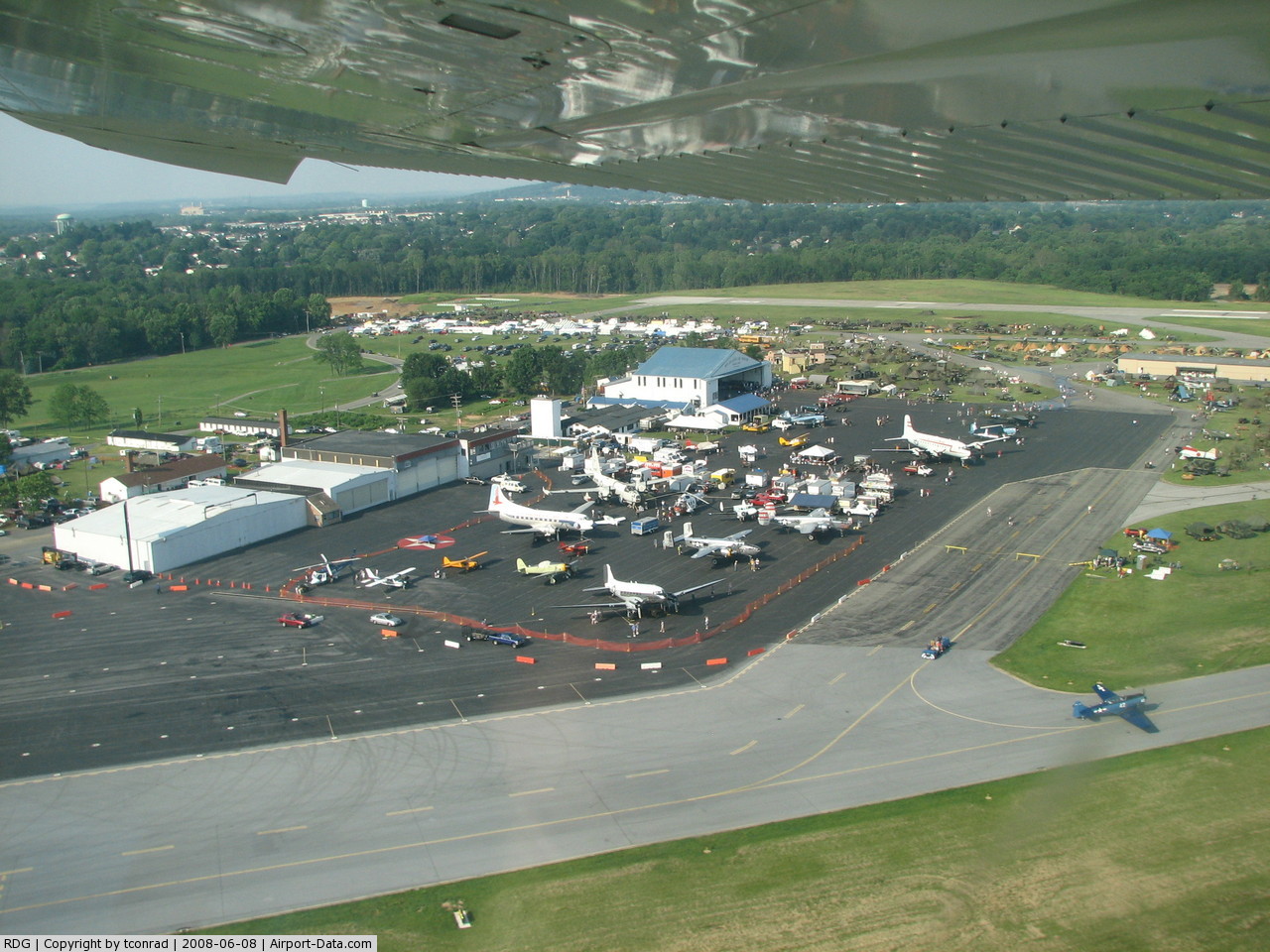
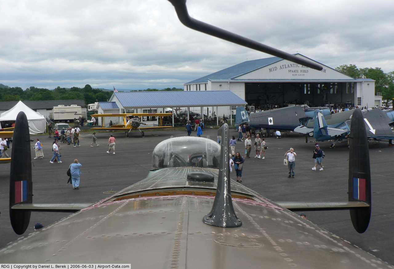
The Mid-Atlantic Air Museum is located at Reading Airport. It collects and actively restores historic war planes and classic airliners as well as rare civilian and military aircraft, with large number of historic aircraft on display to the public. It has also embarked on an ambitious project to restore its P-61B-1-NO Black Widow, recovered from New Guinea in 1989, to flying condition.
The above content comes from Wikipedia and is published under free licenses – click here to read more.
 |
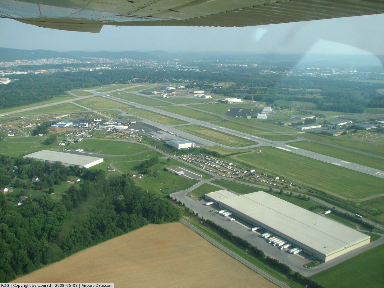
(Click on the photo to enlarge) |
 |
(Click on the photo to enlarge) |
 |
(Click on the photo to enlarge) |
 |
(Click on the photo to enlarge) |
Location & QuickFacts
| FAA Information Effective: | 2008-09-25 |
| Airport Identifier: | RDG |
| Airport Status: | Operational |
| Longitude/Latitude: | 075-57-54.9000W/40-22-42.6000N
-75.965250/40.378500 (Estimated) |
| Elevation: | 344 ft / 104.85 m (Surveyed) |
| Land: | 888 acres |
| From nearest city: | 3 nautical miles NW of Reading, PA |
| Location: | Berks County, PA |
| Magnetic Variation: | 12W (2000) |
Owner & Manager
| Ownership: | Publicly owned |
| Owner: | Reading Regional Arpt Auth. |
| Address: | 2501 Bernville Rd
Reading, PA 19605 |
| Phone number: | 610-372-4666 |
| Manager: | Terry P. Sroka |
| Address: | 2501 Bernville Rd
Reading, PA 19605 |
| Phone number: | 610-372-4666 |
Airport Operations and Facilities
| Airport Use: | Open to public |
| Wind indicator: | Yes |
| Segmented Circle: | Yes |
| Control Tower: | Yes |
| Lighting Schedule: | DUSK-DAWN
WHEN ATCT CLSD ACTVT HIRL RY 13/31; HIRL RY 18/36; REIL RY 31; MALSF RY 36 & TWY LGTS - CTAF. |
| Beacon Color: | Clear-Green (lighted land airport) |
| Landing fee charge: | Yes
LANDING FEE FOR TURBINE ACFT. |
| Sectional chart: | New York |
| Region: | AEA - Eastern |
| Traffic Pattern Alt: | 1056 ft |
| Boundary ARTCC: | ZNY - New York |
| Tie-in FSS: | IPT - Williamsport |
| FSS on Airport: | No |
| FSS Toll Free: | 1-800-WX-BRIEF |
| NOTAMs Facility: | RDG (NOTAM-d service avaliable) |
| Certification type/date: | IV A U 04/197
PPR 24 HRS FOR ACR OPNS WITH MORE THAN 30 PSGR SEATS. CALL AMGR 610-372-4666. ARFF AVAILABLE DAILY 0600-2130. OTHER TIMES BY PPR. |
| Federal Agreements: | NGRY |
Airport Communications
| CTAF: | 119.900 |
| Unicom: | 122.950 |
Airport Services
| Fuel available: | 100LLA |
| Airframe Repair: | MAJOR |
| Power Plant Repair: | MAJOR |
| Bottled Oxygen: | HIGH/LOW |
| Bulk Oxygen: | HIGH/LOW |
Runway Information
Runway 13/31
| Dimension: | 6350 x 150 ft / 1935.5 x 45.7 m |
| Surface: | ASPH, Good Condition |
| Surface Treatment: | Saw-cut or plastic Grooved |
| Weight Limit: | Single wheel: 75000 lbs.
Dual wheel: 200000 lbs.
Dual tandem wheel: 400000 lbs. |
| Edge Lights: | High |
| |
Runway 13 |
Runway 31 |
| Longitude: | 075-58-41.1661W | 075-57-31.0425W |
| Latitude: | 40-23-00.8596N | 40-22-28.2896N |
| Elevation: | 344.00 ft | 330.00 ft |
| Alignment: | 121 | 127 |
| ILS Type: | ILS/DME
| |
| Traffic Pattern: | Left | Left |
| Markings: | Precision instrument, Fair Condition | Precision instrument, Fair Condition |
| Crossing Height: | 45.00 ft | 0.00 ft |
| VASI: | 4-box on left side | |
| Visual Glide Angle: | 3.03° | 0.00° |
| Runway End Identifier: | | Yes |
| Obstruction: | 71 ft trees, 2312.0 ft from runway, 597 ft right of centerline, 29:1 slope to clear | 45 ft trees, 871.0 ft from runway, 477 ft left of centerline, 15:1 slope to clear |
|
Runway 18/36
| Dimension: | 5151 x 150 ft / 1570.0 x 45.7 m |
| Surface: | ASPH, Fair Condition |
| Surface Treatment: | Saw-cut or plastic Grooved |
| Weight Limit: | Single wheel: 75000 lbs.
Dual wheel: 200000 lbs.
Dual tandem wheel: 400000 lbs. |
| Edge Lights: | High |
| |
Runway 18 |
Runway 36 |
| Longitude: | 075-57-45.6040W | 075-57-36.5322W |
| Latitude: | 40-23-05.3614N | 40-22-14.9389N |
| Elevation: | 291.00 ft | 342.00 ft |
| Alignment: | 127 | 127 |
| ILS Type: | | ILS
|
| Traffic Pattern: | Left | Left |
| Markings: | Precision instrument, Fair Condition | Precision instrument, Fair Condition |
| Crossing Height: | 55.00 ft | 0.00 ft |
| VASI: | 4-box on left side | |
| Visual Glide Angle: | 3.00° | 0.00° |
| Approach lights: | | MALSF |
| Obstruction: | 17 ft trees, 293.0 ft from runway, 247 ft right of centerline, 5:1 slope to clear | 15 ft trees, 564.0 ft from runway, 165 ft right of centerline, 24:1 slope to clear |
|
Radio Navigation Aids
| ID |
Type |
Name |
Ch |
Freq |
Var |
Dist |
| BZJ | NDB | Bellgrove | | 328.00 | 10W | 27.1 nm |
| LQX | NDB | Carbon | | 339.00 | 12W | 27.7 nm |
| UKT | NDB | Quakertown | | 208.00 | 12W | 30.7 nm |
| ING | NDB | Ambler | | 275.00 | 11W | 34.7 nm |
| HXM | NDB | Humbolt | | 366.00 | 10W | 36.7 nm |
| DYL | NDB | Doylestown | | 237.00 | 10W | 38.7 nm |
| NXX | NDB | Willow Grove | | 388.00 | 12W | 39.3 nm |
| NXX | TACAN | Willow Grove | 061X | | 10W | 39.1 nm |
| HZL | VOR | Hazleton | | 109.40 | 09W | 36.6 nm |
| PNE | VOR | North Philadelphia | | 112.00 | 10W | 47.3 nm |
| ETX | VOR/DME | East Texas | 039X | 110.20 | 09W | 17.7 nm |
| CKZ | VOR/DME | Pennridge | 025Y | 108.85 | 12W | 31.0 nm |
| ARD | VOR/DME | Yardley | 019X | 108.20 | 10W | 49.1 nm |
| PTW | VORTAC | Pottstown | 112X | 116.50 | 09W | 20.8 nm |
| LRP | VORTAC | Lancaster | 120X | 117.30 | 09W | 21.6 nm |
| MXE | VORTAC | Modena | 079X | 113.20 | 09W | 30.8 nm |
| RAV | VORTAC | Ravine | 093X | 114.60 | 11W | 30.8 nm |
| FJC | VORTAC | Allentown | 122X | 117.50 | 10W | 31.3 nm |
| DQO | VORTAC | Dupont | 087X | 114.00 | 10W | 45.2 nm |
| SEG | VORTAC | Selinsgrove | 041X | 110.40 | 08W | 48.7 nm |
| MDT | VOT | Harrisburg International | | 110.00 | | 38.2 nm |
| PHL | VOT | Philadelphia Intl | | 109.80 | | 45.0 nm |
Remarks
- BIRDS & DEER ON & INVOF ARPT.
- TWY 'E' IS UNAVAILABLE TO AIR CARRIERS.
- TWY "E" PAVEMENT IN POOR CONDITION WITH SURFACE DELAMINATING & RAVELING.
Images and information placed above are from
http://www.airport-data.com/airport/RDG/
We thank them for the data!
| General Info
|
| Country |
United States
|
| State |
PENNSYLVANIA
|
| FAA ID |
RDG
|
| Latitude |
40-22-42.600N
|
| Longitude |
075-57-54.900W
|
| Elevation |
344 feet
|
| Near City |
READING
|
We don't guarantee the information is fresh and accurate. The data may
be wrong or outdated.
For more up-to-date information please refer to other sources.
|
|