 |
|
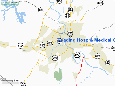
Reading Hosp & Medical Center Heliport |
Location & QuickFacts
| FAA Information Effective: | 2008-09-25 |
| Airport Identifier: | 96PN |
| Airport Status: | Operational |
| Longitude/Latitude: | 075-57-23.7580W/40-19-54.3330N
-75.956599/40.331759 (Estimated) |
| Elevation: | 224 ft / 68.28 m (Estimated) |
| Land: | 0 acres |
| From nearest city: | 3 nautical miles NN of Reading, PA |
| Location: | Berks County, PA |
| Magnetic Variation: | 11W (1985) |
Owner & Manager
| Ownership: | Privately owned |
| Owner: | The Masonic Center Foundation
PROPERTY LEASED FROM MASONIC CENTER FOUNDATION OF READING, PA; WM MOYER DESIGNATED HELIPORT MANAGER. |
| Address: | 300 S Seventh Avenue
West Reading, PA 19611 |
| Phone number: | 215-372-3660 |
| Manager: | William R. Moyer |
| Address: | Reading Hosp & Medical Center
West Reading, PA 19611 |
| Phone number: | 215-378-6256 |
Airport Operations and Facilities
| Airport Use: | Private
MEDICAL USE. |
| Wind indicator: | Yes |
| Segmented Circle: | No |
| Control Tower: | No |
| Lighting Schedule: | RDO REQ |
| Landing fee charge: | No |
| Sectional chart: | New York |
| Region: | AEA - Eastern |
| Boundary ARTCC: | ZNY - New York |
| Tie-in FSS: | IPT - Williamsport |
| FSS on Airport: | No |
| FSS Toll Free: | 1-800-WX-BRIEF |
Runway Information
Helipad H1
| Dimension: | 60 x 60 ft / 18.3 x 18.3 m |
| Surface: | ASPH, Good Condition |
| |
Runway H1 |
Runway |
| Traffic Pattern: | Left | Left |
|
Radio Navigation Aids
| ID |
Type |
Name |
Ch |
Freq |
Var |
Dist |
| BZJ | NDB | Bellgrove | | 328.00 | 10W | 28.0 nm |
| LQX | NDB | Carbon | | 339.00 | 12W | 30.2 nm |
| UKT | NDB | Quakertown | | 208.00 | 12W | 30.7 nm |
| ING | NDB | Ambler | | 275.00 | 11W | 33.2 nm |
| NXX | NDB | Willow Grove | | 388.00 | 12W | 38.2 nm |
| DYL | NDB | Doylestown | | 237.00 | 10W | 38.2 nm |
| HXM | NDB | Humbolt | | 366.00 | 10W | 39.5 nm |
| APG | NDB | Aberdeen | | 349.00 | 11W | 48.4 nm |
| EUD | NDB | York | | 254.00 | 11W | 49.0 nm |
| NXX | TACAN | Willow Grove | 061X | | 10W | 38.1 nm |
| HZL | VOR | Hazleton | | 109.40 | 09W | 39.4 nm |
| PNE | VOR | North Philadelphia | | 112.00 | 10W | 46.0 nm |
| ETX | VOR/DME | East Texas | 039X | 110.20 | 09W | 19.5 nm |
| CKZ | VOR/DME | Pennridge | 025Y | 108.85 | 12W | 30.8 nm |
| ARD | VOR/DME | Yardley | 019X | 108.20 | 10W | 48.3 nm |
| PTW | VORTAC | Pottstown | 112X | 116.50 | 09W | 19.3 nm |
| LRP | VORTAC | Lancaster | 120X | 117.30 | 09W | 19.9 nm |
| MXE | VORTAC | Modena | 079X | 113.20 | 09W | 28.1 nm |
| RAV | VORTAC | Ravine | 093X | 114.60 | 11W | 32.3 nm |
| FJC | VORTAC | Allentown | 122X | 117.50 | 10W | 33.0 nm |
| DQO | VORTAC | Dupont | 087X | 114.00 | 10W | 42.5 nm |
| MDT | VOT | Harrisburg International | | 110.00 | | 37.9 nm |
| PHL | VOT | Philadelphia Intl | | 109.80 | | 42.9 nm |
Remarks
- FOR EMERGENCY MEDICAL USE ONLY.
- HELIPORT CLSD PERMLY.
- PROVIDED ELECTRICAL LINES CROSSING LANDING AREA ARE MOVED OR MARKKED.
Images and information placed above are from
http://www.airport-data.com/airport/96PN/
We thank them for the data!
| General Info
|
| Country |
United States
|
| State |
PENNSYLVANIA
|
| FAA ID |
96PN
|
| Latitude |
40-19-54.333N
|
| Longitude |
075-57-23.758W
|
| Elevation |
224 feet
|
| Near City |
READING
|
We don't guarantee the information is fresh and accurate. The data may
be wrong or outdated.
For more up-to-date information please refer to other sources.
|
|


