 |
|
Location & QuickFacts
| FAA Information Effective: | 2008-09-25 |
| Airport Identifier: | PN36 |
| Airport Status: | Operational |
| Longitude/Latitude: | 079-04-02.1220W/40-44-00.2310N
-79.067256/40.733398 (Estimated) |
| Elevation: | 1420 ft / 432.82 m (Estimated) |
| Land: | 0 acres |
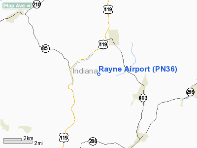
| From nearest city: | 2 nautical miles NE of Home, PA |
| Location: | Indiana County, PA |
| Magnetic Variation: | 08W (1985) |
Owner & Manager
| Ownership: | Privately owned |
| Owner: | Kerry L. Mears |
| Address: | Rd 1
Marion Center, PA 15759 |
| Phone number: | 412-463-8437 |
| Manager: | Kerry L. Mears |
| Address: | Rd 1
Marion Center, PA 15759 |
| Phone number: | 412-463-8437 |
Airport Operations and Facilities
| Airport Use: | Private |
| Wind indicator: | Yes |
| Segmented Circle: | No |
| Control Tower: | No |
| Landing fee charge: | No |
| Sectional chart: | Detroit |
| Region: | AEA - Eastern |
| Boundary ARTCC: | ZOB - Cleveland |
| Tie-in FSS: | AOO - Altoona |
| FSS on Airport: | No |
| FSS Toll Free: | 1-800-WX-BRIEF |
Runway Information
Runway 09/27
| Dimension: | 1600 x 100 ft / 487.7 x 30.5 m |
| Surface: | TURF, |
| |
Runway 09 |
Runway 27 |
| Traffic Pattern: | Left | Left |
|
Radio Navigation Aids
| ID |
Type |
Name |
Ch |
Freq |
Var |
Dist |
| INP | NDB | Indiana | | 242.00 | 08W | 6.1 nm |
| BHU | NDB | Benje | | 382.00 | 07W | 23.5 nm |
| SYS | NDB | Stoystown | | 209.00 | 08W | 39.5 nm |
| MKP | NDB | Mc Keesport | | 287.00 | 07W | 39.7 nm |
| AOO | VOR | Altoona | | 108.80 | 07W | 42.6 nm |
| REC | VOR/DME | Revloc | 043X | 110.60 | 09W | 18.4 nm |
| CIP | VOR/DME | Clarion | 076X | 112.90 | 06W | 30.5 nm |
| JST | VORTAC | Johnstown | 077X | 113.00 | 06W | 27.2 nm |
| TON | VORTAC | Tyrone | 096X | 114.90 | 07W | 33.5 nm |
| IHD | VORTAC | Indian Head | 019X | 108.20 | 06W | 47.5 nm |
Remarks
Images and information placed above are from
http://www.airport-data.com/airport/PN36/
We thank them for the data!
| General Info
|
| Country |
United States
|
| State |
PENNSYLVANIA
|
| FAA ID |
PN36
|
| Latitude |
40-44-00.231N
|
| Longitude |
079-04-02.122W
|
| Elevation |
1420 feet
|
| Near City |
HOME
|
We don't guarantee the information is fresh and accurate. The data may
be wrong or outdated.
For more up-to-date information please refer to other sources.
|
|


