 |
|
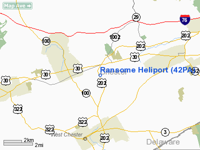
Location & QuickFacts
| FAA Information Effective: | 2008-09-25 |
| Airport Identifier: | 42PA |
| Airport Status: | Operational |
| Longitude/Latitude: | 075-35-09.7470W/40-01-21.3850N
-75.586041/40.022607 (Estimated) |
| Elevation: | 575 ft / 175.26 m (Estimated) |
| Land: | 11 acres |
| From nearest city: | 1 nautical miles NE of Exton, PA |
| Location: | Chester County, PA |
| Magnetic Variation: | 11W (1985) |
Owner & Manager
| Ownership: | Privately owned |
| Owner: | Wlb Partners |
| Address: | 2975 Galloway Road
Bensalem, PA 19020 |
| Phone number: | 215-639-4300 |
| Manager: | Clay C. Bromley |
| Address: | 1420 Phoenixville Pike
West Chester, PA 19380 |
| Phone number: | 215-245-3756 |
Airport Operations and Facilities
| Airport Use: | Private |
| Wind indicator: | Yes |
| Segmented Circle: | No |
| Control Tower: | No |
| Lighting Schedule: | DUSK-DAWN |
| Landing fee charge: | No |
| Sectional chart: | New York |
| Region: | AEA - Eastern |
| Boundary ARTCC: | ZNY - New York |
| Tie-in FSS: | IPT - Williamsport |
| FSS on Airport: | No |
| FSS Toll Free: | 1-800-WX-BRIEF |
Airport Communications
Airport Services
| Fuel available: | A |
| Airframe Repair: | MAJOR |
| Power Plant Repair: | MAJOR |
Runway Information
Helipad H1
| Dimension: | 65 x 65 ft / 19.8 x 19.8 m |
| Surface: | ASPH, Good Condition |
| |
Runway H1 |
Runway |
| Traffic Pattern: | Left | Left |
|
Radio Navigation Aids
| ID |
Type |
Name |
Ch |
Freq |
Var |
Dist |
| ING | NDB | Ambler | | 275.00 | 11W | 15.2 nm |
| NXX | NDB | Willow Grove | | 388.00 | 12W | 22.6 nm |
| UKT | NDB | Quakertown | | 208.00 | 12W | 27.6 nm |
| DYL | NDB | Doylestown | | 237.00 | 10W | 28.4 nm |
| APG | NDB | Aberdeen | | 349.00 | 11W | 37.9 nm |
| RNB | NDB | Rainbow | | 363.00 | 11W | 41.9 nm |
| LQX | NDB | Carbon | | 339.00 | 12W | 48.1 nm |
| NXX | TACAN | Willow Grove | 061X | | 10W | 22.7 nm |
| PNE | VOR | North Philadelphia | | 112.00 | 10W | 26.8 nm |
| CKZ | VOR/DME | Pennridge | 025Y | 108.85 | 12W | 26.0 nm |
| ETX | VOR/DME | East Texas | 039X | 110.20 | 09W | 33.9 nm |
| ARD | VOR/DME | Yardley | 019X | 108.20 | 10W | 34.1 nm |
| PPM | VOR/DME | Phillips | 021X | 108.40 | 09W | 43.0 nm |
| MXE | VORTAC | Modena | 079X | 113.20 | 09W | 7.4 nm |
| PTW | VORTAC | Pottstown | 112X | 116.50 | 09W | 12.1 nm |
| DQO | VORTAC | Dupont | 087X | 114.00 | 10W | 20.7 nm |
| OOD | VORTAC | Woodstown | 075X | 112.80 | 10W | 26.7 nm |
| LRP | VORTAC | Lancaster | 120X | 117.30 | 09W | 33.0 nm |
| VCN | VORTAC | Cedar Lake | 099X | 115.20 | 10W | 40.8 nm |
| FJC | VORTAC | Allentown | 122X | 117.50 | 10W | 42.7 nm |
| GXU | VORTAC | Mc Guire | 043X | 110.60 | 11W | 45.6 nm |
| ENO | VORTAC | Smyrna | 051X | 111.40 | 09W | 47.7 nm |
| PHL | VOT | Philadelphia Intl | | 109.80 | | 18.2 nm |
Remarks
- INGRESS 120/315 DEG, EGRESS 300/135 DEG.
- FREQ 128.95 AVBL FOR USE AT HELIPORT.
- VFR USE ONLY INGRESS/EGRESS ROUTES ARE ESTABD TO ASSUME SEPN FROM OPNS AT WEST CHESTER ARPT.
Images and information placed above are from
http://www.airport-data.com/airport/42PA/
We thank them for the data!
| General Info
|
| Country |
United States
|
| State |
PENNSYLVANIA
|
| FAA ID |
42PA
|
| Latitude |
41-55-11.265N
|
| Longitude |
077-08-28.897W
|
| Elevation |
1040 feet
|
| Near City |
TIOGA
|
We don't guarantee the information is fresh and accurate. The data may
be wrong or outdated.
For more up-to-date information please refer to other sources.
|
|


