 |
|
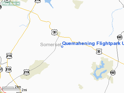
Quemahening Flightpark Ultralight Airport |
Location & QuickFacts
| FAA Information Effective: | 2008-09-25 |
| Airport Identifier: | 2PN4 |
| Airport Status: | Operational |
| Longitude/Latitude: | 078-56-43.8000W/40-04-54.6000N
-78.945500/40.081833 (Estimated) |
| Elevation: | 1997 ft / 608.69 m (Estimated) |
| Land: | 0 acres |
| From nearest city: | 1 nautical miles N of Stoystown, PA |
| Location: | Somerset County, PA |
| Magnetic Variation: | 10W (2000) |
Owner & Manager
| Ownership: | Privately owned |
| Owner: | Allen G. Fritz |
| Address: | 412 Brownstown Hill Road
Stoystown, PA 15563 |
| Phone number: | 814-893-5179 |
| Manager: | Allen G. Fritz |
| Address: | 412 Brownstown Hill Road
Stoystown, PA 15563 |
| Phone number: | 814-893-5179 |
Airport Operations and Facilities
| Airport Use: | Private |
| Wind indicator: | Yes |
| Segmented Circle: | Yes |
| Control Tower: | No |
| Sectional chart: | Detroit |
| Region: | AEA - Eastern |
| Boundary ARTCC: | ZOB - Cleveland |
| Tie-in FSS: | AOO - Altoona |
| FSS Toll Free: | 1-800-WX-BRIEF |
Runway Information
Runway 02/20
| Dimension: | 1000 x 150 ft / 304.8 x 45.7 m |
| Surface: | TURF, |
| |
Runway 02 |
Runway 20 |
| Traffic Pattern: | Left | Left |
|
Runway 13/31
| Dimension: | 540 x 100 ft / 164.6 x 30.5 m |
| Surface: | TURF, |
| |
Runway 13 |
Runway 31 |
| Traffic Pattern: | Left | Left |
|
Radio Navigation Aids
| ID |
Type |
Name |
Ch |
Freq |
Var |
Dist |
| SYS | NDB | Stoystown | | 209.00 | 08W | 1.4 nm |
| BHU | NDB | Benje | | 382.00 | 07W | 23.1 nm |
| CBE | NDB | Cumberland | | 317.00 | 07W | 27.6 nm |
| INP | NDB | Indiana | | 242.00 | 08W | 33.5 nm |
| VV | NDB | Camor | | 299.00 | 08W | 38.7 nm |
| MKP | NDB | Mc Keesport | | 287.00 | 07W | 41.7 nm |
| AOO | VOR | Altoona | | 108.80 | 07W | 32.9 nm |
| GRV | VOR/DME | Grantsville | 070X | 112.30 | 06W | 27.3 nm |
| REC | VOR/DME | Revloc | 043X | 110.60 | 09W | 29.4 nm |
| JST | VORTAC | Johnstown | 077X | 113.00 | 06W | 15.0 nm |
| IHD | VORTAC | Indian Head | 019X | 108.20 | 06W | 20.1 nm |
| THS | VORTAC | St Thomas | 097X | 115.00 | 07W | 46.7 nm |
| TON | VORTAC | Tyrone | 096X | 114.90 | 07W | 48.3 nm |
Remarks
- PRVDD DAYLGT VFR; A CLEAR 20:01 APCH/DEP PATH; A CLEAR PRIMARY SFC; OPERATE IN A MANNER TO MINIMIZE NOISE; AND COORDINATION W/ SOMERSET CITY ARPT FOR VFR TAKEOFFS/LANDINGS.
Images and information placed above are from
http://www.airport-data.com/airport/2PN4/
We thank them for the data!
| General Info
|
| Country |
United States
|
| State |
PENNSYLVANIA
|
| FAA ID |
2PN4
|
| Latitude |
40-04-54.600N
|
| Longitude |
078-56-43.800W
|
| Elevation |
1997 feet
|
| Near City |
STOYSTOWN
|
We don't guarantee the information is fresh and accurate. The data may
be wrong or outdated.
For more up-to-date information please refer to other sources.
|
|


