 |
|
| Quakertown Airport |
| IATA: UKT – ICAO: KUKT – FAA LID: UKT |
| Summary |
| Airport type |
Public |
| Owner/Operator |
Bucks County Airport Authority |
| Serves |
Quakertown, Pennsylvania |
| Elevation AMSL |
526 ft / 160 m |
| Coordinates |
40°26′07″N 075°22′55″W / 40.43528°N 75.38194°W / 40.43528; -75.38194 |
| Runways |
| Direction |
Length |
Surface |
| ft |
m |
| 11/29 |
3,201 |
976 |
Asphalt |
| Statistics (2008) |
| Aircraft operations |
29,642 |
| Based aircraft |
88 |
| Source: Federal Aviation Administration |
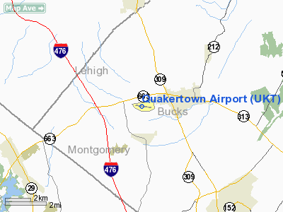
Quakertown Airport (IATA: UKT, ICAO: KUKT, FAA LID: UKT) is a public use airport located in Bucks County, Pennsylvania, United States and owned by the Bucks County Airport Authority. It is two nautical miles (3.7 km) west of the central business district of Quakertown, Pennsylvania. The airport was dedicated on January 22, 1965. It is home to the Civil Air Patrol Squadron 904.
Facilities and aircraft
Quakertown Airport covers an area of 122 acres (49 ha) at an elevation of 526 feet (160 m) above mean sea level. It has one asphalt paved runway designated 11/29 which measures 3,201 by 50 feet (976 x 15 m).
For the 12-month period ending September 4, 2008, the airport had 29,642 aircraft operations, an average of 81 per day: 99% general aviation and 1% air taxi. At that time there were 88 aircraft based at this airport: 89% single-engine, 6% multi-engine, 2% jet, 1% helicopter and 2% ultralight.
The above content comes from Wikipedia and is published under free licenses – click here to read more.
Location & QuickFacts
| FAA Information Effective: | 2008-09-25 |
| Airport Identifier: | UKT |
| Airport Status: | Operational |
| Longitude/Latitude: | 075-22-54.9430W/40-26-06.7630N
-75.381929/40.435212 (Estimated) |
| Elevation: | 526 ft / 160.32 m (Surveyed) |
| Land: | 122 acres |
| From nearest city: | 2 nautical miles W of Quakertown, PA |
| Location: | Bucks County, PA |
| Magnetic Variation: | 12W (2005) |
Owner & Manager
| Ownership: | Publicly owned |
| Owner: | Bucks County Airport Auth |
| Address: | Old Easton Rd, Po Box 1185
Doylestown, PA 18901 |
| Phone number: | 215-345-1970 |
| Manager: | Robert Fowler |
| Address: | 2425 Milford Sq Pike
Quakertown, PA 18951 |
| Phone number: | 215-538-3055 |
Airport Operations and Facilities
| Airport Use: | Open to public |
| Wind indicator: | Yes |
| Segmented Circle: | No |
| Control Tower: | No |
| Lighting Schedule: | DUSK-DAWN |
| Beacon Color: | Clear-Green (lighted land airport) |
| Landing fee charge: | No |
| Sectional chart: | New York |
| Region: | AEA - Eastern |
| Traffic Pattern Alt: | 1000 ft |
| Boundary ARTCC: | ZNY - New York |
| Tie-in FSS: | IPT - Williamsport |
| FSS on Airport: | No |
| FSS Toll Free: | 1-800-WX-BRIEF |
| NOTAMs Facility: | UKT (NOTAM-d service avaliable) |
| Federal Agreements: | NGY |
Airport Communications
| CTAF: | 122.725 |
| Unicom: | 122.725 |
Airport Services
| Fuel available: | 100LLA
100 LL AVBL 24 HRS SELF-SERVE. |
| Airframe Repair: | MAJOR |
| Power Plant Repair: | MAJOR |
| Bottled Oxygen: | NONE |
| Bulk Oxygen: | NONE |
Runway Information
Runway 11/29
| Dimension: | 3201 x 50 ft / 975.7 x 15.2 m |
| Surface: | ASPH, Good Condition |
| Weight Limit: | Single wheel: 12000 lbs. |
| Edge Lights: | Medium |
| |
Runway 11 |
Runway 29 |
| Longitude: | 075-23-15.3780W | 075-22-34.4820W |
| Latitude: | 40-26-09.1520N | 40-26-04.2770N |
| Elevation: | 526.00 ft | 504.00 ft |
| Alignment: | 99 | 127 |
| Traffic Pattern: | Left | Left |
| Markings: | Basic, Good Condition | Non-precision instrument, Good Condition |
| VASI: | 2-box on left side | 2-box on left side |
| Visual Glide Angle: | 5.10° | 4.75° |
| Obstruction: | 54 ft tree, 341.0 ft from runway, 254 ft left of centerline, 2:1 slope to clear
RNWY 11 GND +11 FT 149 FT FRM THLD 149 FT L | 19 ft brush, 209.0 ft from runway, 224 ft right of centerline
RY 29 HAS +5 FT BRUSH 174 FT FM THLD 198 FT LEFT. |
|
Radio Navigation Aids
| ID |
Type |
Name |
Ch |
Freq |
Var |
Dist |
| UKT | NDB | Quakertown | | 208.00 | 12W | 3.9 nm |
| DYL | NDB | Doylestown | | 237.00 | 10W | 13.3 nm |
| NXX | NDB | Willow Grove | | 388.00 | 12W | 18.3 nm |
| ING | NDB | Ambler | | 275.00 | 11W | 19.1 nm |
| LQX | NDB | Carbon | | 339.00 | 12W | 28.4 nm |
| HXM | NDB | Humbolt | | 366.00 | 10W | 43.5 nm |
| CAT | NDB | Chatham | | 254.00 | 11W | 47.2 nm |
| NXX | TACAN | Willow Grove | 061X | | 10W | 18.1 nm |
| PNE | VOR | North Philadelphia | | 112.00 | 10W | 27.2 nm |
| HZL | VOR | Hazleton | | 109.40 | 09W | 46.9 nm |
| CKZ | VOR/DME | Pennridge | 025Y | 108.85 | 12W | 5.0 nm |
| ETX | VOR/DME | East Texas | 039X | 110.20 | 09W | 16.3 nm |
| ARD | VOR/DME | Yardley | 019X | 108.20 | 10W | 24.3 nm |
| SBJ | VOR/DME | Solberg | 076X | 112.90 | 10W | 30.6 nm |
| BWZ | VOR/DME | Broadway | 089X | 114.20 | 11W | 33.6 nm |
| STW | VOR/DME | Stillwater | 033X | 109.60 | 11W | 41.0 nm |
| PTW | VORTAC | Pottstown | 112X | 116.50 | 09W | 15.2 nm |
| FJC | VORTAC | Allentown | 122X | 117.50 | 10W | 17.8 nm |
| MXE | VORTAC | Modena | 079X | 113.20 | 09W | 33.8 nm |
| RBV | VORTAC | Robbinsville | 085X | 113.80 | 10W | 43.0 nm |
| GXU | VORTAC | Mc Guire | 043X | 110.60 | 11W | 44.2 nm |
| LRP | VORTAC | Lancaster | 120X | 117.30 | 09W | 45.8 nm |
| DQO | VORTAC | Dupont | 087X | 114.00 | 10W | 46.7 nm |
| OOD | VORTAC | Woodstown | 075X | 112.80 | 10W | 48.2 nm |
| PHL | VOT | Philadelphia Intl | | 109.80 | | 34.5 nm |
Remarks
- DEER ON & INVOF ARPT.
- SVC AFTER HRS CTC 610-653-8121.
Images and information placed above are from
http://www.airport-data.com/airport/UKT/
We thank them for the data!
| General Info
|
| Country |
United States
|
| State |
PENNSYLVANIA
|
| FAA ID |
UKT
|
| Latitude |
40-26-06.763N
|
| Longitude |
075-22-54.943W
|
| Elevation |
526 feet
|
| Near City |
QUAKERTOWN
|
We don't guarantee the information is fresh and accurate. The data may
be wrong or outdated.
For more up-to-date information please refer to other sources.
|
|


