|
|
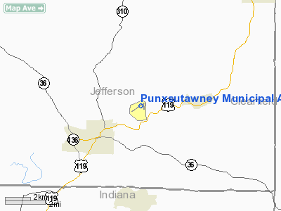
Punxsutawney Muni Airport |
 |
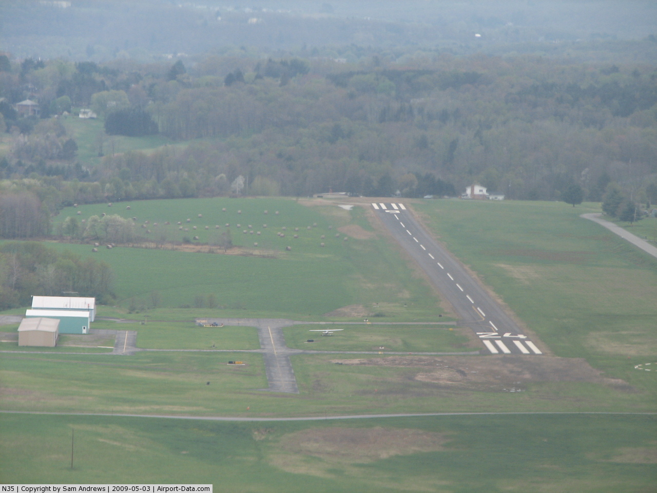
(Click on the photo to enlarge) |
 |
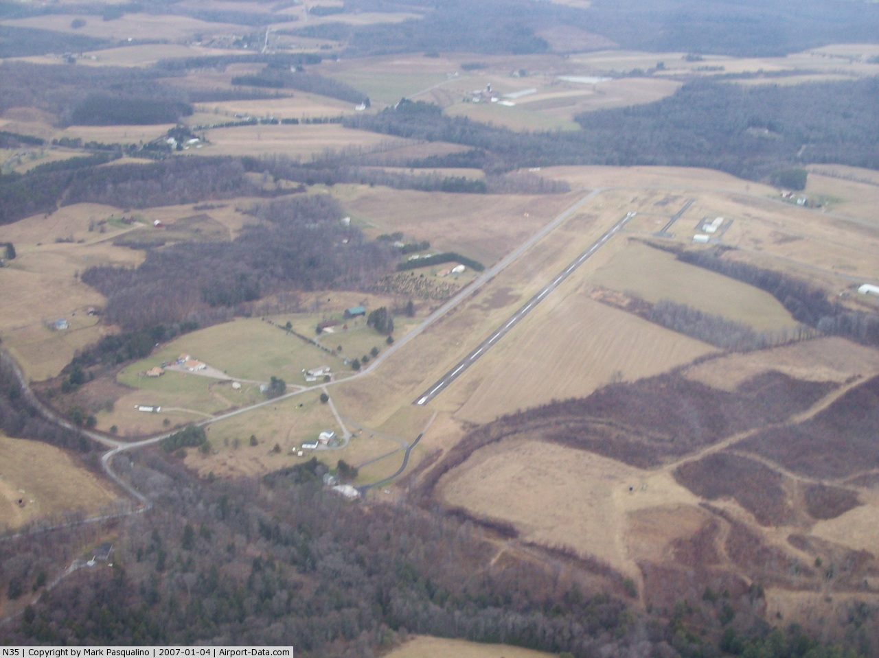
(Click on the photo to enlarge) |
 |
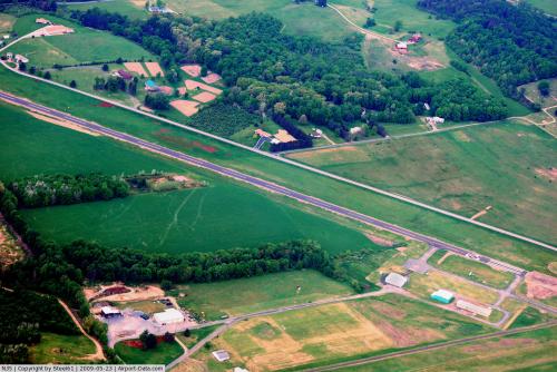
(Click on the photo to enlarge) |
Location & QuickFacts
| FAA Information Effective: | 2008-09-25 |
| Airport Identifier: | N35 |
| Airport Status: | Operational |
| Longitude/Latitude: | 078-55-48.0190W/40-58-00.0290N
-78.930005/40.966675 (Estimated) |
| Elevation: | 1439 ft / 438.61 m (Surveyed) |
| Land: | 130 acres |
| From nearest city: | 3 nautical miles NE of Punxsutawney, PA |
| Location: | Jefferson County, PA |
| Magnetic Variation: | 10W (2005) |
Owner & Manager
| Ownership: | Publicly owned |
| Owner: | Punxsutawney Airport Auth |
| Address: | Po Box 365
Punxsutawney, PA 15767 |
| Phone number: | 814-938-2997
CELL-814-590-1137. |
| Manager: | Rick Young |
| Address: | Po Box 365
Punxsutawney, PA 15767 |
| Phone number: | 814-938-2997 |
Airport Operations and Facilities
| Airport Use: | Open to public |
| Wind indicator: | Yes |
| Segmented Circle: | Yes |
| Control Tower: | No |
| Lighting Schedule: | DUSK-DAWN
ACTVT MIRL RYS 01/19 & 06/24, PAPI RYS 06 & 24; REIL RYS 01, 19, 06, & 24 - CTAF. |
| Beacon Color: | Clear-Green (lighted land airport) |
| Landing fee charge: | No |
| Sectional chart: | Detroit |
| Region: | AEA - Eastern |
| Boundary ARTCC: | ZOB - Cleveland |
| Tie-in FSS: | AOO - Altoona |
| FSS on Airport: | No |
| FSS Toll Free: | 1-800-WX-BRIEF |
| NOTAMs Facility: | AOO (NOTAM-d service avaliable) |
| Federal Agreements: | NGY |
Airport Communications
| CTAF: | 123.000 |
| Unicom: | 123.000 |
Airport Services
| Fuel available: | 100LL
FOR FUEL CALL 814-590-1137. |
| Airframe Repair: | NONE |
| Power Plant Repair: | NONE |
| Bottled Oxygen: | NONE |
| Bulk Oxygen: | NONE |
Runway Information
Runway 01/19
| Dimension: | 2026 x 100 ft / 617.5 x 30.5 m |
| Surface: | TURF-GRVL, Fair Condition |
| Edge Lights: | Medium |
| |
Runway 01 |
Runway 19 |
| Longitude: | 078-55-33.1180W | 078-55-34.1190W |
| Latitude: | 40-57-49.2290N | 40-58-09.2290N |
| Alignment: | 127 | 127 |
| Traffic Pattern: | Left | Left |
| Runway End Identifier: | Yes | Yes |
| Obstruction: | 68 ft trees, 1369.0 ft from runway, 233 ft left of centerline, 20:1 slope to clear | 20 ft road, 249.0 ft from runway, 12:1 slope to clear |
|
Runway 06/24
| Dimension: | 3003 x 50 ft / 915.3 x 15.2 m |
| Surface: | ASPH, Fair Condition |
| Weight Limit: | Single wheel: 12500 lbs. |
| Edge Lights: | Medium |
| |
Runway 06 |
Runway 24 |
| Longitude: | 078-56-14.0380W | 078-55-41.2690W |
| Latitude: | 40-57-52.3630N | 40-58-08.5980N |
| Elevation: | 1410.00 ft | 1437.00 ft |
| Alignment: | 57 | 127 |
| Traffic Pattern: | Left | Left |
| Markings: | Basic, Fair Condition | Basic, Fair Condition |
| Crossing Height: | 45.00 ft | 40.00 ft |
| VASI: | 2-light PAPI on left side | 2-light PAPI on left side |
| Visual Glide Angle: | 4.00° | 4.00° |
| Runway End Identifier: | Yes | Yes |
| Obstruction: | 25 ft trees, 266.0 ft from runway, 251 ft right of centerline, 2:1 slope to clear | 79 ft trees, 1805.0 ft from runway, 63 ft left of centerline, 20:1 slope to clear |
|
Radio Navigation Aids
| ID |
Type |
Name |
Ch |
Freq |
Var |
Dist |
| INP | NDB | Indiana | | 242.00 | 08W | 21.0 nm |
| BHU | NDB | Benje | | 382.00 | 07W | 38.8 nm |
| AOO | VOR | Altoona | | 108.80 | 07W | 48.0 nm |
| CIP | VOR/DME | Clarion | 076X | 112.90 | 06W | 26.3 nm |
| REC | VOR/DME | Revloc | 043X | 110.60 | 09W | 26.6 nm |
| TON | VORTAC | Tyrone | 096X | 114.90 | 07W | 30.6 nm |
| ETG | VORTAC | Keating | 107X | 116.00 | 10W | 38.7 nm |
| JST | VORTAC | Johnstown | 077X | 113.00 | 06W | 39.3 nm |
| PSB | VORTAC | Philipsburg | 102X | 115.50 | 10W | 42.7 nm |
| TDT | VORTAC | Tidioute | 123X | 117.60 | 09W | 50.0 nm |
Remarks
- TURF SOFT AND WET DURING SPRING THAW.
- 56 FT STACK E OF RY 01.
- RY 01/19 CLSD NOV-APR DUE TO INCLEMENT WEATHER.
- BIRDS; DEER & WOODCHUCK ON & INVOF ARPT.
- VFR OPNS ONLY
Images and information placed above are from
http://www.airport-data.com/airport/N35/
We thank them for the data!
| General Info
|
| Country |
United States
|
| State |
PENNSYLVANIA
|
| FAA ID |
N35
|
| Latitude |
40-58-00.029N
|
| Longitude |
078-55-48.019W
|
| Elevation |
1439 feet
|
| Near City |
PUNXSUTAWNEY
|
We don't guarantee the information is fresh and accurate. The data may
be wrong or outdated.
For more up-to-date information please refer to other sources.
|
|