 |
|
Location & QuickFacts
| FAA Information Effective: | 2008-09-25 |
| Airport Identifier: | 08PA |
| Airport Status: | Operational |
| Longitude/Latitude: | 075-29-58.6710W/41-03-30.3160N
-75.499631/41.058421 (Estimated) |
| Elevation: | 1812 ft / 552.30 m (Estimated) |
| Land: | 0 acres |
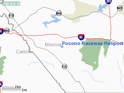
| From nearest city: | 3 nautical miles SW of Pocono Pines, PA |
| Location: | Monroe County, PA |
| Magnetic Variation: | 12W (1985) |
Owner & Manager
| Ownership: | Privately owned |
| Owner: | Pocono Raceway |
| Address: | P.o. Box 500
Long Pond, PA 18334 |
| Phone number: | 717-646-2300 |
| Manager: | Joseph R. Mattioli |
| Address: | Po Box 500
Long Pond, PA 18334 |
| Phone number: | 717-646-2300 |
Airport Operations and Facilities
| Airport Use: | Private |
| Wind indicator: | Yes |
| Segmented Circle: | Yes |
| Control Tower: | No |
| Landing fee charge: | No |
| Sectional chart: | New York |
| Region: | AEA - Eastern |
| Boundary ARTCC: | ZNY - New York |
| Tie-in FSS: | IPT - Williamsport |
| FSS on Airport: | No |
| FSS Toll Free: | 1-800-WX-BRIEF |
Runway Information
Helipad H1
| Dimension: | 200 x 150 ft / 61.0 x 45.7 m |
| Surface: | TURF, |
| |
Runway H1 |
Runway |
| Traffic Pattern: | Left | Left |
|
Radio Navigation Aids
| ID |
Type |
Name |
Ch |
Freq |
Var |
Dist |
| CYE | NDB | Crystal Lake | | 410.00 | 11W | 17.6 nm |
| LQX | NDB | Carbon | | 339.00 | 12W | 18.9 nm |
| HXM | NDB | Humbolt | | 366.00 | 10W | 22.9 nm |
| UKT | NDB | Quakertown | | 208.00 | 12W | 39.2 nm |
| DYL | NDB | Doylestown | | 237.00 | 10W | 46.7 nm |
| HZL | VOR | Hazleton | | 109.40 | 09W | 28.8 nm |
| STW | VOR/DME | Stillwater | 033X | 109.60 | 11W | 28.8 nm |
| ETX | VOR/DME | East Texas | 039X | 110.20 | 09W | 29.9 nm |
| BWZ | VOR/DME | Broadway | 089X | 114.20 | 11W | 34.5 nm |
| CKZ | VOR/DME | Pennridge | 025Y | 108.85 | 12W | 41.3 nm |
| SBJ | VOR/DME | Solberg | 076X | 112.90 | 10W | 44.8 nm |
| HUO | VOR/DME | Huguenot | 108X | 116.10 | 11W | 46.2 nm |
| LVZ | VORTAC | Wilkes-barre | 053X | 111.60 | 10W | 15.5 nm |
| FJC | VORTAC | Allentown | 122X | 117.50 | 10W | 20.0 nm |
| LHY | VORTAC | Lake Henry | 045X | 110.80 | 10W | 25.1 nm |
| SAX | VORTAC | Sparta | 104X | 115.70 | 11W | 43.6 nm |
Images and information placed above are from
http://www.airport-data.com/airport/08PA/
We thank them for the data!
| General Info
|
| Country |
United States
|
| State |
PENNSYLVANIA
|
| FAA ID |
08PA
|
| Latitude |
41-03-30.316N
|
| Longitude |
075-29-58.671W
|
| Elevation |
1812 feet
|
| Near City |
POCONO PINES
|
We don't guarantee the information is fresh and accurate. The data may
be wrong or outdated.
For more up-to-date information please refer to other sources.
|
|


