 |
|
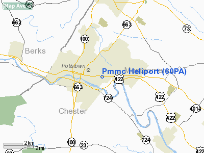
Location & QuickFacts
| FAA Information Effective: | 2008-09-25 |
| Airport Identifier: | 60PA |
| Airport Status: | Operational |
| Longitude/Latitude: | 075-37-22.6630W/40-14-36.3500N
-75.622962/40.243431 (Estimated) |
| Elevation: | 168 ft / 51.21 m (Estimated) |
| Land: | 168 acres |
| From nearest city: | 0 nautical miles E of Pottstown, PA |
| Location: | Montgomery County, PA |
| Magnetic Variation: | 12W (1995) |
Owner & Manager
| Ownership: | Privately owned |
| Owner: | Pottstown Meml Medical Center |
| Address: | Armand Hammer Blvd
Pottstown, PA 19464 |
| Phone number: | 610-327-7065 |
| Manager: | Ed Crews |
| Address: | Armand Hammer Blvd
Pottstown, PA 19464 |
| Phone number: | 610-327-7065 |
Airport Operations and Facilities
| Airport Use: | Private
MEDICAL USE HELIPORT. |
| Wind indicator: | Yes |
| Segmented Circle: | No |
| Control Tower: | No |
| Lighting Schedule: | DUSK-DAWN |
| Sectional chart: | New York |
| Region: | AEA - Eastern |
| Boundary ARTCC: | ZNY - New York |
| Tie-in FSS: | IPT - Williamsport |
| FSS on Airport: | No |
| FSS Toll Free: | 1-800-WX-BRIEF |
Runway Information
Helipad H1
| Dimension: | 60 x 60 ft / 18.3 x 18.3 m |
| Surface: | CONC, |
| |
Runway H1 |
Runway |
| Traffic Pattern: | Left | Left |
|
Radio Navigation Aids
| ID |
Type |
Name |
Ch |
Freq |
Var |
Dist |
| ING | NDB | Ambler | | 275.00 | 11W | 17.0 nm |
| UKT | NDB | Quakertown | | 208.00 | 12W | 18.5 nm |
| NXX | NDB | Willow Grove | | 388.00 | 12W | 22.2 nm |
| DYL | NDB | Doylestown | | 237.00 | 10W | 23.6 nm |
| LQX | NDB | Carbon | | 339.00 | 12W | 34.7 nm |
| BZJ | NDB | Bellgrove | | 328.00 | 10W | 44.2 nm |
| HXM | NDB | Humbolt | | 366.00 | 10W | 47.9 nm |
| APG | NDB | Aberdeen | | 349.00 | 11W | 48.1 nm |
| NXX | TACAN | Willow Grove | 061X | | 10W | 22.1 nm |
| PNE | VOR | North Philadelphia | | 112.00 | 10W | 29.8 nm |
| HZL | VOR | Hazleton | | 109.40 | 09W | 49.6 nm |
| CKZ | VOR/DME | Pennridge | 025Y | 108.85 | 12W | 17.7 nm |
| ETX | VOR/DME | East Texas | 039X | 110.20 | 09W | 20.5 nm |
| ARD | VOR/DME | Yardley | 019X | 108.20 | 10W | 32.8 nm |
| SBJ | VOR/DME | Solberg | 076X | 112.90 | 10W | 45.2 nm |
| BWZ | VOR/DME | Broadway | 089X | 114.20 | 11W | 49.5 nm |
| PTW | VORTAC | Pottstown | 112X | 116.50 | 09W | 3.1 nm |
| MXE | VORTAC | Modena | 079X | 113.20 | 09W | 19.7 nm |
| FJC | VORTAC | Allentown | 122X | 117.50 | 10W | 30.0 nm |
| LRP | VORTAC | Lancaster | 120X | 117.30 | 09W | 31.6 nm |
| DQO | VORTAC | Dupont | 087X | 114.00 | 10W | 34.0 nm |
| OOD | VORTAC | Woodstown | 075X | 112.80 | 10W | 39.4 nm |
| RAV | VORTAC | Ravine | 093X | 114.60 | 11W | 48.4 nm |
| GXU | VORTAC | Mc Guire | 043X | 110.60 | 11W | 49.2 nm |
| PHL | VOT | Philadelphia Intl | | 109.80 | | 28.4 nm |
Remarks
- (E111-1) EASTERLY OPNS ARE RIGHT OF WIRES ON EAST POLE MARKED & NORTH OPNS ARE NOT RECOMMENDED UNLESS POLES; WIRES & TREES REMOVED; SLOPE CUT TO GRADE; UTILITY POLE NORTH REMOVED; AND A WIND INDICATORIS ERECTED AT OR NEAR GROUND LEVEL RATHER THAN AT ROOFTOP.
- PRVDD HELICOPTERS FROM THIS FACILITY ARE LIMITED TO WEIGHING LESS THAN 12500 LBS; IFR OPNS ARE NOT CONDUCTED; THERE IS A CLEAR 8:1 INGRESS/EGRESS;
Images and information placed above are from
http://www.airport-data.com/airport/60PA/
We thank them for the data!
| General Info
|
| Country |
United States
|
| State |
PENNSYLVANIA
|
| FAA ID |
60PA
|
| Latitude |
40-14-36.350N
|
| Longitude |
075-37-22.663W
|
| Elevation |
168 feet
|
| Near City |
POTTSTOWN
|
We don't guarantee the information is fresh and accurate. The data may
be wrong or outdated.
For more up-to-date information please refer to other sources.
|
|


