 |
|
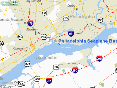
Philadelphia Seaplane Base Airport |
Location & QuickFacts
| FAA Information Effective: | 2008-09-25 |
| Airport Identifier: | 9N2 |
| Airport Status: | Operational |
| Longitude/Latitude: | 075-17-58.6710W/39-51-32.4060N
-75.299631/39.859002 (Estimated) |
| Elevation: | 0 ft / 0.00 m (Estimated) |
| Land: | 8 acres |
| From nearest city: | 1 nautical miles S of Essington, PA |
| Location: | Delaware County, PA |
| Magnetic Variation: | 11W (1985) |
Owner & Manager
| Ownership: | Publicly owned |
| Owner: | Township Of Tinicum |
| Address: | 629 N Governor Printz Blvd
Essington, PA 19029 |
| Phone number: | 610-521-3530 |
| Manager: | Hank Grenfell |
| Address: | 97 Wannamaker Ave
Essington, PA 19029 |
| Phone number: | 610-521-3530
CALL 610-521-7710 PRIOR TO ARRIVAL |
Airport Operations and Facilities
| Airport Use: | Open to public |
| Wind indicator: | Yes |
| Segmented Circle: | No |
| Control Tower: | No |
| Landing fee charge: | No |
| Sectional chart: | Washington |
| Region: | AEA - Eastern |
| Boundary ARTCC: | ZDC - Washington |
| Responsible ARTCC: | ZNY - New York |
| Tie-in FSS: | IPT - Williamsport |
| FSS on Airport: | No |
| FSS Toll Free: | 1-800-WX-BRIEF |
| NOTAMs Facility: | IPT (NOTAM-d service avaliable) |
Airport Communications
Airport Services
Runway Information
Runway 11/29
| Dimension: | 9100 x 250 ft / 2773.7 x 76.2 m |
| Surface: | WATER, |
| |
Runway 11 |
Runway 29 |
| Traffic Pattern: | Right | Left |
|
Radio Navigation Aids
| ID |
Type |
Name |
Ch |
Freq |
Var |
Dist |
| ING | NDB | Ambler | | 275.00 | 11W | 16.1 nm |
| NXX | NDB | Willow Grove | | 388.00 | 12W | 21.1 nm |
| RNB | NDB | Rainbow | | 363.00 | 11W | 27.6 nm |
| DYL | NDB | Doylestown | | 237.00 | 10W | 29.8 nm |
| UKT | NDB | Quakertown | | 208.00 | 12W | 34.0 nm |
| APG | NDB | Aberdeen | | 349.00 | 11W | 42.1 nm |
| NEL | NDB | Lakehurst | | 396.00 | 13W | 45.8 nm |
| NXX | TACAN | Willow Grove | 061X | | 10W | 21.4 nm |
| DOV | TACAN | Dover | 037X | | 09W | 44.4 nm |
| NEL | TACAN | Lakehurst | 055X | | 11W | 44.9 nm |
| NEL | UHF/NDB | Lakehurst | | 274.80 | 13W | 45.8 nm |
| PNE | VOR | North Philadelphia | | 112.00 | 10W | 18.9 nm |
| ARD | VOR/DME | Yardley | 019X | 108.20 | 10W | 29.8 nm |
| CKZ | VOR/DME | Pennridge | 025Y | 108.85 | 12W | 32.0 nm |
| PPM | VOR/DME | Phillips | 021X | 108.40 | 09W | 46.7 nm |
| ETX | VOR/DME | East Texas | 039X | 110.20 | 09W | 46.8 nm |
| OOD | VORTAC | Woodstown | 075X | 112.80 | 10W | 13.4 nm |
| MXE | VORTAC | Modena | 079X | 113.20 | 09W | 17.5 nm |
| DQO | VORTAC | Dupont | 087X | 114.00 | 10W | 17.9 nm |
| VCN | VORTAC | Cedar Lake | 099X | 115.20 | 10W | 24.7 nm |
| PTW | VORTAC | Pottstown | 112X | 116.50 | 09W | 24.9 nm |
| GXU | VORTAC | Mc Guire | 043X | 110.60 | 11W | 33.7 nm |
| ENO | VORTAC | Smyrna | 051X | 111.40 | 09W | 39.0 nm |
| CYN | VORTAC | Coyle | 081X | 113.40 | 10W | 40.1 nm |
| ACY | VORTAC | Atlantic City | 023X | 108.60 | 10W | 41.3 nm |
| RBV | VORTAC | Robbinsville | 085X | 113.80 | 10W | 42.4 nm |
| LRP | VORTAC | Lancaster | 120X | 117.30 | 09W | 48.3 nm |
| PHL | VOT | Philadelphia Intl | | 109.80 | | 2.6 nm |
Remarks
- TSNT TFC CTC PHILADELPHIA APCH CTL FOR TFC ADVISORIES.
- CALL 610-521-7710 PRIOR TO ARRIVAL
- NO NIGHT OPERATIONS
- VFR USE ONLY
Images and information placed above are from
http://www.airport-data.com/airport/9N2/
We thank them for the data!
| General Info
|
| Country |
United States
|
| State |
PENNSYLVANIA
|
| FAA ID |
9N2
|
| Latitude |
39-51-32.406N
|
| Longitude |
075-17-58.671W
|
| Elevation |
0 feet
|
| Near City |
ESSINGTON
|
We don't guarantee the information is fresh and accurate. The data may
be wrong or outdated.
For more up-to-date information please refer to other sources.
|
|


