 |
|
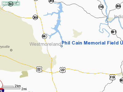
Phil Cain Memorial Field Ultralight Airport |
Location & QuickFacts
| FAA Information Effective: | 2008-09-25 |
| Airport Identifier: | 3PN9 |
| Airport Status: | Operational |
| Longitude/Latitude: | 079-33-00.2800W/40-26-30.3900N
-79.550078/40.441775 (Estimated) |
| Elevation: | 1210 ft / 368.81 m (Estimated) |
| Land: | 69 acres |
| From nearest city: | 5 nautical miles E of Export, PA |
| Location: | Westmoreland County, PA |
| Magnetic Variation: | 09W (2000) |
Owner & Manager
| Ownership: | Privately owned |
| Owner: | Jonathan A. Kepes |
| Address: | Box 369 Rr#1
Export, PA 15632 |
| Phone number: | 724-468-5482 |
| Manager: | Jonathan A. Kepes |
| Address: | Box 369 Rr#1
Export, PA 15632 |
| Phone number: | 724-468-5482 |
Airport Operations and Facilities
| Airport Use: | Private |
| Wind indicator: | Yes |
| Segmented Circle: | Yes |
| Control Tower: | No |
| Sectional chart: | Detroit |
| Region: | AEA - Eastern |
| Boundary ARTCC: | ZOB - Cleveland |
| Tie-in FSS: | AOO - Altoona |
| FSS Toll Free: | 1-800-WX-BRIEF |
Airport Services
Runway Information
Runway 05/23
| Dimension: | 700 x 100 ft / 213.4 x 30.5 m |
| Surface: | TURF, |
| |
Runway 05 |
Runway 23 |
| Traffic Pattern: | Right | Left |
|
Radio Navigation Aids
| ID |
Type |
Name |
Ch |
Freq |
Var |
Dist |
| MKP | NDB | Mc Keesport | | 287.00 | 07W | 11.8 nm |
| BHU | NDB | Benje | | 382.00 | 07W | 13.4 nm |
| INP | NDB | Indiana | | 242.00 | 08W | 24.9 nm |
| PNU | NDB | Washington County | | 255.00 | 08W | 33.3 nm |
| VV | NDB | Camor | | 299.00 | 08W | 34.8 nm |
| SYS | NDB | Stoystown | | 209.00 | 08W | 36.1 nm |
| AGC | VOR/DME | Allegheny | 037X | 110.00 | 09W | 24.5 nm |
| REC | VOR/DME | Revloc | 043X | 110.60 | 09W | 37.2 nm |
| CIP | VOR/DME | Clarion | 076X | 112.90 | 06W | 42.6 nm |
| HLG | VOR/DME | Wheeling | 059X | 112.20 | 07W | 47.9 nm |
| IHD | VORTAC | Indian Head | 019X | 108.20 | 06W | 29.4 nm |
| MMJ | VORTAC | Montour | 057X | 112.00 | 08W | 29.6 nm |
| JST | VORTAC | Johnstown | 077X | 113.00 | 06W | 33.6 nm |
| EWC | VORTAC | Ellwood City | 105X | 115.80 | 08W | 38.0 nm |
Remarks
- PRVDD DALGT/VFR; A CLEAR 20:1 APCH/DEP PATH; A CLEAR PRIMARY SFC; AND OPERATE IN A MANNER TO MINIMIZE DISTURBANCES OVER RESIDENTS IN THE COMMUNITY.
Images and information placed above are from
http://www.airport-data.com/airport/3PN9/
We thank them for the data!
| General Info
|
| Country |
United States
|
| State |
PENNSYLVANIA
|
| FAA ID |
3PN9
|
| Latitude |
40-26-30.390N
|
| Longitude |
079-33-00.280W
|
| Elevation |
1210 feet
|
| Near City |
EXPORT
|
We don't guarantee the information is fresh and accurate. The data may
be wrong or outdated.
For more up-to-date information please refer to other sources.
|
|


