 |
|
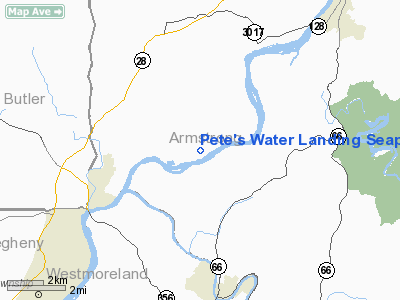
Pete's Water Landing Seaplane Base Airport |
Location & QuickFacts
| FAA Information Effective: | 2008-09-25 |
| Airport Identifier: | 0PN1 |
| Airport Status: | Operational |
| Longitude/Latitude: | 079-37-08.0000W/40-41-58.0000N
-79.618889/40.699444 (Estimated) |
| Elevation: | 757 ft / 230.73 m (Estimated) |
| Land: | 0 acres |
| From nearest city: | 4 nautical miles SW of Freeport, PA |
| Location: | Armstrong County, PA |
| Magnetic Variation: | 09W (1995) |
Owner & Manager
| Ownership: | Privately owned |
| Owner: | Peter M Massetto |
| Address: | 1166 River Rd
Freeport, PA 16229 |
| Phone number: | 724-295-2205 |
| Manager: | Peter M Massetto |
| Address: | 1166 River Rd
Freeport, PA 16229 |
| Phone number: | 724-295-2205 |
Airport Operations and Facilities
| Airport Use: | Private |
| Wind indicator: | Yes |
| Segmented Circle: | No |
| Control Tower: | No |
| Sectional chart: | Detroit |
| Region: | AEA - Eastern |
| Boundary ARTCC: | ZOB - Cleveland |
| Tie-in FSS: | AOO - Altoona |
| FSS Toll Free: | 1-800-WX-BRIEF |
Airport Communications
Runway Information
Runway 06/24
| Dimension: | 7500 x 800 ft / 2286.0 x 243.8 m |
| Surface: | WATER, |
| |
Runway 06 |
Runway 24 |
| Traffic Pattern: | Left | Left |
|
Radio Navigation Aids
| ID |
Type |
Name |
Ch |
Freq |
Var |
Dist |
| MKP | NDB | Mc Keesport | | 287.00 | 07W | 22.0 nm |
| BHU | NDB | Benje | | 382.00 | 07W | 25.1 nm |
| INP | NDB | Indiana | | 242.00 | 08W | 25.5 nm |
| UCP | NDB | Castle | | 272.00 | 09W | 41.1 nm |
| PNU | NDB | Washington County | | 255.00 | 08W | 41.6 nm |
| SYS | NDB | Stoystown | | 209.00 | 08W | 48.9 nm |
| VV | NDB | Camor | | 299.00 | 08W | 49.4 nm |
| HBD | NDB | Hubbard | | 408.00 | 08W | 49.6 nm |
| FKL | VOR | Franklin | | 109.60 | 06W | 45.7 nm |
| CIP | VOR/DME | Clarion | 076X | 112.90 | 06W | 27.8 nm |
| AGC | VOR/DME | Allegheny | 037X | 110.00 | 09W | 31.8 nm |
| REC | VOR/DME | Revloc | 043X | 110.60 | 09W | 40.8 nm |
| EWC | VORTAC | Ellwood City | 105X | 115.80 | 08W | 28.0 nm |
| MMJ | VORTAC | Montour | 057X | 112.00 | 08W | 29.2 nm |
| JST | VORTAC | Johnstown | 077X | 113.00 | 06W | 42.6 nm |
| IHD | VORTAC | Indian Head | 019X | 108.20 | 06W | 45.2 nm |
Remarks
- SEE AIRSPACE DETERMINATION DTD 28 MAY 1998 FOR CONDITIONS.
Images and information placed above are from
http://www.airport-data.com/airport/0PN1/
We thank them for the data!
| General Info
|
| Country |
United States
|
| State |
PENNSYLVANIA
|
| FAA ID |
0PN1
|
| Latitude |
40-41-58.000N
|
| Longitude |
079-37-08.000W
|
| Elevation |
757 feet
|
| Near City |
FREEPORT
|
We don't guarantee the information is fresh and accurate. The data may
be wrong or outdated.
For more up-to-date information please refer to other sources.
|
|


