 |
|
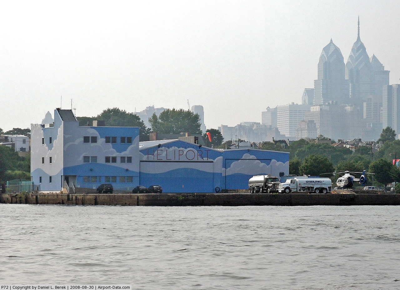 |
(Click on the photo to enlarge) |
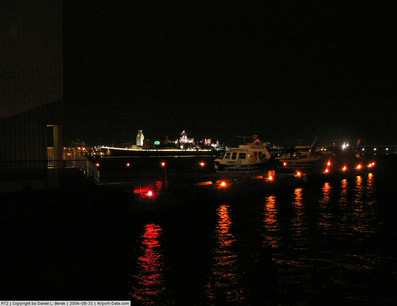 |
(Click on the photo to enlarge) |
Location & QuickFacts
| FAA Information Effective: | 2008-09-25 |
| Airport Identifier: | P72 |
| Airport Status: | Operational |
| Longitude/Latitude: | 075-08-28.6360W/39-56-14.4060N
-75.141288/39.937335 (Estimated) |
| Elevation: | 15 ft / 4.57 m (Estimated) |
| Land: | 1 acres |
| From nearest city: | 0 nautical miles N of Philadelphia, PA |
| Location: | Philadelphia County, PA |
| Magnetic Variation: | 11W (1985) |
Owner & Manager
| Ownership: | Publicly owned |
| Owner: | Philadelphia Port Corporation |
| Address: | 1020 Public Ledger Bldg
Philadelphia, PA 19106 |
| Phone number: | 215-928-9100 |
| Manager: | Phil Bidden |
| Address: | 801 S Columbus Blvd
Philadelphia, PA 19147 |
| Phone number: | 215-271-2510 |
Airport Operations and Facilities
| Airport Use: | Open to public |
| Wind indicator: | Yes |
| Segmented Circle: | No |
| Control Tower: | No |
| Lighting Schedule: | RDO-CTL
ACTVT PERIMETER LGTS - 123.025. |
| Beacon Color: | Clear-Green-Yellow (heliport) |
| Landing fee charge: | Yes |
| Sectional chart: | Washington |
| Region: | AEA - Eastern |
| Boundary ARTCC: | ZDC - Washington |
| Responsible ARTCC: | ZNY - New York |
| Tie-in FSS: | IPT - Williamsport |
| FSS on Airport: | No |
| FSS Toll Free: | 1-800-WX-BRIEF |
| NOTAMs Facility: | IPT (NOTAM-d service avaliable) |
Airport Communications
Airport Services
| Fuel available: | A |
| Airframe Repair: | MAJOR |
| Power Plant Repair: | MAJOR |
Runway Information
Helipad H1
| Dimension: | 68 x 68 ft / 20.7 x 20.7 m |
| Surface: | ASPH, Fair Condition |
| Edge Lights: | Non-standard lighting system
YELLOW LIGHTS ON EAST AND SOUTH SIDES ONLY. |
| |
Runway H1 |
Runway |
| Traffic Pattern: | Left | Left |
| Markings: | Basic, Fair Condition | , |
|
Radio Navigation Aids
| ID |
Type |
Name |
Ch |
Freq |
Var |
Dist |
| ING | NDB | Ambler | | 275.00 | 11W | 13.1 nm |
| NXX | NDB | Willow Grove | | 388.00 | 12W | 15.1 nm |
| DYL | NDB | Doylestown | | 237.00 | 10W | 24.0 nm |
| UKT | NDB | Quakertown | | 208.00 | 12W | 30.2 nm |
| RNB | NDB | Rainbow | | 363.00 | 11W | 31.2 nm |
| NEL | NDB | Lakehurst | | 396.00 | 13W | 37.7 nm |
| NXX | TACAN | Willow Grove | 061X | | 10W | 15.5 nm |
| NEL | TACAN | Lakehurst | 055X | | 11W | 36.8 nm |
| NEL | UHF/NDB | Lakehurst | | 274.80 | 13W | 37.7 nm |
| PNE | VOR | North Philadelphia | | 112.00 | 10W | 10.6 nm |
| ARD | VOR/DME | Yardley | 019X | 108.20 | 10W | 21.8 nm |
| CKZ | VOR/DME | Pennridge | 025Y | 108.85 | 12W | 28.1 nm |
| SBJ | VOR/DME | Solberg | 076X | 112.90 | 10W | 42.9 nm |
| ETX | VOR/DME | East Texas | 039X | 110.20 | 09W | 46.0 nm |
| OOD | VORTAC | Woodstown | 075X | 112.80 | 10W | 19.6 nm |
| MXE | VORTAC | Modena | 079X | 113.20 | 09W | 24.4 nm |
| VCN | VORTAC | Cedar Lake | 099X | 115.20 | 10W | 25.3 nm |
| GXU | VORTAC | Mc Guire | 043X | 110.60 | 11W | 25.5 nm |
| PTW | VORTAC | Pottstown | 112X | 116.50 | 09W | 25.8 nm |
| DQO | VORTAC | Dupont | 087X | 114.00 | 10W | 26.6 nm |
| CYN | VORTAC | Coyle | 081X | 113.40 | 10W | 33.5 nm |
| RBV | VORTAC | Robbinsville | 085X | 113.80 | 10W | 33.7 nm |
| ACY | VORTAC | Atlantic City | 023X | 108.60 | 10W | 39.0 nm |
| ENO | VORTAC | Smyrna | 051X | 111.40 | 09W | 45.8 nm |
| FJC | VORTAC | Allentown | 122X | 117.50 | 10W | 49.6 nm |
| PHL | VOT | Philadelphia Intl | | 109.80 | | 6.3 nm |
Remarks
- RY H1 SHALLOW SFC DEPRESSIONS.
- RY H1 INGRESS 235/315 DEGS, EGRESS 055/135 DEGS.
- DETERMINATION PENDING.
Images and information placed above are from
http://www.airport-data.com/airport/P72/
We thank them for the data!
| General Info
|
| Country |
United States
|
| State |
PENNSYLVANIA
|
| FAA ID |
P72
|
| Latitude |
39-56-14.406N
|
| Longitude |
075-08-28.636W
|
| Elevation |
15 feet
|
| Near City |
PHILADELPHIA
|
We don't guarantee the information is fresh and accurate. The data may
be wrong or outdated.
For more up-to-date information please refer to other sources.
|
|


